Beauty and Danger on Malerweg Trail Stage Four

Stage four of the Malerweg starts in Altendorf and finishes in Neumannmühle. It is part of the Malerweg Trail (Painter’s Way), which is a series of eight point-to-point trails through Saxon Switzerland National Park in Germany. It roughly follows the path of German landscape painters who frequented the area in the 18th Century.

Building in Bad Schandau

My Son Alex and I had only planned four days of hiking while in Dresden, but because of the amount of rain that fell while we were there, we were only able to hike two days. Having read blog posts of people who had done all eight stages, stage four seemed to be one of the favorites of the eight stages.

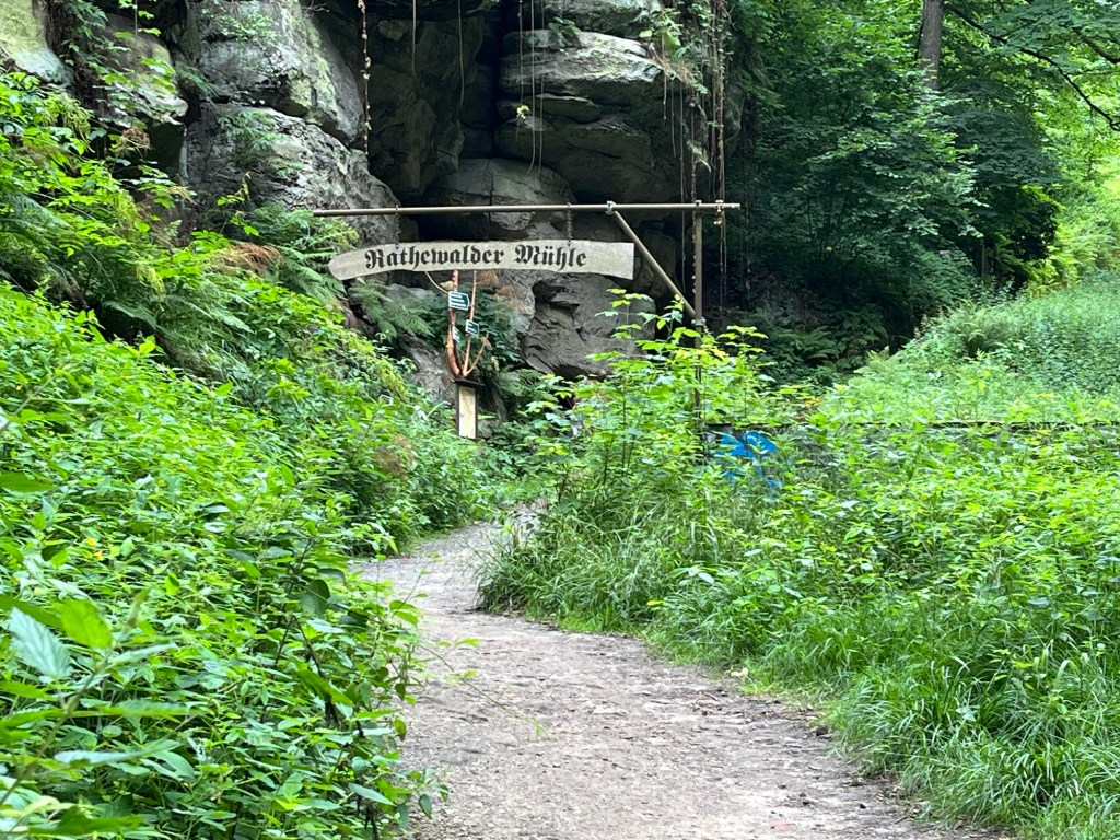
Our day started with a train ride from Dresden to Bad Schandau. From there, we needed to take a bus from Bad Schandau to Altendorf. Once we got off the bus in Altendorf, it only took a few minutes to find the sign directing us to the Malerweg trail.

We followed the signs, and it wasn’t long before we came across a sign that said the path was under repair and that we needed to turn around to go to an alternative path. That forced us to turn around and eventually led us down a fairly steep trail with a lot of switchbacks that descended from Altendorf.

At the bottom of the hill was a campground where we missed a sign and walked another quarter mile or so before I thought that the trail didn’t seem right. My instincts told me we weren’t on the Malerweg, so we turned around and returned to the campground, where we saw the sign pointing to the Malerweg, which we had missed the first time. We had barely even started hiking, and we had already come across a closed trail and taken a wrong turn – not a great way to start.

Walking beside the sandstone pillars

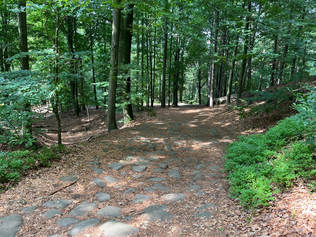
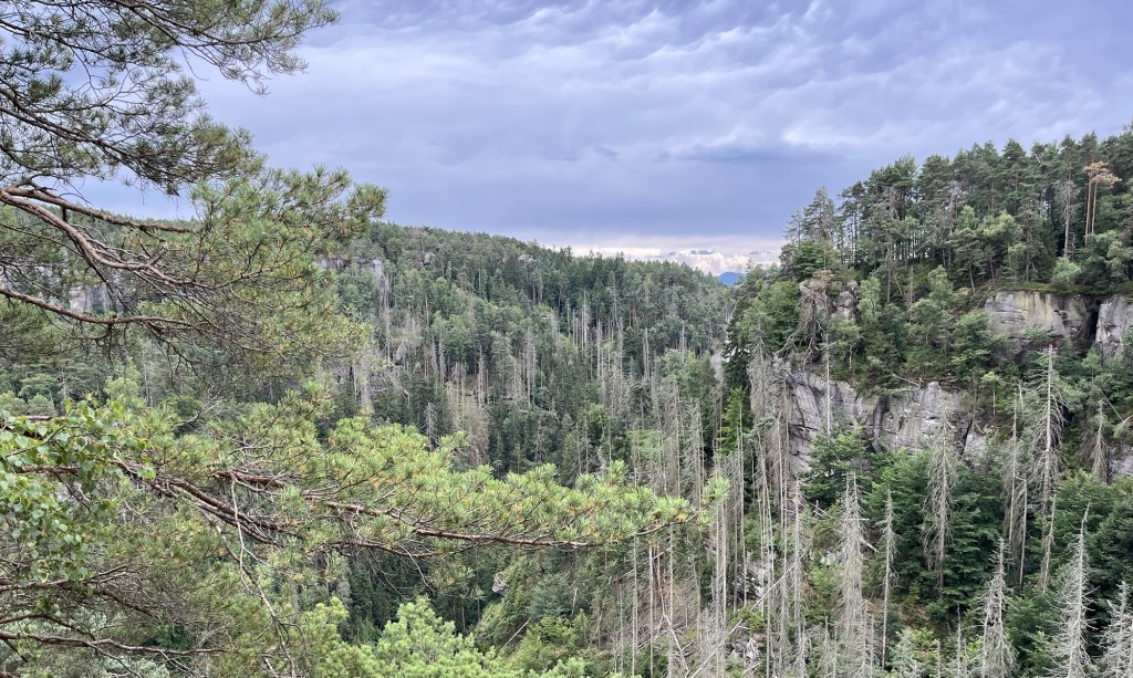
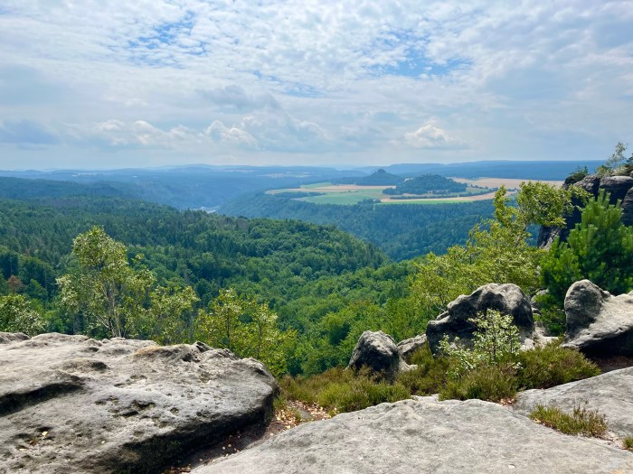
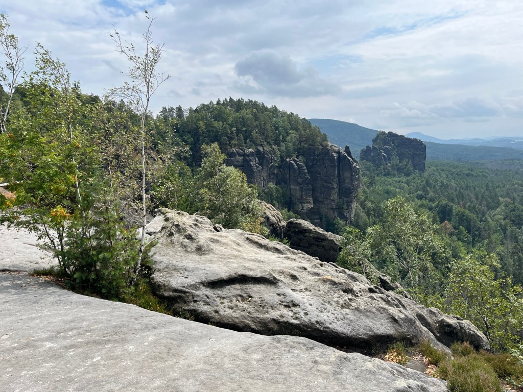
From there, we started an approximately 1,000-ft ascent over the next four miles. The first part of the ascent was through prairie and woods until we reached the sandstone mountains. The early parts of the hike weren’t that scenic, but as we approached those stone cliffs, we were treated to amazing views.

Sandstone pillars next to the trail

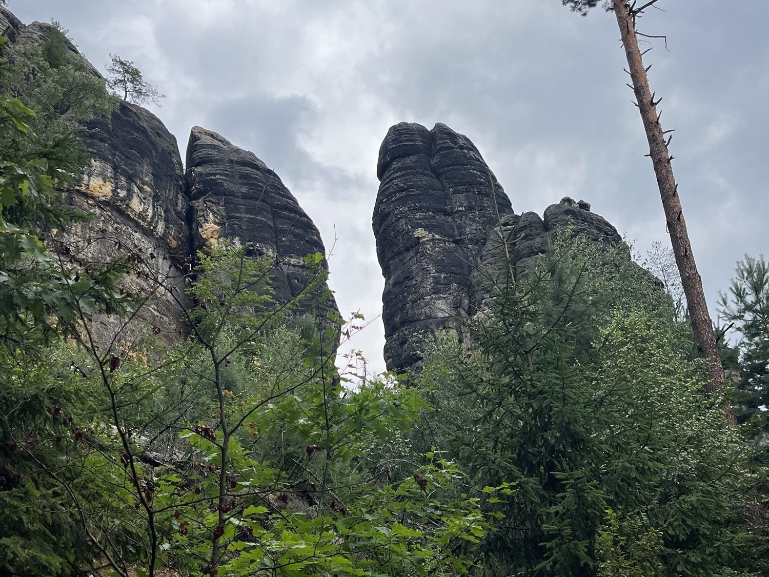
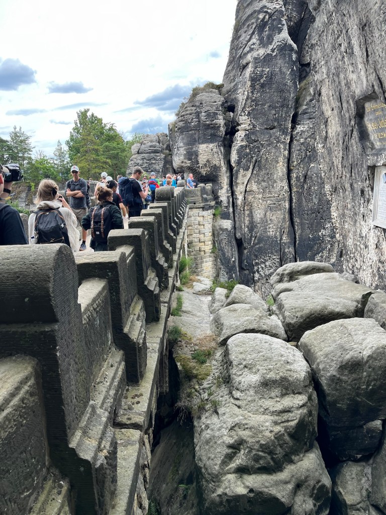
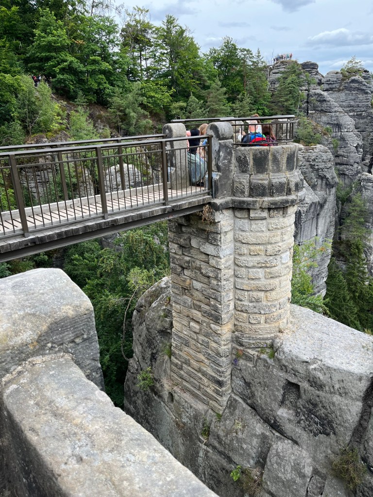
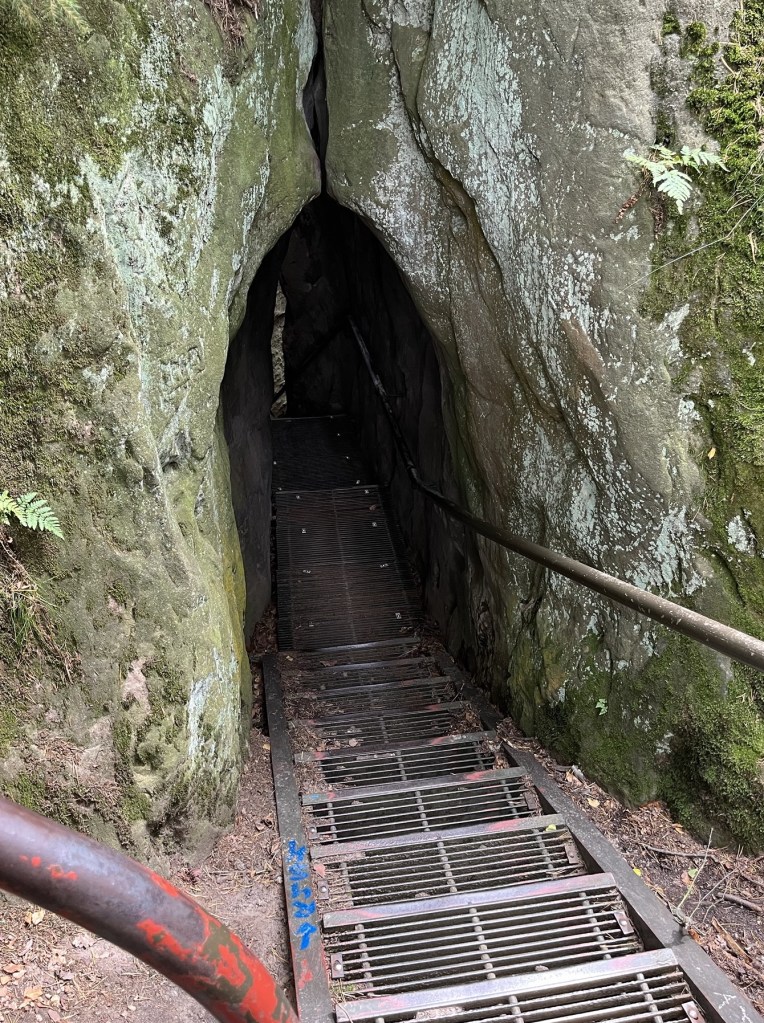
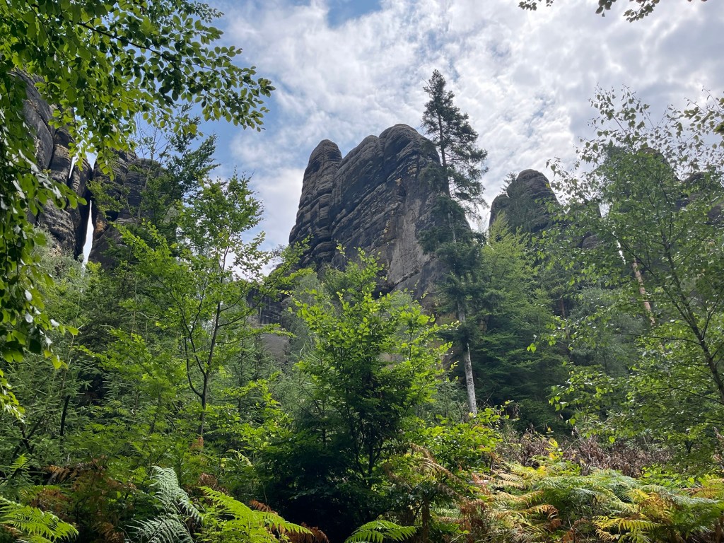
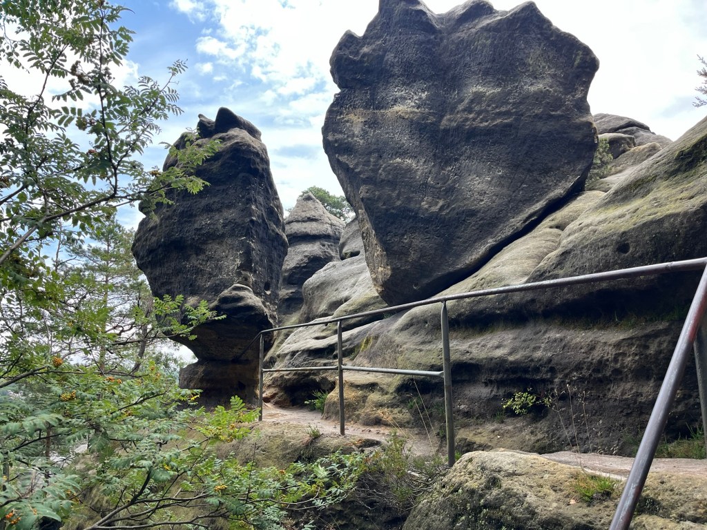
The trail took us around a series of sandstone pillars for about 15 to 20 minutes before leading us uphill. This area has a large sandstone bluff, and the Malerweg trail continues on top of the bluff for a few miles. However, first we needed to climb from the trail up onto the sandstone bluffs.

Metal stairs on the sandstone ridge

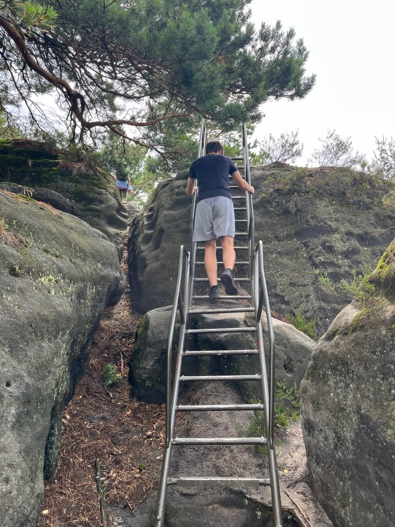
On the ascent, the trail was varied. Often there would be metal stairs with handrails, other times, wooden steps, and sometimes you would need to climb on the rocks themselves. There were spots that I thought were fairly dangerous, and the footing was tricky, but after a while, we made it to the top of the bluffs, where we were treated to some spectacular views.

Looking down on the trail after climbing onto a bluff.

I was baffled by how dangerous the trail felt in parts. At one point, I was completely stretched out, holding onto the base of a metal railing, with my feet desperately trying to grip onto a large boulder, which was slick from the sand on top of the stone. This was precariously over what would be a fall of at least fifty feet.

View from the top of the sandstone bluffs

The baffling part, though, wasn’t the fact that I perceived it to be so dangerous; it was the number of much older Germans and German children doing this hike. Alex and I are in pretty good shape, and these German hikers were treating this trail like it’s a walk along a gentle river. As I learned on the Camino de Santiago earlier this year, when it comes to hiking, Germans are pretty hardcore.

Off in the distance, you can see the channel carved by the Elbe River and across it, a plateau with farmland atop it.

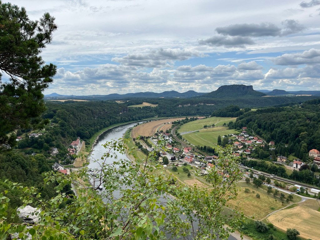
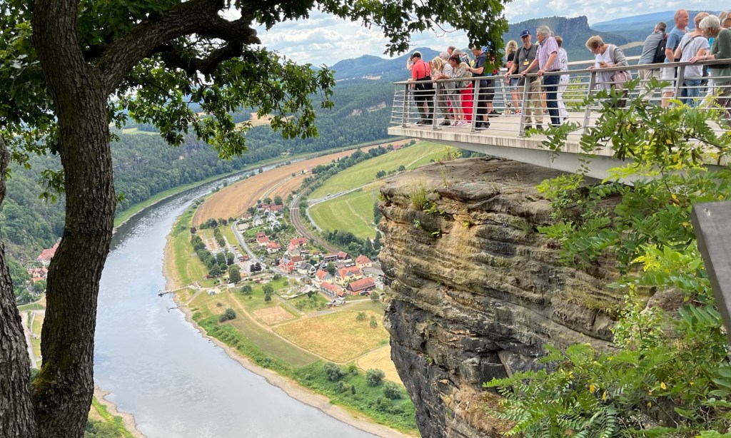
For about an hour, we walked along the top of the sandstone ridge, with phenomenal views of Saxon Switzerland National Park. On occasion, we would have to climb on top of rocks formations, and sometimes we would need to descend. However, the whole time, we were enjoying breathtaking views of the Elbe River and the Elbe Sandstone Mountains.

Metal stairs poke up between rocks on the bluff

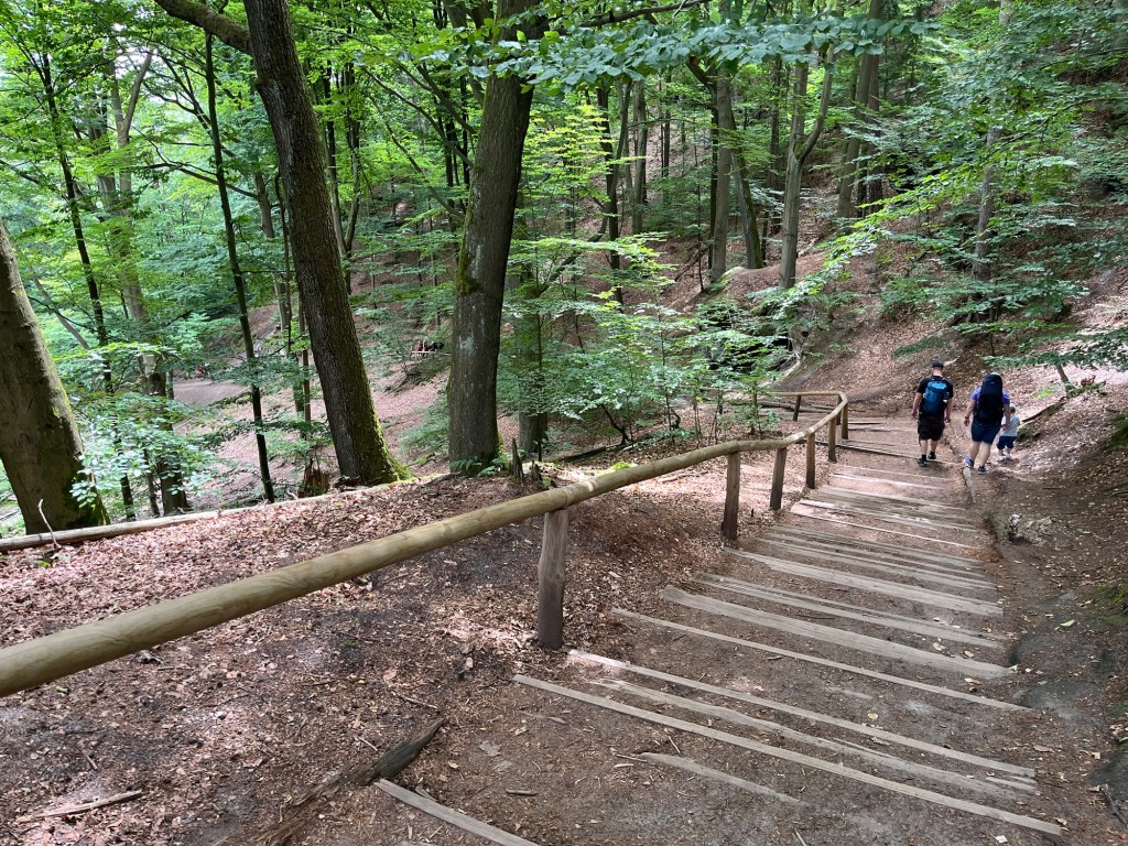
Finally, we began our descent out of the ridge and down along the edge of the sandstone pillars. We were in a pine forest, with the sandstone cliffs next to us. We were starting to get hungry and hoped to find civilization so we could stop for some food and a drink.

A railing along the edge of a steep drop-off.

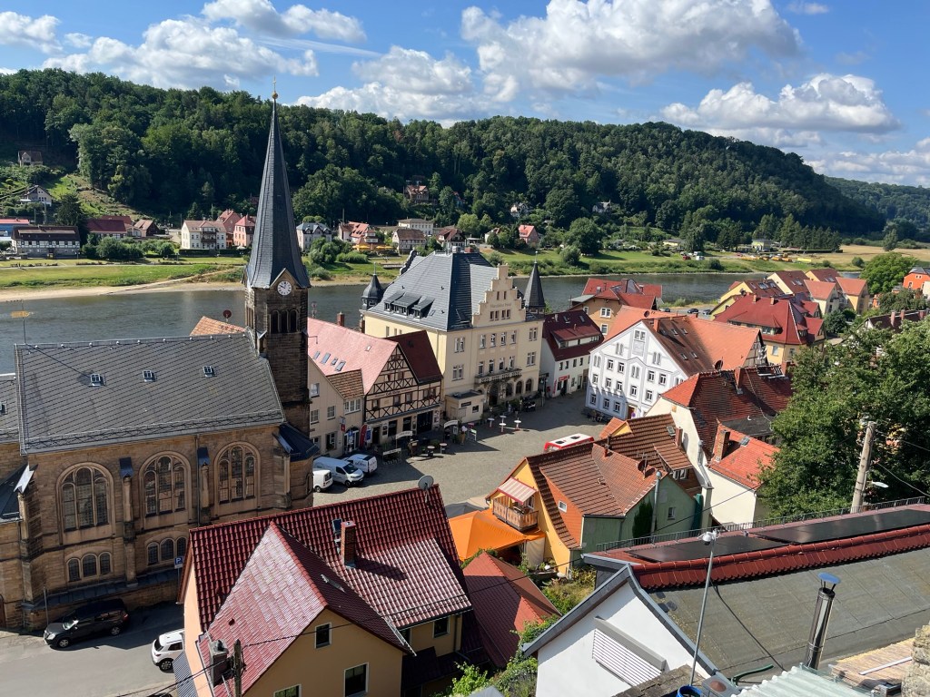
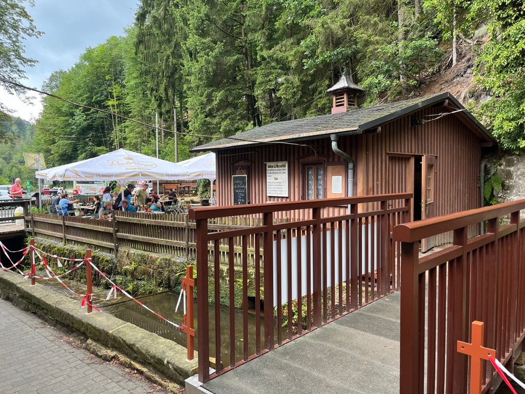
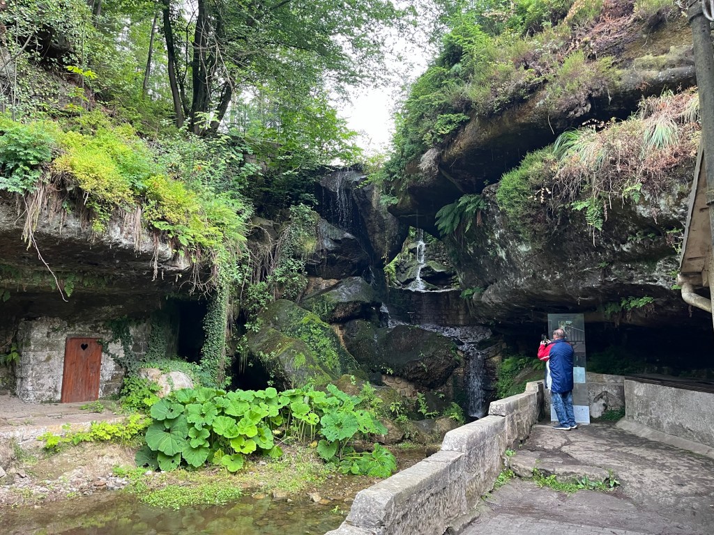
While the hike had provided us with spectacular views, it hadn’t yet passed through any towns that had restaurants. This was unlike Stage Two of the Malerweg, which had plenty of opportunities to stop for a drink and a bite to eat. After about four hours and ten miles of hiking, we finally stopped at Lichtenhainer Wasserfall.

After the descent, we found this amazing tree and formation

Lichtenhainer Wasserfall is a waterfall with a beer garden and restaurant nearby. We both ordered sausages and potato salad, and enjoyed some rest by the waterfall. The food tasted great, but I couldn’t tell if it was because it was actually great or because the hiking had made me extremely hungry.

A section of the trail perched on the edge of a cliff

I had a couple of beers, including a dunkel made by Sachsisches Schmuggler, which is made in nearby Sebnitz. It hit the spot, and we were ready to head off into the woods again.

Biergarten at Lichtenhainer Wasserfall

We only had two or three miles left, so with food in our bellies, we were feeling pretty good. Unfortunately, it was only a matter of about 10 minutes before it started to completely downpour. At first, we put on our raincoats and continued on, thinking that the rain would have to break up eventually.

Lichtenhainer Wasserfall

The rain was so heavy that the raincoats were powerless to stop us from getting wet. We walked about a mile away from Lichtenhainer Wasserfall before giving up and walking back in the other direction. We really wanted to finish, but without really knowing how much further we needed to go and being completely soaked to the bone, we decided to return to Lichtenhainer Wasserfall and take the train back to Bad Schandau.

It was disappointing not to finish the rest of Malerweg Stage Four; however, I felt pretty sure that we had experienced most of the beauty of the stage, with all of the amazing views at the top of the ridge of the Elbe Sandstone Mountains. It was an absolutely amazing hike, and while I wish we had finished it, I was glad that we were able to do the parts that we did.

If you are thinking about hiking some of the Malerweg, I would highly recommend doing stage four. You should, however, keep in mind that there are parts of the trail that are very technical and sometimes dangerous. Just don’t be surprised if you get passed by a German family with a couple of grandparents and a four-year-old.

Stage Two of the Malerweg Trail

The Malerweg is a famous hiking path through Saxon Switzerland National Park in Germany. It has eight stages, each starting in one town and ending in another. For an avid hiker of average endurance, each stage takes a day to complete. Anyone who hikes the full eight days will be treated to a variety of landscapes, spectacular viewpoints, and quaint German villages.

Radfahrerkirche in Stadt Wehlen

Malerweg is German for “The Painter’s Way.” In the middle of the 18th Century, landscape artists came to the area to paint the Elbe Sandstone Mountains. The area became so popular that the artists began to share their routes, and an ideal route was created. When the railroad arrived in the 19th Century, the route fell out of favor. Over a century, efforts had been made to recreate the path, and finally, in 2006, an optimized route of 116 kilometers was created.

I knew we would not have enough time to hike the entire Malerweg, so I chose a few stages I wanted to hike. Stage two was at the top of my list because of the Bastei Bridge. As I’ve learned, if there is something that you really want to do, do it on the first day that has good weather.

We were treated to fantastic weather. It was an absolutely fabulous day with mostly clear skies and temperatures hovering around 70 degrees Fahrenheit.

View from the trail over Stadt Wehlen

The day started with a train ride from our Airbnb in Dresden, followed by a ferry ride across the Elbe from the train station in Stadt Wehlen to the town itself. From the Radfahrerkirche, the church in the main square of Stadt Wehlen, the trail starts on stairs that switchback up a steep hill overlooking the town.

From there, we followed the signs along the Malerweg through the woods. This section involved about a 600-foot climb, which was fairly gradual but strenuous nonetheless. As I’ve learned, though, if you want a great view, you need to climb a hill. In fact, the more you climb, the better the view.

The path between Stadt Wehlen and Bastei was wooded and full of large stones

After about an hour of hiking, we arrived in Bastei. Bastei is probably the most scenic and most visited part of Saxon Switzerland National Park. We immediately stopped at the Panorama Biergarten for a couple of pretzels and drinks.

There are two sides to Bastei: one facing the Elbe River and one facing the sandstone mountains. From the Panorama Biergarten, we saw the side with the sweeping views of the Elbe. Even though the views from this biergarten are amazing, this side of Bastei is less impressive than the other.

View from Panorama Biergarten in Bastei

We finished our snack in the biergarten and walked over to the other side of Bastei, and were immediately struck by the amazing views of the sandstone mountains. Spreading off into the horizon was a sea of gray sandstone columns smoothed from millions of years of erosion.

The sandstone mountains were formed during the Cretaceous period when this area was under the sea. A 600-meter-thick sandstone slab was formed at the bottom of the sea. When geologic forces caused the area to rise from the sea, erosion of the sandstone formed these landscapes. What is left is breathtaking.

Bastei Bridge

We continued walking along the path until we saw the Bastei Bridge. This sandstone bridge was built in 1851 to link multiple sandstone columns. It is a major tourist attraction and is a man-made object that complements nature rather than detracts from it.

Bastei Bridge

Most of the time we spent on the trail was by ourselves. That was not the case in Bastei. There are many ways to get to Bastei without hiking the Malerweg. There are parking lots near Bastei for people who drive, there is a bus that goes to Bastei, or you can take a much shorter 1-kilometer hike from Rathen.

Outlook stretching off the Bastei Bridge

This meant that while we were in Bastei, the trails were very crowded as people jockeyed for position to see the Elbe Sandstone Mountains and the Bastei Bridge. The crowds were fairly thick for at least a kilometer from the Bridge itself. There is a great reason for this, though—the views are tremendous.

Elbe River taken from the outlook near the Bastei Bridge

Continuing on the Malerweg past the Bastei Bridge, multiple viewpoints of the Elbe River valley and the Sandstone Mountains are simply amazing. We spent a lot of time in this area taking pictures and just looking out over the breathtaking landscape.

Viewing platform overlooking the Elbe River

Eventually, we reached the end of the sandstone bluffs at Bastei and had to start heading downhill on the trail. There were a decent number of hikers still on the trail, but they were starting to thin out.

Descending from Bastei

When we finished our descent, we were treated to a man-made lake, as the creek that ran through the area had been dammed up. People were enjoying the lake with paddle boats and kayaks, while others hiked around the lake. It was a beautiful location.

Walking along the Amelsee

That path continued until we reached Rathwalde and stopped for a little lunch. Rathwalde is a cute little village with a few restaurants. It was a nice place to stop for a little while and rest.

After stopping in Rothwalde, we got off the correct Malerweg path. I’m not sure if we missed a sign or if we misinterpreted one, but we ended up going the wrong way and had to use Google Maps to try to get us to Hohnstein, which was the end town of Malerweg stage two. That took us on a narrow blacktopped road, which wasn’t particularly fun or scenic to walk.

View from Hocksteinaussicht

Eventually, we made it back onto the Malerweg and ended up in a place called Hocksteinaussicht, a rocky lookout with a view of the village of Hohnstein. After taking in the views from Hocksteinaussicht, we descended from the rock down a set of metal stairs between the rocks. Finally making it to the bottom of the hill, we found ourselves at a road where we could go left or right. We chose to go left, which was, again, the incorrect choice.

Metal stairs through a break in the sandstone descend from Hocksteinaussicht.

Had we chosen the path to the right, we would have been treated to a pleasant walk through the woods ending in Hohnstein. Much of that path would have been along a gentle creek. Unfortunately, since we chose the other direction, we ended up on another road walking the long way into Hohnstein.

Walking into Hohnstein

When we finally did make it into Hohnstein, we were greeted by a beautiful German village with a castle on top of the highest point. It dates back to at least the 14th Century and is now a hotel.

Hohnstein

We wandered a little around the town and finally caught a bus back to the Pirna train station to catch the train back to our Airbnb in Dresden.

Between the sweeping views of the Elbe valley, the Elbe Sandstone Mountains, the Bastei Bridge, and all of the beautiful forests, creeks, and ponds, this is by far the most scenic hike I’ve ever been on. Even though the last couple of hours had been frustrating with our wrong turns along the Malerweg, we had an absolutely tremendous hike on the second stage of the Malerweg.