Stage Two of the Malerweg Trail

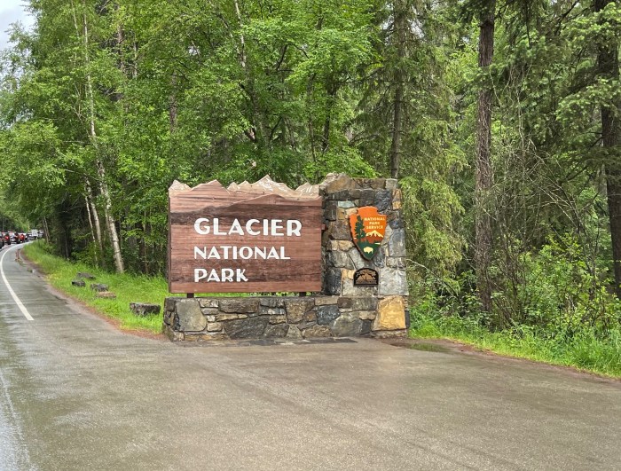
The Malerweg is a famous hiking path through Saxon Switzerland National Park in Germany. It has eight stages, each starting in one town and ending in another. For an avid hiker of average endurance, each stage takes a day to complete. Anyone who hikes the full eight days will be treated to a variety of landscapes, spectacular viewpoints, and quaint German villages.

Radfahrerkirche in Stadt Wehlen

Malerweg is German for “The Painter’s Way.” In the middle of the 18th Century, landscape artists came to the area to paint the Elbe Sandstone Mountains. The area became so popular that the artists began to share their routes, and an ideal route was created. When the railroad arrived in the 19th Century, the route fell out of favor. Over a century, efforts had been made to recreate the path, and finally, in 2006, an optimized route of 116 kilometers was created.

I knew we would not have enough time to hike the entire Malerweg, so I chose a few stages I wanted to hike. Stage two was at the top of my list because of the Bastei Bridge. As I’ve learned, if there is something that you really want to do, do it on the first day that has good weather.

We were treated to fantastic weather. It was an absolutely fabulous day with mostly clear skies and temperatures hovering around 70 degrees Fahrenheit.

View from the trail over Stadt Wehlen

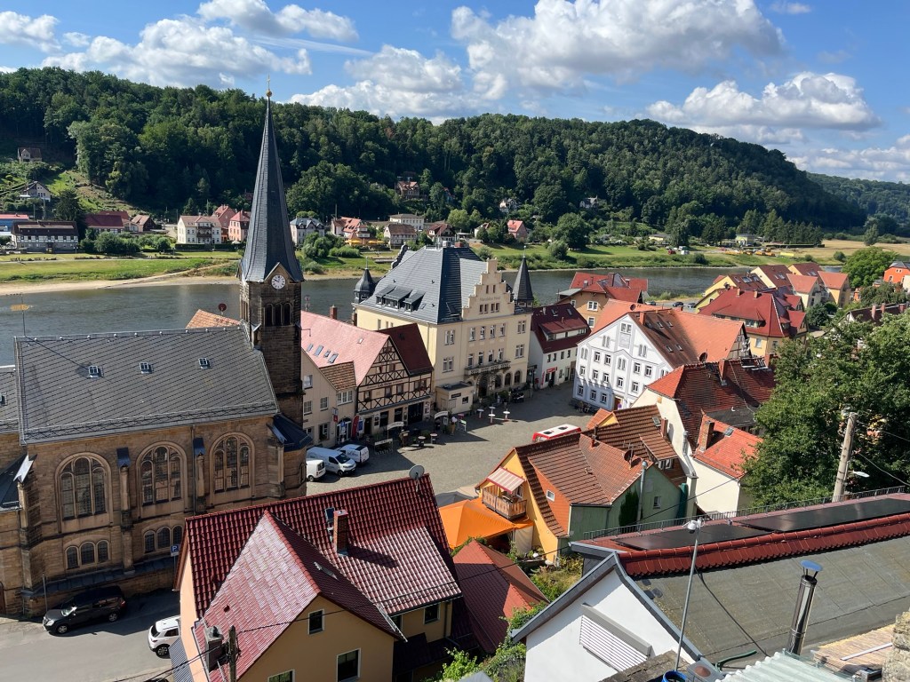
The day started with a train ride from our Airbnb in Dresden, followed by a ferry ride across the Elbe from the train station in Stadt Wehlen to the town itself. From the Radfahrerkirche, the church in the main square of Stadt Wehlen, the trail starts on stairs that switchback up a steep hill overlooking the town.

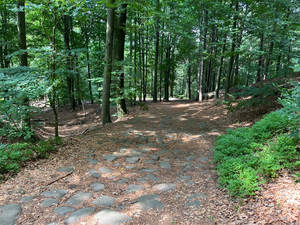
From there, we followed the signs along the Malerweg through the woods. This section involved about a 600-foot climb, which was fairly gradual but strenuous nonetheless. As I’ve learned, though, if you want a great view, you need to climb a hill. In fact, the more you climb, the better the view.

The path between Stadt Wehlen and Bastei was wooded and full of large stones

After about an hour of hiking, we arrived in Bastei. Bastei is probably the most scenic and most visited part of Saxon Switzerland National Park. We immediately stopped at the Panorama Biergarten for a couple of pretzels and drinks.

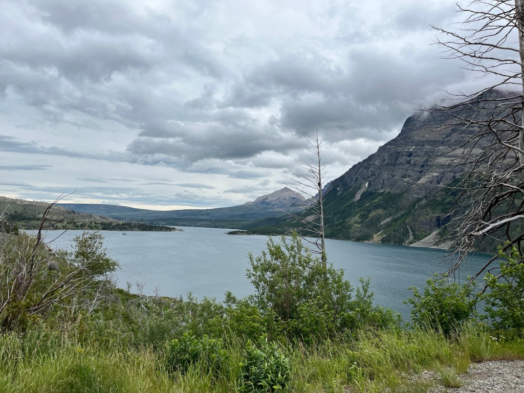
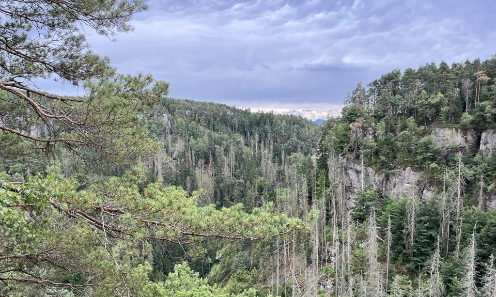
There are two sides to Bastei: one facing the Elbe River and one facing the sandstone mountains. From the Panorama Biergarten, we saw the side with the sweeping views of the Elbe. Even though the views from this biergarten are amazing, this side of Bastei is less impressive than the other.

View from Panorama Biergarten in Bastei

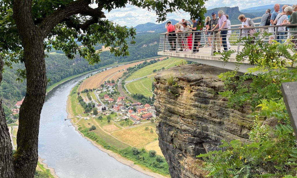
We finished our snack in the biergarten and walked over to the other side of Bastei, and were immediately struck by the amazing views of the sandstone mountains. Spreading off into the horizon was a sea of gray sandstone columns smoothed from millions of years of erosion.

The sandstone mountains were formed during the Cretaceous period when this area was under the sea. A 600-meter-thick sandstone slab was formed at the bottom of the sea. When geologic forces caused the area to rise from the sea, erosion of the sandstone formed these landscapes. What is left is breathtaking.

Bastei Bridge

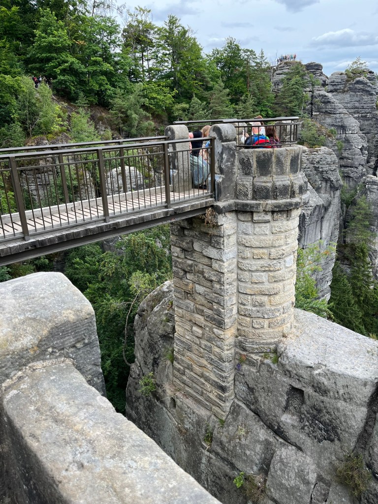
We continued walking along the path until we saw the Bastei Bridge. This sandstone bridge was built in 1851 to link multiple sandstone columns. It is a major tourist attraction and is a man-made object that complements nature rather than detracts from it.

Bastei Bridge

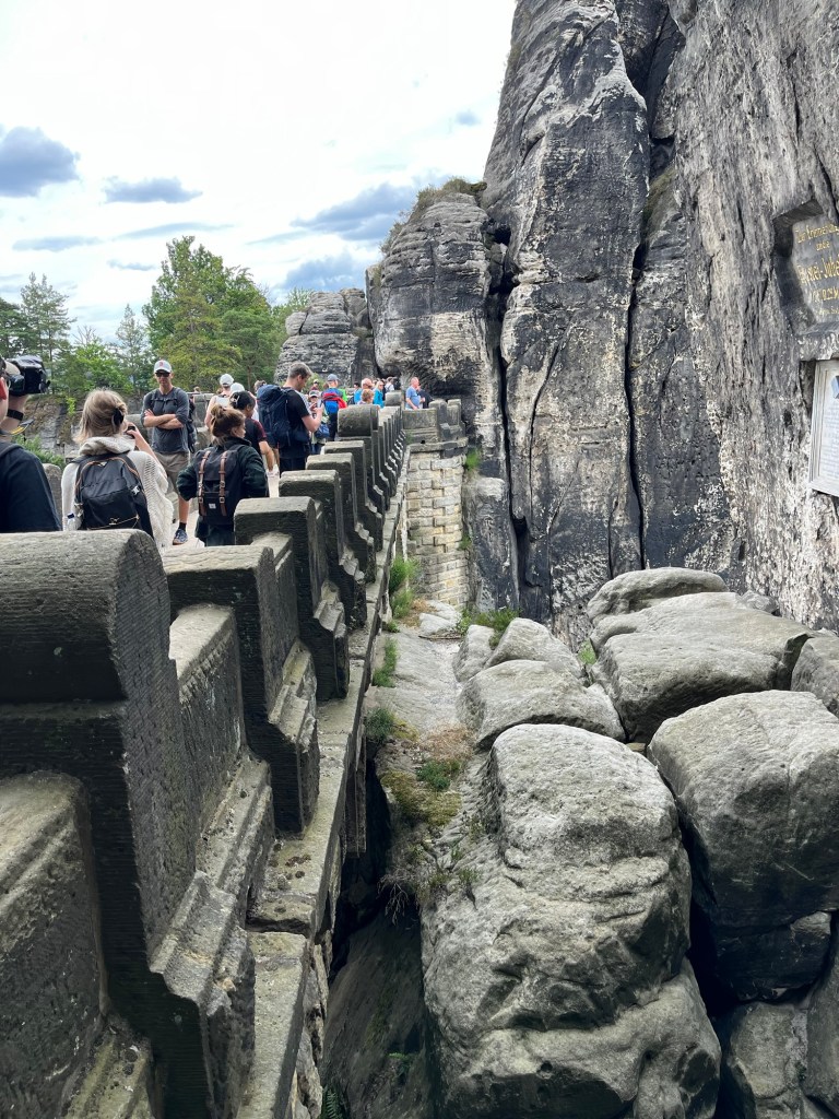
Most of the time we spent on the trail was by ourselves. That was not the case in Bastei. There are many ways to get to Bastei without hiking the Malerweg. There are parking lots near Bastei for people who drive, there is a bus that goes to Bastei, or you can take a much shorter 1-kilometer hike from Rathen.

Outlook stretching off the Bastei Bridge

This meant that while we were in Bastei, the trails were very crowded as people jockeyed for position to see the Elbe Sandstone Mountains and the Bastei Bridge. The crowds were fairly thick for at least a kilometer from the Bridge itself. There is a great reason for this, though—the views are tremendous.

Elbe River taken from the outlook near the Bastei Bridge

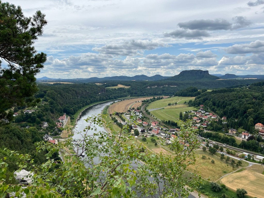
Continuing on the Malerweg past the Bastei Bridge, multiple viewpoints of the Elbe River valley and the Sandstone Mountains are simply amazing. We spent a lot of time in this area taking pictures and just looking out over the breathtaking landscape.

Viewing platform overlooking the Elbe River

Eventually, we reached the end of the sandstone bluffs at Bastei and had to start heading downhill on the trail. There were a decent number of hikers still on the trail, but they were starting to thin out.

Descending from Bastei

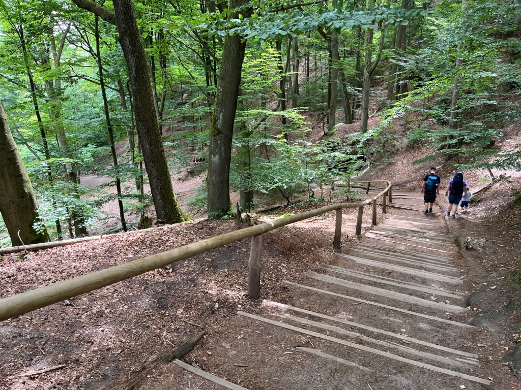
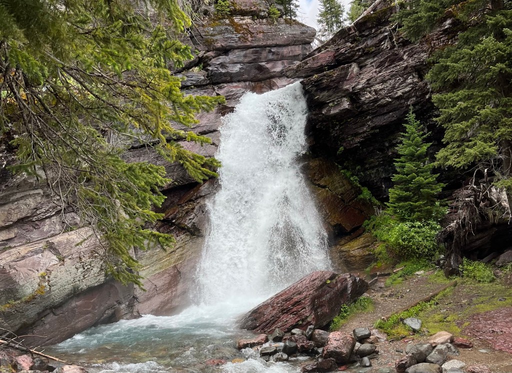
When we finished our descent, we were treated to a man-made lake, as the creek that ran through the area had been dammed up. People were enjoying the lake with paddle boats and kayaks, while others hiked around the lake. It was a beautiful location.

Walking along the Amelsee

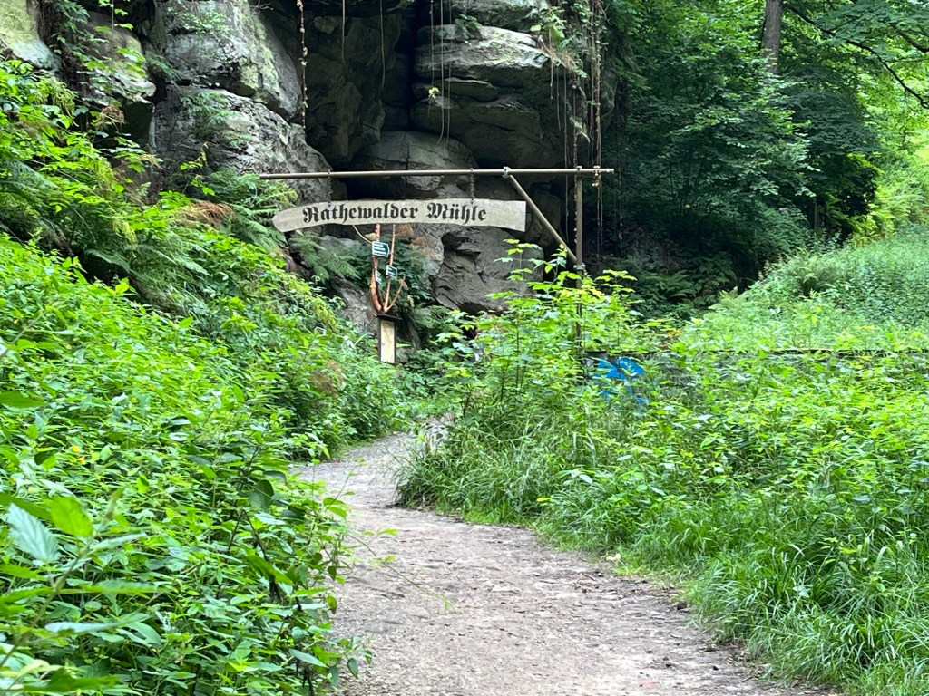
That path continued until we reached Rathwalde and stopped for a little lunch. Rathwalde is a cute little village with a few restaurants. It was a nice place to stop for a little while and rest.

After stopping in Rothwalde, we got off the correct Malerweg path. I’m not sure if we missed a sign or if we misinterpreted one, but we ended up going the wrong way and had to use Google Maps to try to get us to Hohnstein, which was the end town of Malerweg stage two. That took us on a narrow blacktopped road, which wasn’t particularly fun or scenic to walk.

View from Hocksteinaussicht

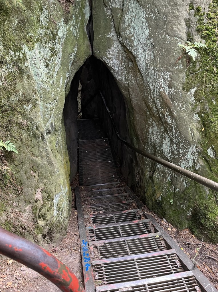
Eventually, we made it back onto the Malerweg and ended up in a place called Hocksteinaussicht, a rocky lookout with a view of the village of Hohnstein. After taking in the views from Hocksteinaussicht, we descended from the rock down a set of metal stairs between the rocks. Finally making it to the bottom of the hill, we found ourselves at a road where we could go left or right. We chose to go left, which was, again, the incorrect choice.

Metal stairs through a break in the sandstone descend from Hocksteinaussicht.

Had we chosen the path to the right, we would have been treated to a pleasant walk through the woods ending in Hohnstein. Much of that path would have been along a gentle creek. Unfortunately, since we chose the other direction, we ended up on another road walking the long way into Hohnstein.

Walking into Hohnstein

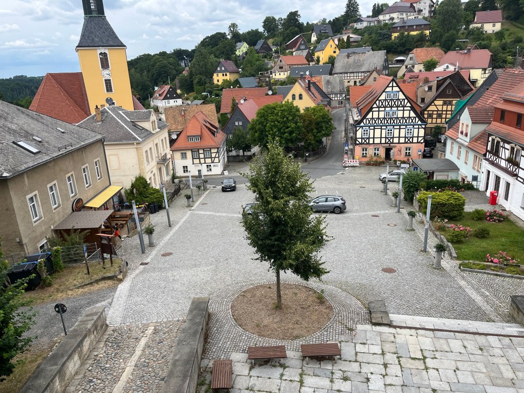
When we finally did make it into Hohnstein, we were greeted by a beautiful German village with a castle on top of the highest point. It dates back to at least the 14th Century and is now a hotel.

Hohnstein

We wandered a little around the town and finally caught a bus back to the Pirna train station to catch the train back to our Airbnb in Dresden.

Between the sweeping views of the Elbe valley, the Elbe Sandstone Mountains, the Bastei Bridge, and all of the beautiful forests, creeks, and ponds, this is by far the most scenic hike I’ve ever been on. Even though the last couple of hours had been frustrating with our wrong turns along the Malerweg, we had an absolutely tremendous hike on the second stage of the Malerweg.

Going-to-the-Sun Road – Glacier National Park

Normally, I’m the one who does the planning for our family trips. However, I recently found myself in Montana with a group of my old high school friends who made the trek to see our friend Mat get married. It was pretty obvious early on that they were on top of it and I could just show up and enjoy it. I knew that we would be going to Glacier National park as part of this, but I didn’t do an ounce of research on it before we left, which is very unusual for me.

Glacier National Park Entrance Sign

On the first night, we went to Tamarack Brewing for dinner. I was enjoying an IPA while we caught up on old times. The conversation switched to how we would secure passes to “Going-to-the-Sun Road”. Tracy said she would set a reminder for 7 p.m. the next day, which was during the wedding reception, to get the car pass.

Having done zero research for this trip I thought the pass was for “Sun Road” and she just said that in a weird way. Then I heard some of the others say things like “It will be fun to drive Going-to-the-Sun road” and “I’m glad they managed to get Going-to-the-Sun road open.”

I started to strain my ears and look quizzically at them. What’s going on, am I having a stroke? These are all smart, accomplished people, why are they talking like they just learned English last week? Once I figured out that the road was called “Going-to-the-Sun Road,” I was both a little relieved and still a little confused by why a road would be named that.

What is Going-to-the-Sun Road?

According to the National Park Service, Going-to-the-Sun Road is a two lane road built in the late 1920’s and early 1930’s. It is 50 miles long and essentially bisects Glacier National Park from Apgar to St. Mary. It is the only road that goes through Glacier National Park and is one of the most scenic roads in the United States.

The road is named for Going-to-the-Sun Mountain. It is unclear whether the origin of the mountain’s name is based on a Blackfoot Indian legend about the deity Sour Spirit teaching the Blackfoot to hunt or whether the explorer James Willard Schultz made up the name.

Getting a Pass for Going-to-the-Sun Road

The number of cars allowed on Going-to-the-Sun Road is limited. This is to keep the narrow two-lane road and especially the small parking areas on the side of the road from being overwhelmed by cars. Reservations for Going-to-the-Sun Road can be made at Recreation.gov.

There are two types of reservations, one that can be made 120 days in advance, if you have sufficiently planned ahead, and one that can be made at 7 p.m. mountain time, the day before. Tracy grabbed our pass at 7 p.m. which is why she needed to do it during the wedding reception.

The next morning we packed up the minivan and headed out to Glacier National Park. After a quick stop for coffee and breakfast, we had to check our park passes at one set of security and then our pass for the Going-to-the-Sun Road at a second security stop. Once we were through security, we were on our way.

Driving Along Lake McDonald

The drive begins from Apgar along Lake McDonald. Lake McDonald is about 10 miles long, about a mile wide and a pretty impressive 472 feet deep. The beginning of this drive is a beautiful and calm drive through the forest with Lake McDonald on the left hand side. It remains a pretty calm drive past Lake McDonald Lodge, the Trail of the Cedars and up until you hit the West Tunnel, about 20 miles into the drive.

Tunnel cut into rock face

The Ascent to Logan Pass

After the West Tunnel, there is a switchback and then a constant and gradual ascent toward Logan Pass. This is the beginning of a long stretch of road built on the edge of cliffs with long beautiful vistas, waterfalls and mountaintops poking out through the clouds.

View of a valley on the way up to Logan’s Pass on the Going to the Sun Road.

Being the driver is a definite disadvantage. Tim was our driver and while the rest of us were gawking over the views, he had to pay attention to the road. Going-to-the-Sun road is an active driving situation with narrow lanes, tight curves and frequent stops. The temptation to stare at the landscape instead of the narrow road has to be pretty intense.

Much of the early part of our ascent to the pass was marked by a lot of fog, but it made for dramatic views of the mountains and valleys when they cleared.

Ascending up towards Logan’s Pass, we entered the clouds.

At one point, we caught a quick glance of a Big Horn Sheep or a Mountain Goat right on the side of the road, just poking his head out from behind the stone wall, but it happened so fast my brain didn’t fully process it. We stopped at the next pull-off but couldn’t see him, so I don’t know what exactly we saw but it had horns and it was right next to the road.

Waterfall where Adler Creek goes under the Going to the Sun Road.

As we continued our ascent, we started to come across snow. It became very obvious why they aren’t able to open the roads until June or July because the amount of snow that has to be removed every year is massive. The remainder of the snow accumulation was still pretty deep by the side of the road in some spots.

According to the National Park Service, Glacier National Park receives an average of 157 inches of snowfall per year at its headquarters in West Glacier and much more at higher elevations. Opening Going-to-the-Sun-Road is a massive undertaking that starts around April and lasts for months. This past year, they had to deal with a drift that was 80 feet high, so it takes a long time for this snow to melt completely.

Snow on the side of the road, slightly before Oberlin Bend

We got out of the car on multiple occasions to take photos at pull-offs along the road, but we got out to walk around at Oberlin Bend. There is a wood and steel grate walkway there. There was still a considerable amount of snow left in the area and it gave us a sense of how long it must take for it to melt every year – this was June 30th!

It was still very snowy at Oberlin Bend

Logan Pass and the Highline Trail

Just a little bit further up the road from Oberlin Bend, we then had a chance to stop at the Logan Pass Visitor Center. There is some bathrooms and a cute little gift shop there. Steph and I took a little walk out the back of the visitor center and she showed me the people who were hiking the Highline Trail.

Mountain obscured by clouds near Logan Pass

Prior to the trip we briefly considered doing that trail, but decided to do the Avalanche Lake hike instead since it was considerably less terrifying. The Highline Trail is known for its breathtaking views and a section called “The Ledge” which is only 6-8 feet wide with a sheer drop over a hundred feet down. There is a steel cable to hold onto in this section. If you’re brave enough, parking for people doing the Highline Trail is available at Logan Pass Visitor Center.

Jackson Glacier Outlook

We got back in the minivan and continued on, now going downhill. We stopped at the Jackson Glacier Overlook, where a ranger explained to a fairly large group about the remaining glaciers in the park and how the number of glaciers and size has been shrinking since around 1850. That overlook, of course, has a view of Jackson Glacier, but it is quite far from the overlook.

Way off in the distance is Jackson Glacier, one of the 26 remaining glaciers in Glacier National Park. There were 80 at the end of the Little Ice Age, which ended around 1850.

St Mary’s Lake

We completed the drive by stopping at the Visitors Center at St Mary. There is a little gift shop in there as well as some museum-like exhibits about the history of the Native American people indigenous to the area.

St Mary’s Lake

As is going to be the case for most people on the Going-to-the-Sun Road, we needed to do the entire drive back to the start at Apgar, so we returned to the car for the 50 mile return trip.

Piegan Pass Trail

When we did the first half of the drive, we didn’t get to do a hike near St Mary’s Lake. We tried on the way through the first time to get a parking spot on one of the pull-offs near Piegan Pass Trail but couldn’t. On the return trip, after a little work, we were able to get a parking spot and get out and stretch our legs a little.

Bering Falls on Piegan Pass Trail

We walked a very short distance to see Bering Falls and then turned around and walked to along the path to a point which I believe was the end of Piegan Pass Trail. There is a rocky area jutting out into St Mary’s Lake there where there was a lot of great photo opportunities.

View of St Mary’s Lake from Piegan Pass Trail

Piegan Pass is a heavily traveled trail, at least in this area, so the odds of being approached by a bear is low. We did bring along bear spray just to be sure, but there were no signs of bears in this area. We hiked around 3 miles, and returned back to the minivan to finish our drive.

St Mary’s Lake from the end of Piegan Pass Trail

A Bear Sighting

Near the end of the return trip back to Apgar, we came across a traffic jam. Obviously, we weren’t expecting a traffic jam on Going-to-the-Sun Road, so we assumed that there must be an animal around. Once enough cars had cleared, we pulled off to the side of the road to see what was going on.

The cub is looking for mama, definitely thinks she’s across the road.

There was an animal making noise by the side of the road, and it was a sound I wasn’t familiar with. After a little while, I saw a baby bear head pop up on the side of the road. It was very clear that the bear was in distress and probably looking for his mama. Now, honestly while that is adorable, it’s also pretty terrifying since I’m assuming a stressed mama bear must be nearby as well.

The cub makes an attempt to cross the road but gets scared back into the tall grass by a car.

The cub made several attempts to cross the road, but kept getting scared off by traffic. Finally Tim jumped out into the road and stopped traffic so that the bear could finally cross and hopefully be reunited with his mama.

Tim stops traffic and finally allows for the bear to cross the road.

The Importance of Great Travel Companions

If you’re driving Going-to-the-Sun Road, you will be spending probably a minimum of 6 hours with people in a car, assuming that you are at least stopping once in a while to take pictures and enjoy nature. Spending that much time in a car, you might want to have people with you that you also enjoy spending a minimum of 6 hours with.

For me, this turned out to be a great group with whom to do this drive. We talked about the old days, our families, and a lot about travel. Obviously, I like to talk about travel, but sometimes feel a little weird about it. Honestly, I avoid the subject with people who don’t travel much, because they’re either not interested or I’m afraid it comes off as braggy. It’s something that I’m really passionate about and to have spent a few days with people who are as passionate about travel as me made for great conversations.

The crew being silly. From left to right: Julie, Tracy, Steph, Carrie and Tim.

I loved hearing about all of the places they’ve been and I’ve certainly taken some mental notes about places that I might want to visit based on our conversations. In between all of these conversations, there was also plenty of carpool karaoke, which I abstained from to save everyone else’s eardrums. In the end, it was a great time with some great friends.

I would definitely recommend driving Going-to-the-Sun Road if you get a chance. It’s an unbelievably beautiful drive. The variety of views from mountain lakes and snow covered peaks to waterfalls is astonishing. It’s also one of the few really accessible places in Glacier National Park for people who aren’t doing long hikes. Keep in mind that the number of car passes are limited and you will need to purchase those in advance. Then all you need is a full tank of gas, some great friends, and some snacks and you will get to witness one of America’s great treasures.