Thanks to our Travel Companions

As long as I can remember, I was fascinated by geography. When I was a child, we had a driftwood-framed color map of Puerto Rico that my parents brought home from a trip before I was born. I stared at that map for hours, imagining what it would be like to live on a Caribbean island.

When I was in Junior High, my Mom bought a beautiful, large-format world atlas. I spent so much time flipping through those pages, imagining what life is like in different areas of the world. I was fascinated by what was outside of my narrow world.

My family didn’t travel much, and when we did, it was to areas within the Midwest that were pretty much the same as where I grew up. Travel wasn’t a priority for us, but it was always something I wished I could do.

Marrying an Adventurous Soul

I always tell people I married a hippy, but that’s not really accurate. I married a woman with an adventurous soul. For most of our marriage, I felt like the cautious person who was always saying no to every crazy idea that she had, but over time, she wore me down, and I started to see life more in the way she saw it.

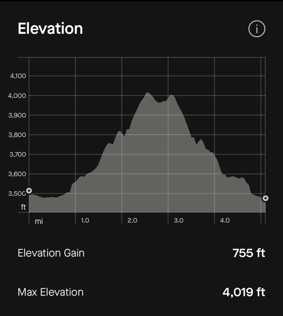
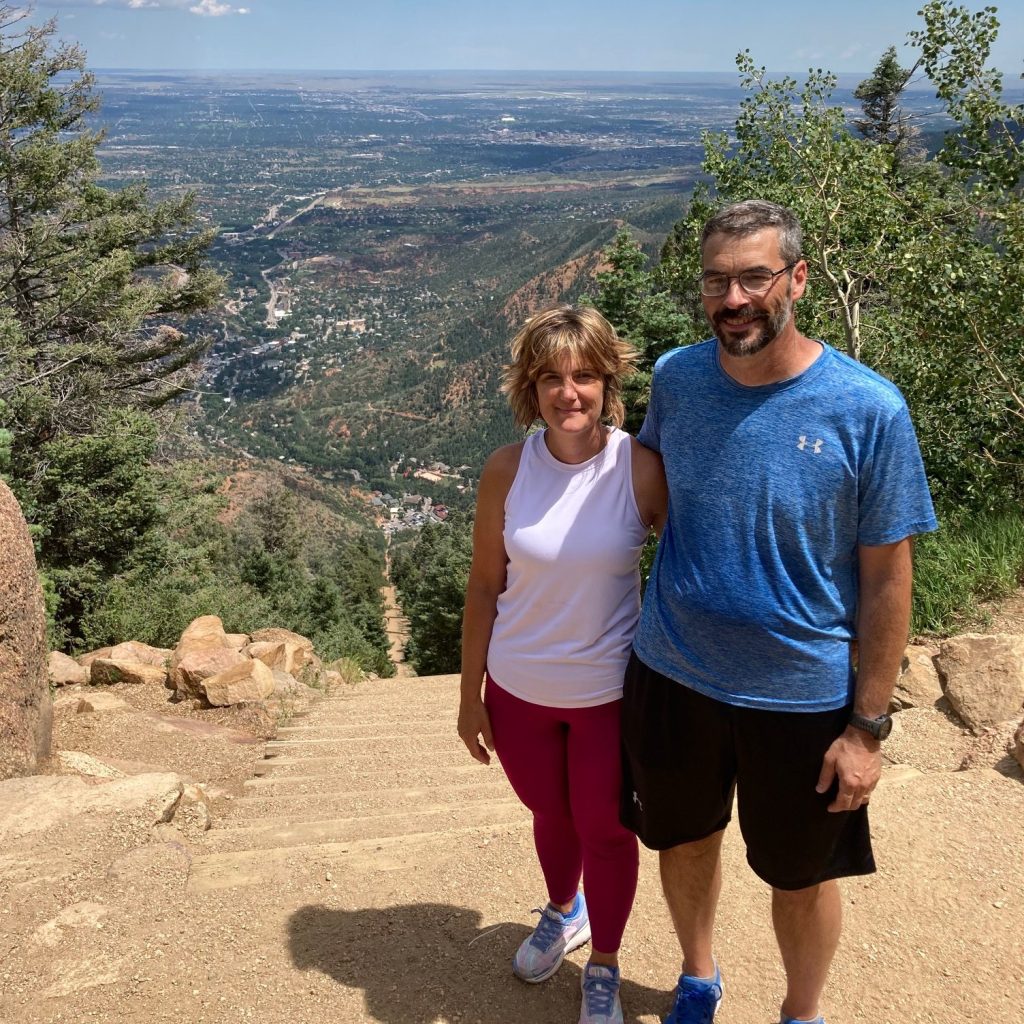
For example, in 2022, on a camping trip in Colorado Springs, we were talking to a couple at a microbrewery, and they suggested that we hike the Incline, a trail on an abandoned funicular line that climbs 2,000 feet in one mile. Jenn said, “That sounds awesome, let’s do it!” I looked at her like she was crazy, but I agreed to go. It turned out to be an insanely challenging hike, but it had amazing views and was unbelievably rewarding.

At the top step of the Incline in Manitou Springs, Colorado.

Getting off the Couch

Doing the incline was a great experience, but we wouldn’t have attempted it if we weren’t in pretty good shape. I personally wouldn’t have been capable of doing it without Jenn’s persistence.

When our children were young, we found it difficult to get much activity because our lives revolved around working, cooking, watching the kids, and shuffling them to activities. But as they grew older, she insisted that we exercise more. She dragged me, kicking and screaming, into fitness, and since that time, I’ve run eight half marathons, two marathons, and an ultra marathon, usually one event each year.

Starting line at the UTMB Cote d’Azur 55K in 2025.

Camping Against My Will

Jenn grew up camping. I absolutely did not. My family’s idea of “roughing it” was staying at a hotel that didn’t have a pool. Jenn did not accept my unwillingness to camp, and I’m glad she didn’t. When the kids were very young, we started off tent camping, then moved to a pop-up camper, and later to a full-sized travel trailer.

The family at St Mary’s Lake near Idaho Springs, Colorado.

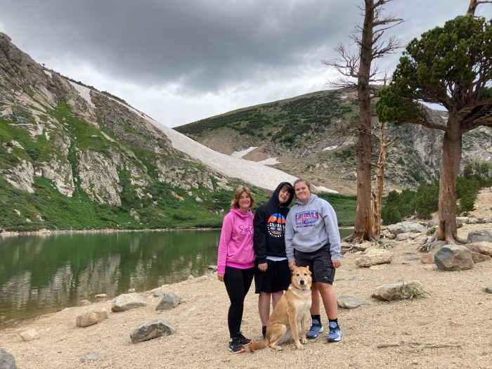
I enjoy camping now, but my favorite part of camping is the hiking that accompanies it. When we took the kids to Colorado in 2022, we camped for two weeks, and in that time, we were able to do some amazing hikes. My favorite was a hike to the lake next to St Mary’s Glacier at 10,000 feet.

Exploring Other Countries

I had always dreamed of visiting other countries, but other than one trip to Cancun, I had never left the United States. The main problem was always the expense of flying. I never thought we could afford to take a family of four overseas with the cost of flights. However, in 2022, I started to look into travel hacking and specifically how to use points and miles to lower the cost of our flights and hotel stays.

Travel hacking lowered the cost of our travel and allowed us to be much more adventurous than in the past. Since then, we’ve had five trips to Europe, one to Mexico (two for Jenn), a trip to Canada, and a trip to Costa Rica. It has allowed us to share these amazing locations with our kids at ages where they can truly appreciate them.

Opening the World for our Children

Our daughter, Emma, graduated from High School in 2023, and to celebrate, we went to Europe for the first time. We had a whirlwind trip, visiting Zurich, Munich, Venice, Rome, and Stockholm over the course of two weeks. During that time, we were able to share as much food, culture, and sightseeing as we could with our kids.

Swiss flags line a street in Zurich

On the last day of our trip, Alex, who had been extremely quiet the entire trip, said that he didn’t want to go home. We honestly couldn’t tell if he was having a good time before that. He was just quietly soaking it all in. At that moment, I realized that we could take our kids anywhere and they would be happy to join us.

The Bridge of Sighs in Venice

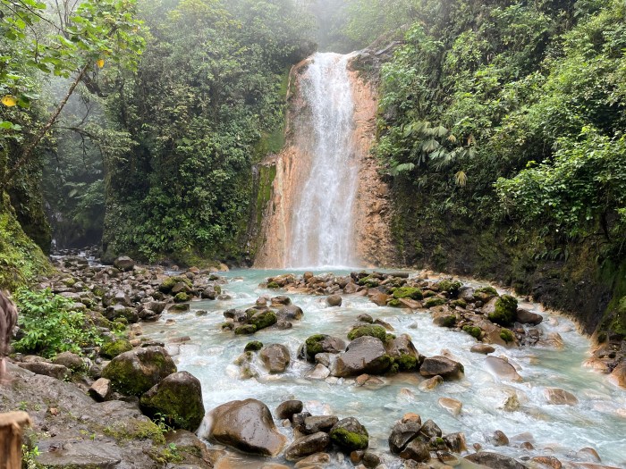
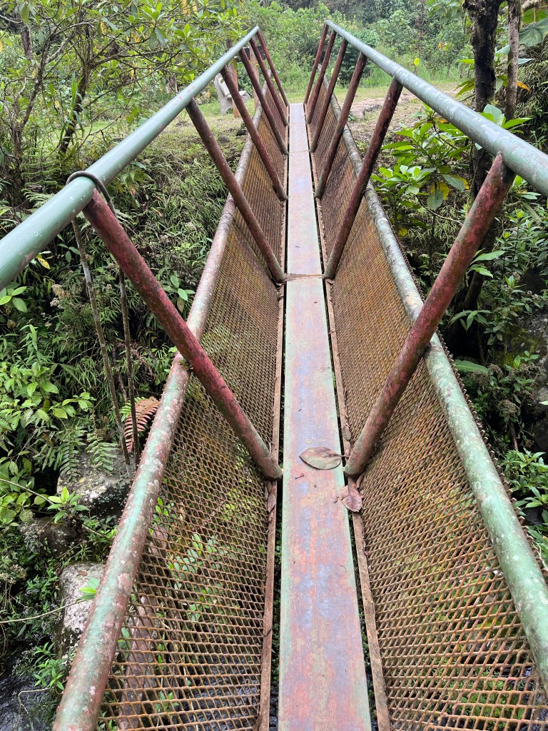
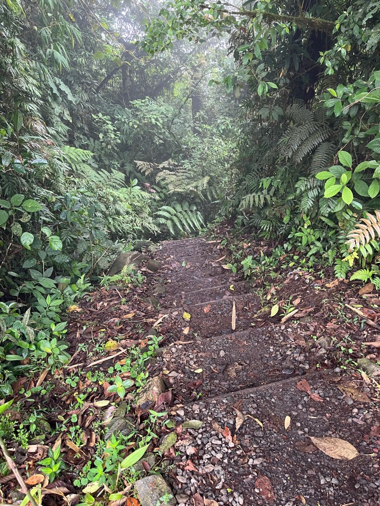
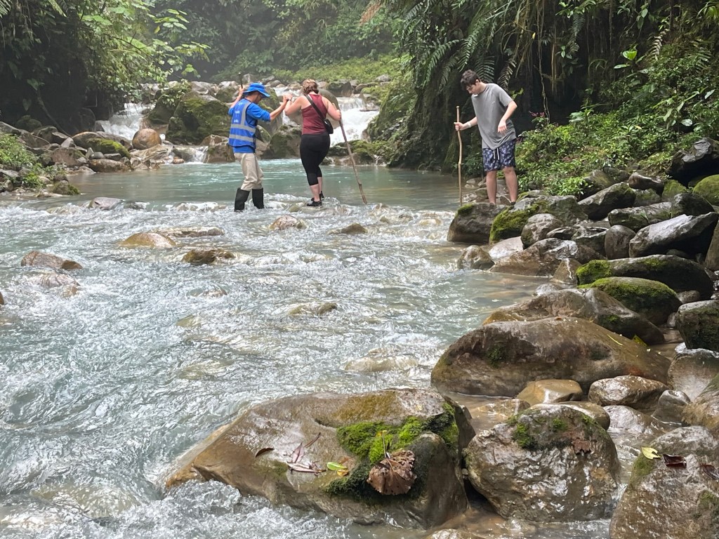
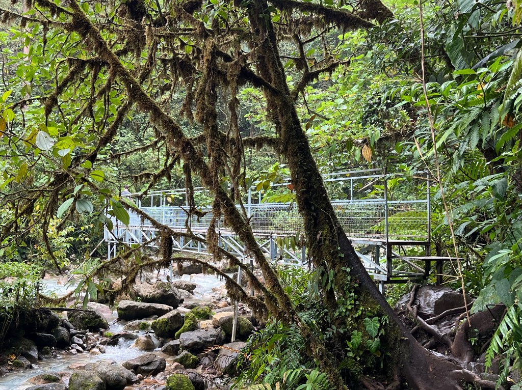
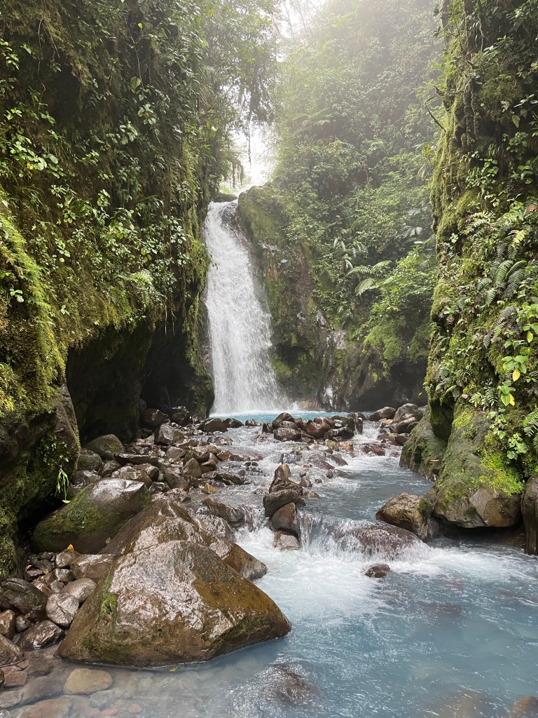
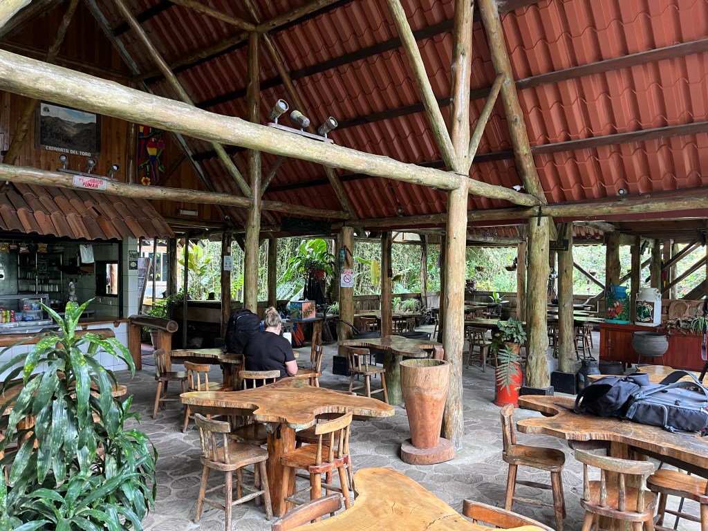
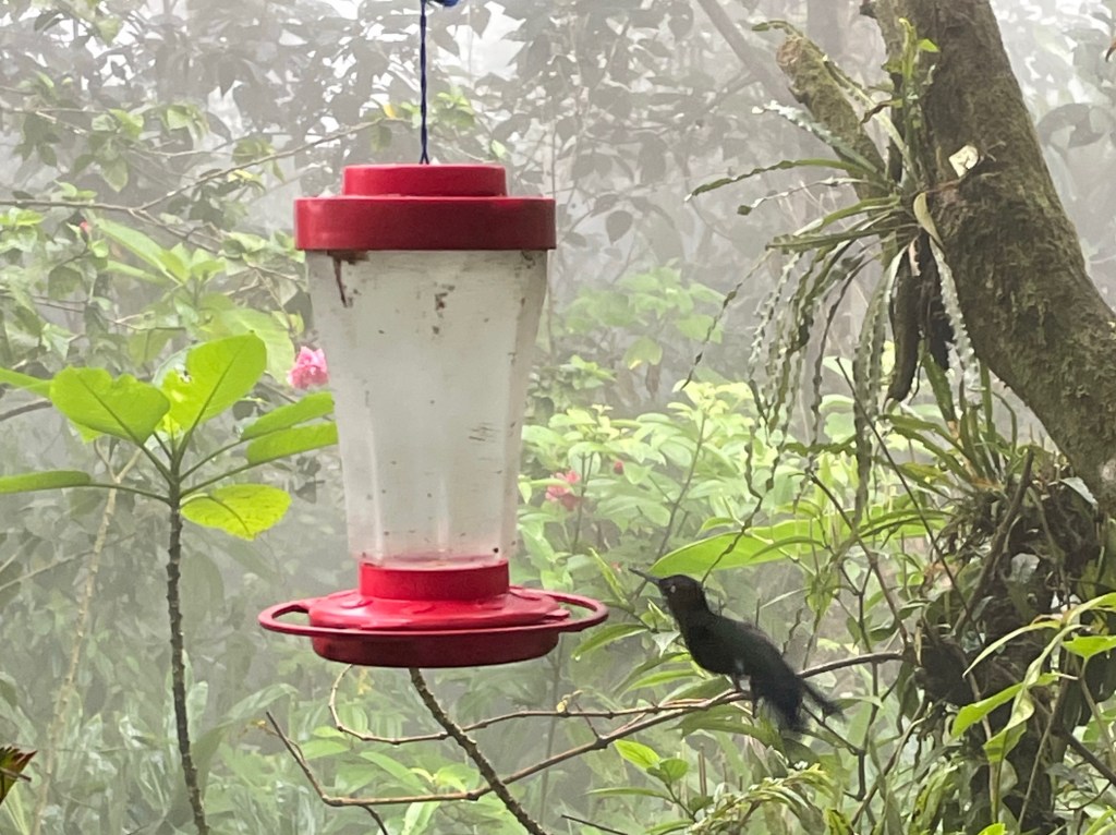
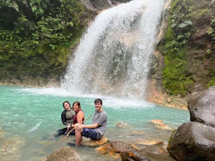
In 2024, we took a spring break trip to Costa Rica, where we spent some time at the beach, did some hiking, and soaked up some authentic Costa Rican culture. The thing that we all remember more than anything on that trip was visiting the Blue Falls of Costa Rica. It is a hiking location with seven amazing turquoise blue waterfalls that cascade from the side of a volcano. It was a memorable hike.

The family enjoying the pool in front of a waterfall in Costa Rica

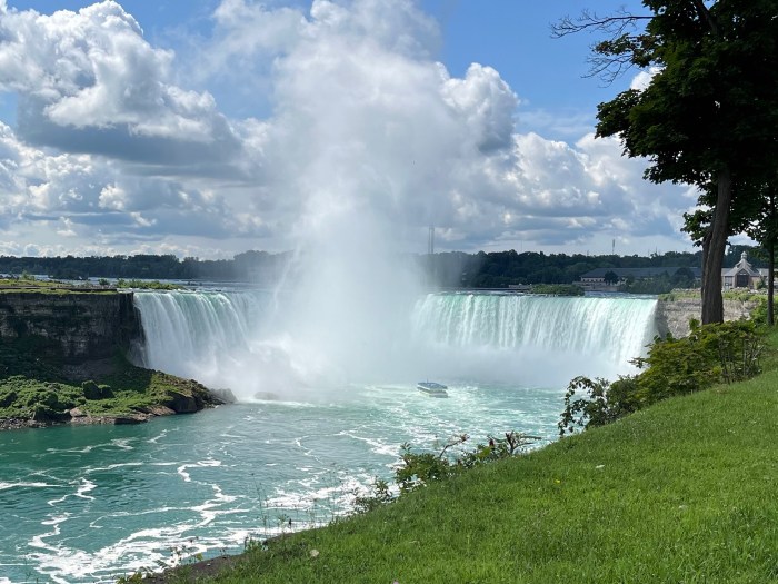
That summer, we took our camper to Hamilton, Ontario, and visited Toronto and Niagara Falls. It was crazy to me that I had never visited Canada, but it was well worth the trip across our northern border.

Horseshoe Falls from the Canadian side of Niagara Falls

For Spring Break in 2025, we did something a little more adventurous and spent six days on the Camino de Santiago de Compostela, where we hiked over 100 kilometers from Portugal to Spain. It was a difficult physical challenge, but it also allowed us to spend a lot of time in the Spanish countryside.

Alex hiking through a village on the Camino

Exploring the world with our children before they were too old to tag along with Mom and Dad was something we really set out to do. I’m really grateful that in the last few years we have been able to travel in a way that I hope shaped their views on the world. What I didn’t expect was that our children wouldn’t be our only travel companions.

Our Other Travel Companions

In the fall of 2024, we went to Italy with our good friends Bill and Theresa, and Jenn’s parents, Mark and Margie. I was a little apprehensive because there is a risk that spending that much time together could result in arguments and annoyances that can ruin a relationship. Travel can be stressful and can expose problems you were unaware of.

A church at the marina in Vernazza, Italy.

It turned out that we had a great time with very little stress. We visited Florence, Cinque Terre, Venice, and Rome on our trip. It was a great trip, and since we had visited Venice and Rome before, we were able to show some of our favorite stops from our first visit to Italy.

Port of Nice

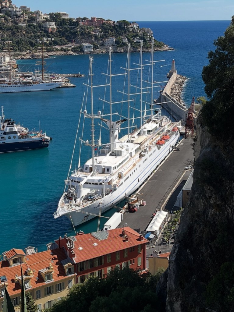
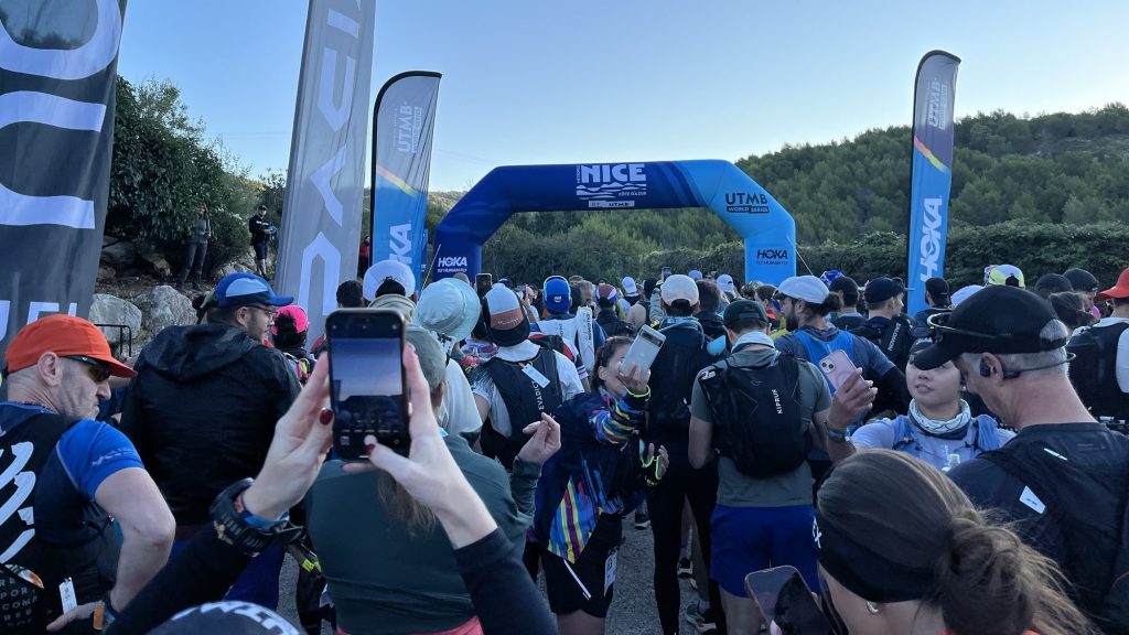
We enjoyed traveling with Bill and Theresa so much that when we went to Nice, France, for the UTMB Côte d’Azur ultramarathons in September of this year, they came along and participated in the races as well. We had a great time visiting Monaco and Nice. On the way back, we stopped in Dublin, where we visited a few old pubs and toured the Jameson Distillery.

Temple Bar District in Dublin

Jenn also did a girls’ trip to Playa del Carmen to celebrate her sister’s 50th birthday, as well as a trip to Munich and Dublin to celebrate our niece Zoey’s high school graduation.

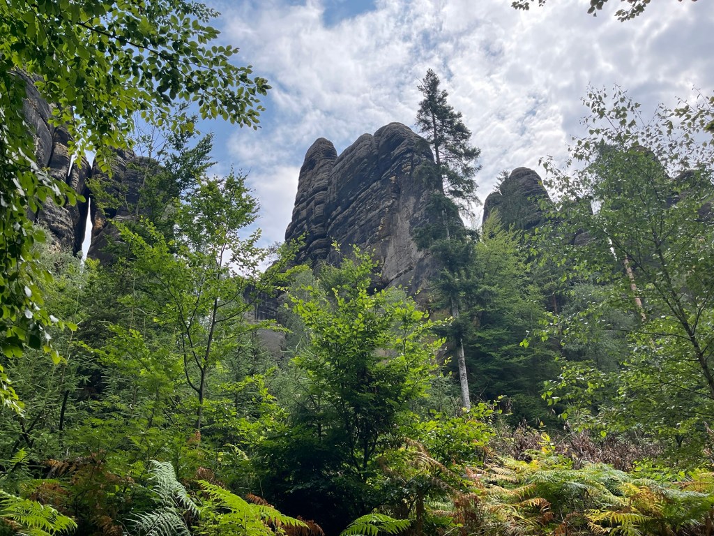
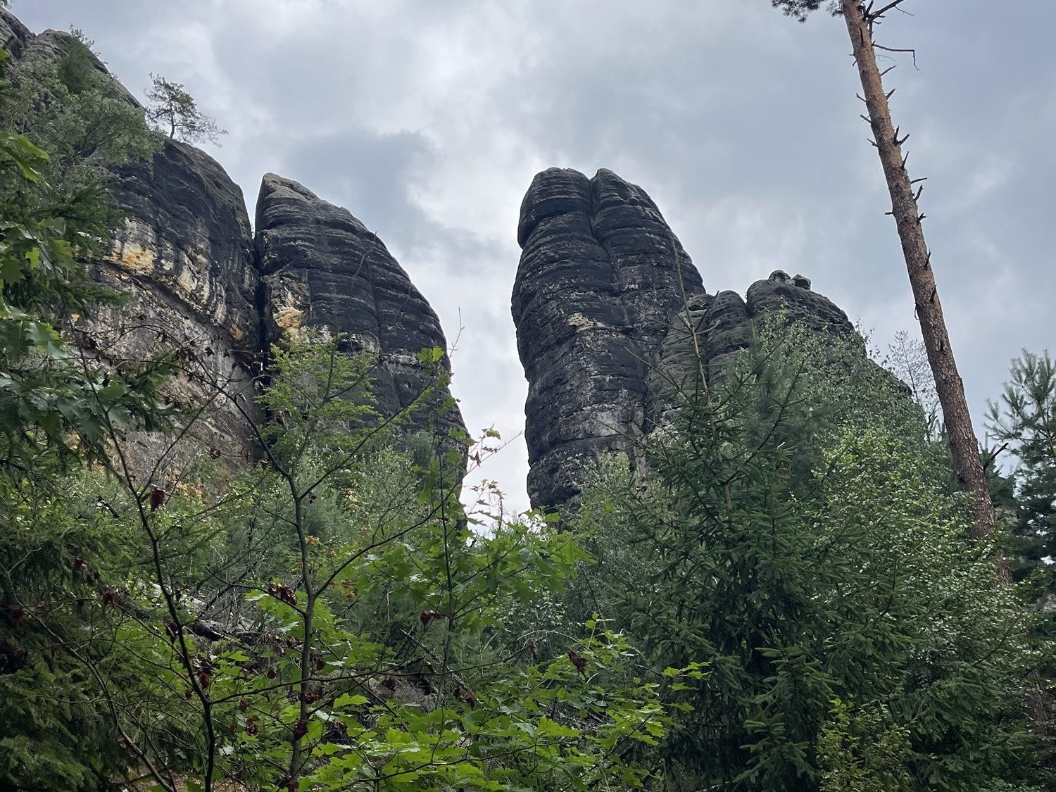
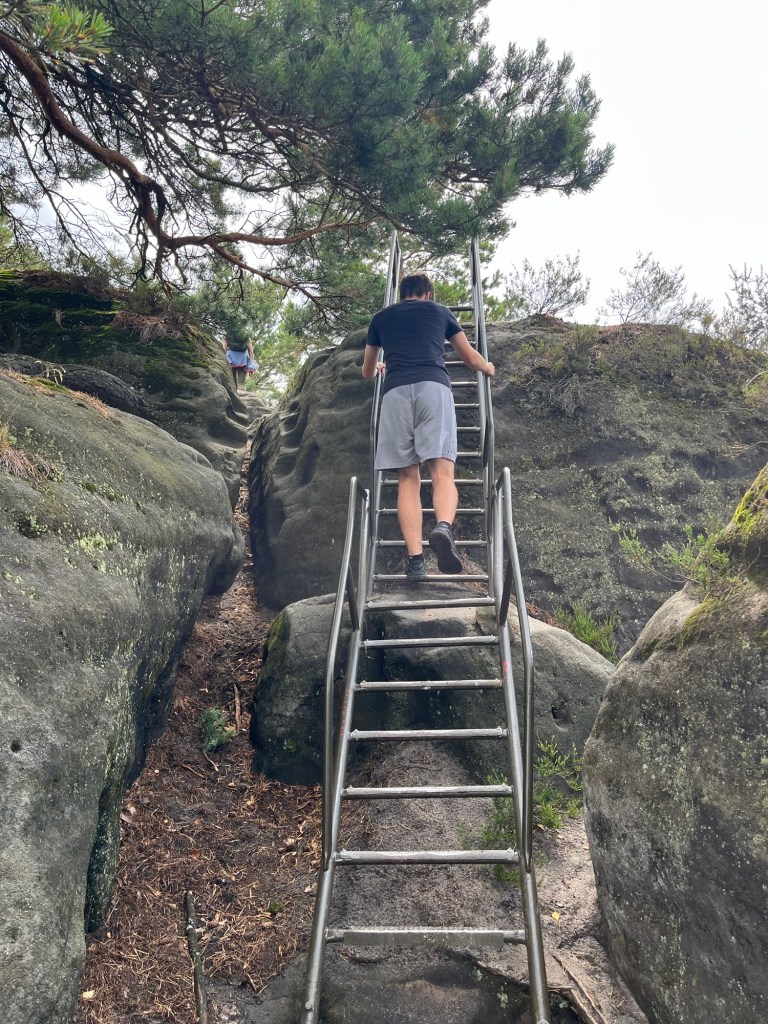
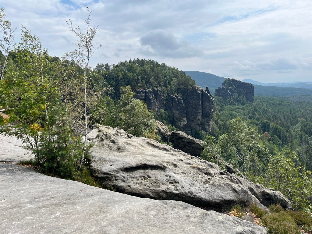
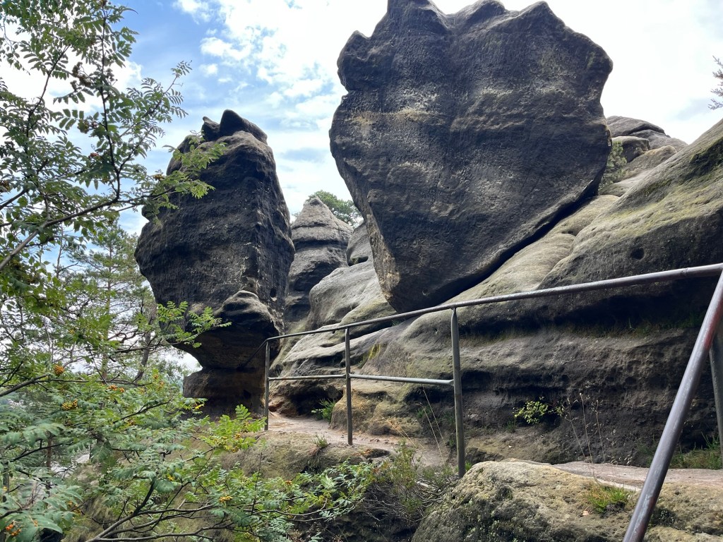
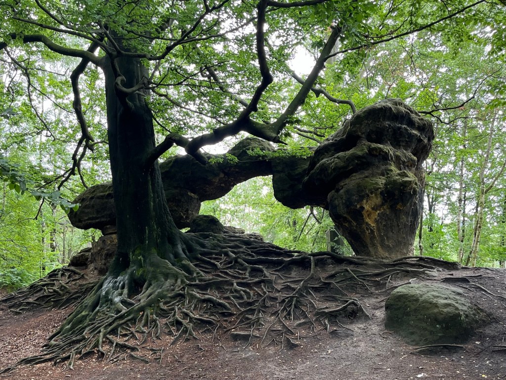
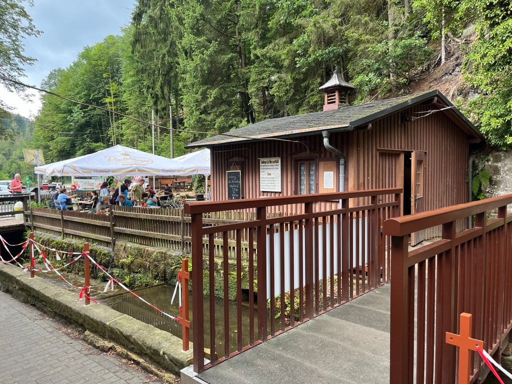
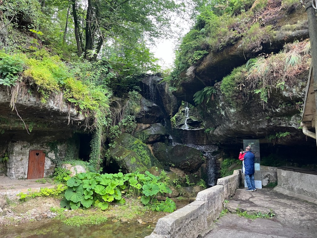
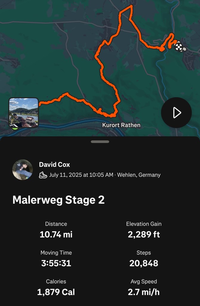
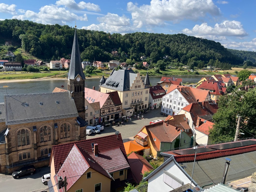
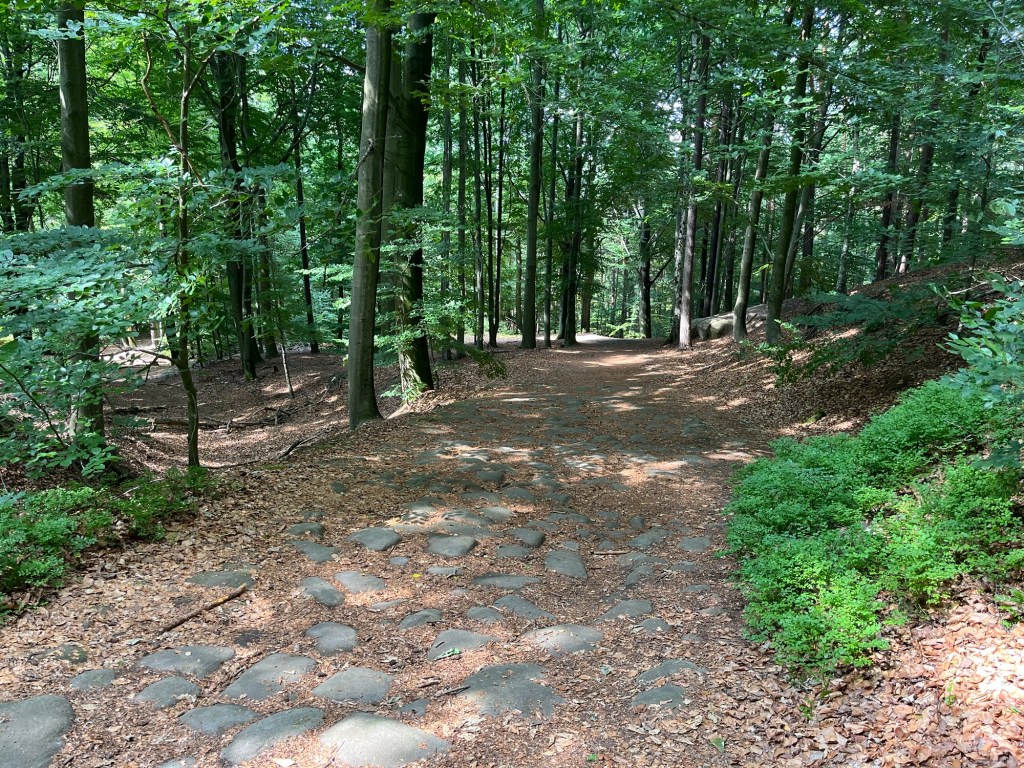
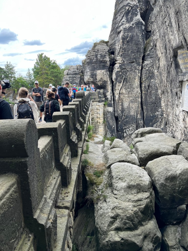
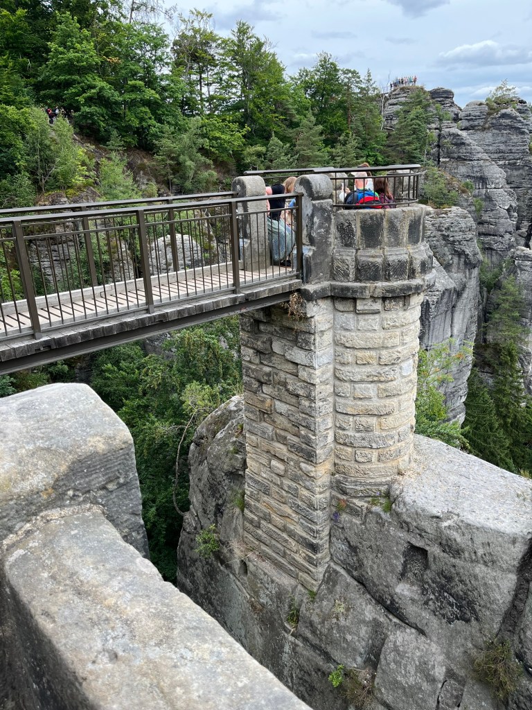
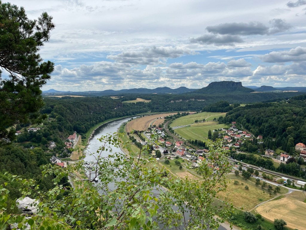
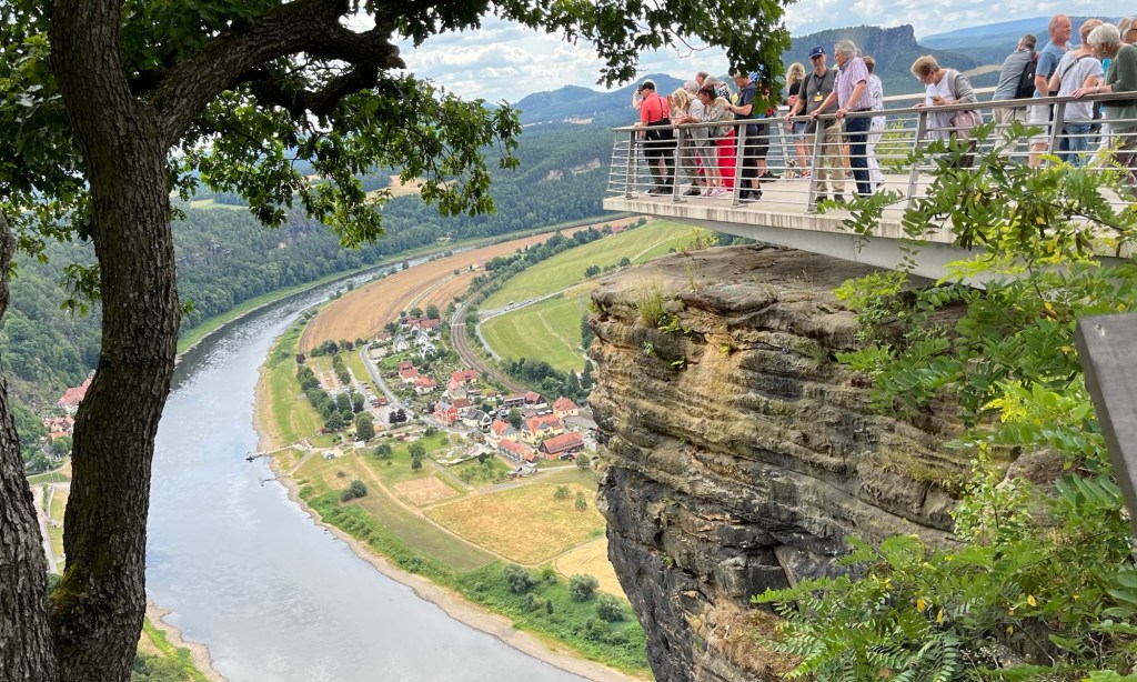
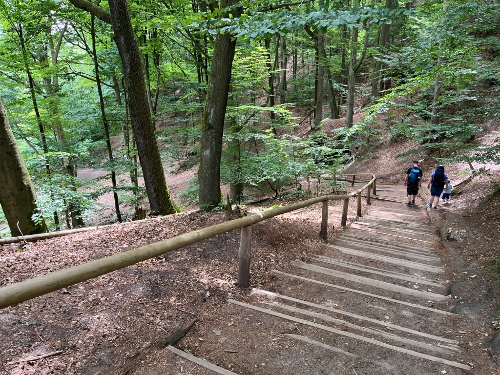
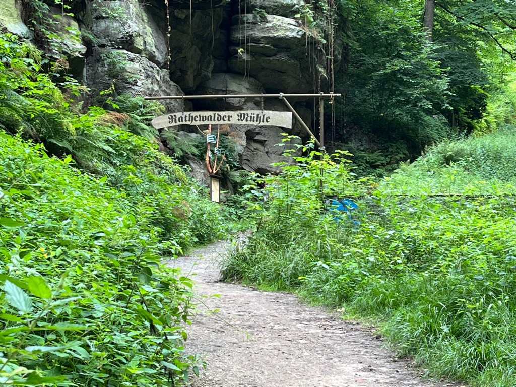
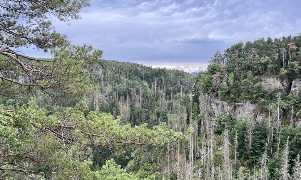
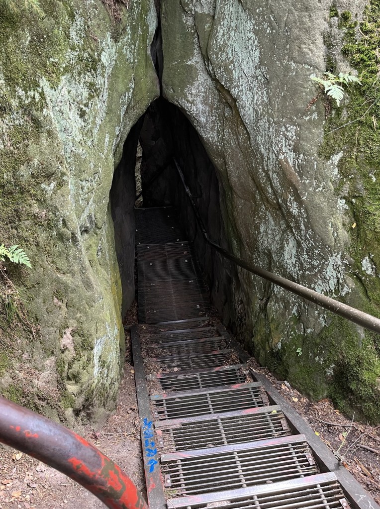
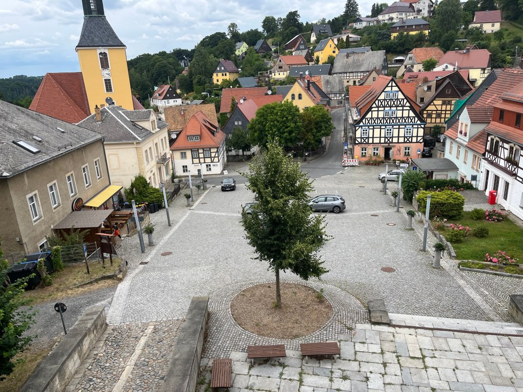
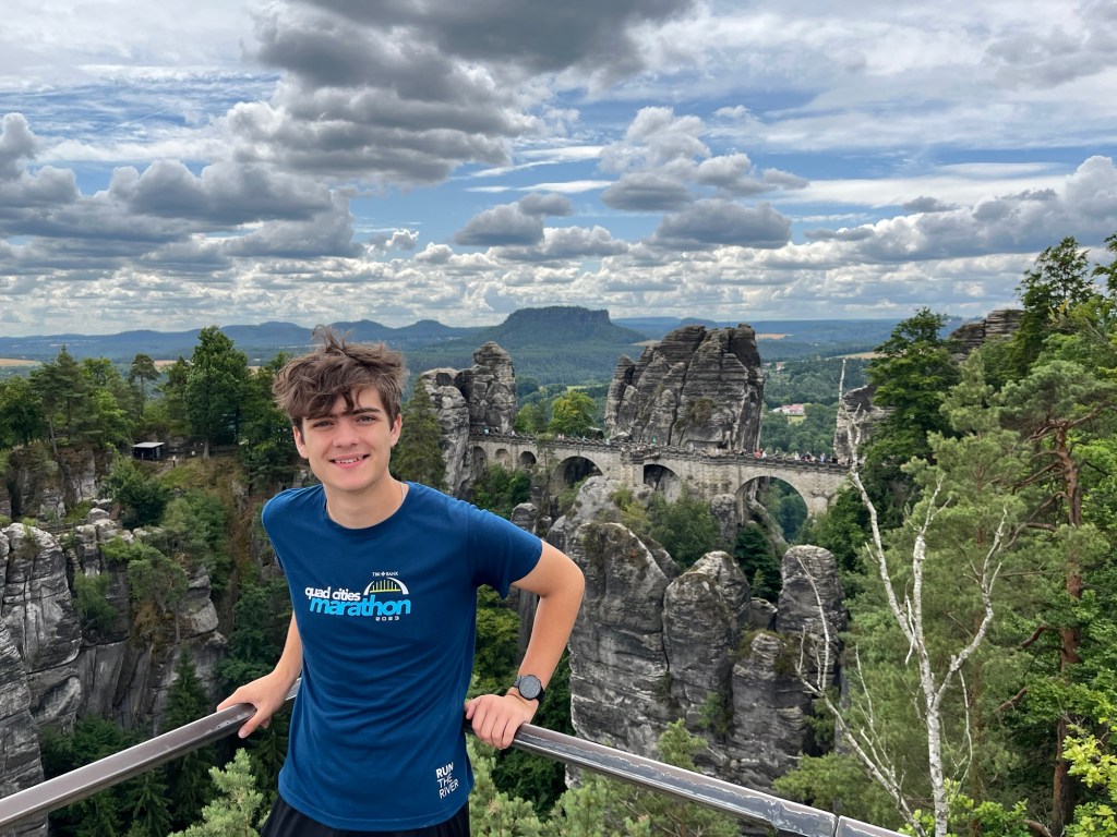
While the girls were in Munich and Dublin, Alex and I took a trip to Berlin, Dresden, and Saxon Switzerland National Park in Germany. We spent time visiting the historic sites and hiking a couple of days on the Malerweg trail.

View of the Elbe Valley from high up on the Malerweg trail

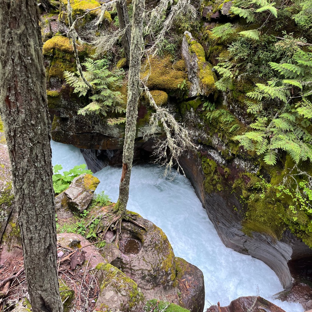
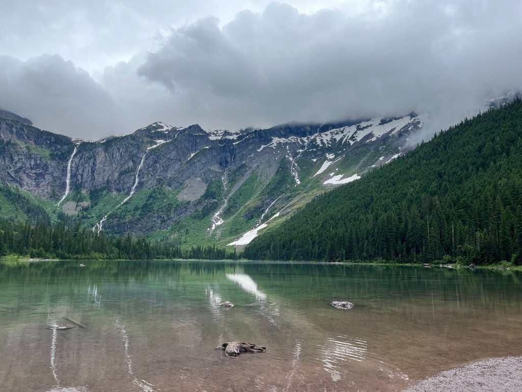
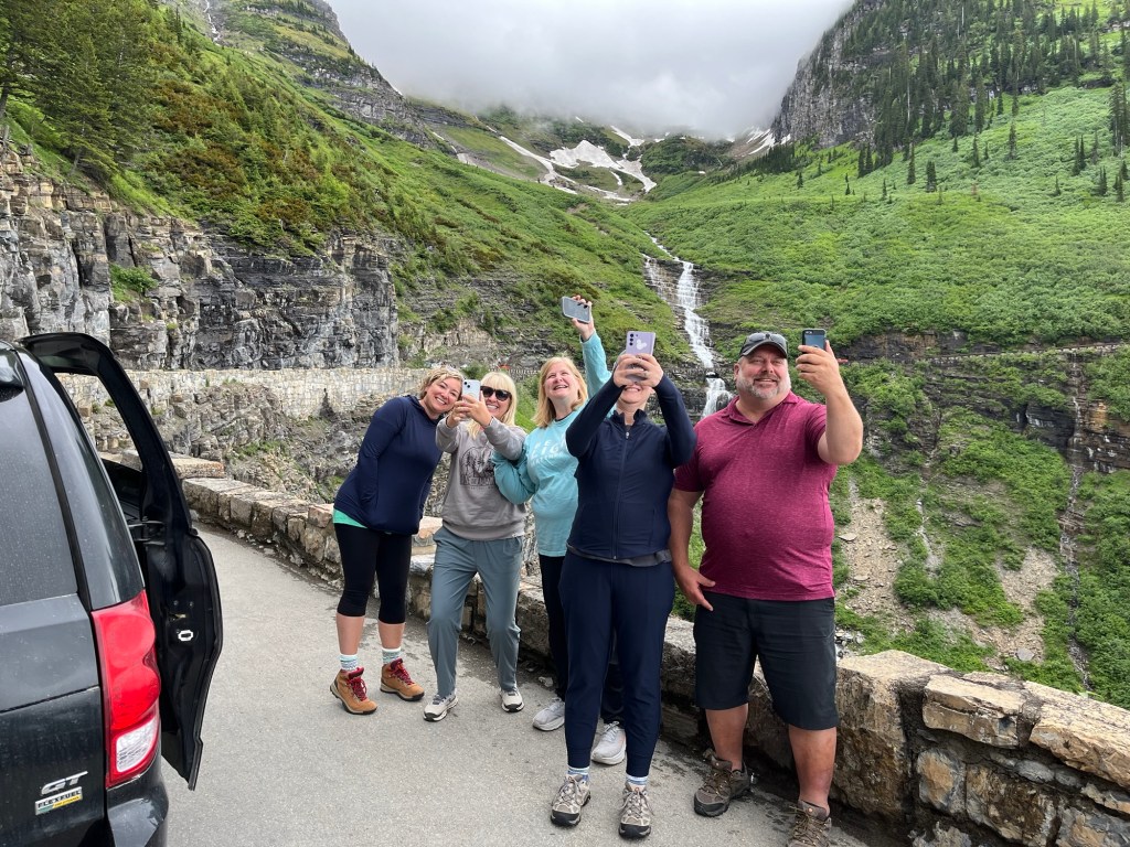
I also had the opportunity to reconnect with my old high school friends on a trip to Montana, where our friend Mat was getting married. While we were there, we did some hiking in Glacier National Park and drove the famous Going to the Sun road.

Avalanche Lake in Glacier National Park

That has been a lot of travel in a short amount of time, and at times it has been stressful. But I think back to how we were just a little over a decade ago, when we were staying close to home, watching a lot of television, and not doing much physical activity. Because of Jenn’s insistence that we not rot on the couch, I’ve been able to experience the world I dreamed about visiting when I was younger.

But it hasn’t just been the fact that we’ve experienced the world; it’s the fact that those experiences have been with people who were really important to us.

Whether it has been hiking to waterfalls in Costa Rica with our kids,

Or having drinks with friends along the beach in Nice,

Or catching up with some old friends in Montana,

Or hiking with my son in Germany,

Or exploring Cinque Terre with Jenn’s Parents,

Travel is so much better when you do it with people you love.

I’m thankful to my wife, Jenn, for pushing me to do all of the things that have enriched my life over the years, and thankful to all the people who accompanied us on our journeys. I couldn’t imagine travel, or life, without you all.

Happy Thanksgiving!

Colline du Chateau

Perched 300 feet above the Mediterranean Sea, Colline du Chateau is a beautiful park with amazing views of Nice. To the west of the park lies Old Nice, with its narrow streets and buildings dating back to the 16th Century. Also to the west is the beautiful beach along the Quai des Etats-Unis and a walkway. To the east is the Port of Nice with its impressive collection of multi-million dollar yachts.

A wide boardwalk separates the main road from the beach. The hill in the background is Colline du Chateau.

Colline du Chateau was the home of a military fort until 1706, when the fort was destroyed by King Louis XIV, during the War of Spanish Succession. More than 100 years later, in 1822, the King of Sardinia turned Colline du Chateau into a park. Starting as a botanical park, it was developed over time, leading to the beautiful park that it is today.

View from the stairway on the west side of Colline du Chateau.

We began our walk from the beach. It was a perfect day with mostly sunny skies, the temperature was around 70 degrees Fahrenheit and a slight breeze coming off of the Mediterranean. Walking up to Colline du Chateau, the hill looks imposing with its steep slope. A stone staircase, with multiple switchbacks is there on the west side of the hill to aid walkers in hiking up the slope.

One of the many amazing viewpoints at the top of the hill

At nearly every switchback, there are viewing platforms, allowing you to catch your breath while looking out over Old Nice and the beach. Every viewpoint was essentially the same, each one from a greater height.

A quiet moment under a tree at the top of Colline du Chateau

At the top of the stairs, the hill flattens out, and a traditional park emerges. There is a large, open grassy area with a children’s playground.

There is also a snack bar at the top of the hill with a good variety of snacks. Besides things like ice cream and hot dogs, it also sells things like crepes. Also, in addition to selling soft drinks and water, they also sold cappuccino, aperol spritz, prosecco, and champagne. As unique as the snack bar was, we just paid for a couple of bottles of water and continued our walk around the park.

Port of Nice

We walked across the park to the east side of the hill. The east side has fantastic views of the Port of Nice. The port has a wide variety of boats within the marina, from some fairly small sailboats to enormous yachts. There is also room in the port for small cruise ships. Club Med 2 was docked in the marina on this day.

Looking East from the southeast edge of the park with Mont Boron in the background. Club Med 2 is the large docked ship near the breakwater.

Off in the distance, over the marina, houses ascend up to Mont Boron, which is another park on top of a much larger hill. Mont Boron is taller and much larger than Colline du Chateau.

Cascade du Chateau

After viewing the marina, we went looking for the Cascade. The Cascade is a man-made waterfall on the west side, near the top of the hill. It is a very popular place to take pictures.

A plane flies over the plaza at the top of Colline du Chateau

Directly above the Cascade is a large cobblestone plaza. This is the highest point of the park and has fantastic views of Nice from all directions. We stayed there for a while, admiring the views, while watching an seemingly endless string of airplanes descending into Nice Airport.

View of the Old Town of Nice from the plaza

Under the plaza is another snack bar called Lou Casteu. We stopped in and grabbed a couple of French beers and enjoyed the weather and the view. It was a lovely place to take a few minutes to relax.

Stairs descend to the marina on the east side of the park.

We finished our drinks and decided to return to our Airbnb, which was just north of the park. That meant we were able to walk a little more through the park, and then we descended down the path and stairs on the east side of the park by the Marina.

It was an absolutely lovely day in Colline du Chateau. It is a beautiful place for a walk, with many places to relax. There are amazing views from practically everywhere in the park. This is an absolute must visit for anyone who is spending time in Nice.

Beauty and Danger on Malerweg Trail Stage Four

Stage four of the Malerweg starts in Altendorf and finishes in Neumannmühle. It is part of the Malerweg Trail (Painter’s Way), which is a series of eight point-to-point trails through Saxon Switzerland National Park in Germany. It roughly follows the path of German landscape painters who frequented the area in the 18th Century.

Building in Bad Schandau

My Son Alex and I had only planned four days of hiking while in Dresden, but because of the amount of rain that fell while we were there, we were only able to hike two days. Having read blog posts of people who had done all eight stages, stage four seemed to be one of the favorites of the eight stages.

Our day started with a train ride from Dresden to Bad Schandau. From there, we needed to take a bus from Bad Schandau to Altendorf. Once we got off the bus in Altendorf, it only took a few minutes to find the sign directing us to the Malerweg trail.

We followed the signs, and it wasn’t long before we came across a sign that said the path was under repair and that we needed to turn around to go to an alternative path. That forced us to turn around and eventually led us down a fairly steep trail with a lot of switchbacks that descended from Altendorf.

At the bottom of the hill was a campground where we missed a sign and walked another quarter mile or so before I thought that the trail didn’t seem right. My instincts told me we weren’t on the Malerweg, so we turned around and returned to the campground, where we saw the sign pointing to the Malerweg, which we had missed the first time. We had barely even started hiking, and we had already come across a closed trail and taken a wrong turn – not a great way to start.

Walking beside the sandstone pillars

From there, we started an approximately 1,000-ft ascent over the next four miles. The first part of the ascent was through prairie and woods until we reached the sandstone mountains. The early parts of the hike weren’t that scenic, but as we approached those stone cliffs, we were treated to amazing views.

Sandstone pillars next to the trail

The trail took us around a series of sandstone pillars for about 15 to 20 minutes before leading us uphill. This area has a large sandstone bluff, and the Malerweg trail continues on top of the bluff for a few miles. However, first we needed to climb from the trail up onto the sandstone bluffs.

Metal stairs on the sandstone ridge

On the ascent, the trail was varied. Often there would be metal stairs with handrails, other times, wooden steps, and sometimes you would need to climb on the rocks themselves. There were spots that I thought were fairly dangerous, and the footing was tricky, but after a while, we made it to the top of the bluffs, where we were treated to some spectacular views.

Looking down on the trail after climbing onto a bluff.

I was baffled by how dangerous the trail felt in parts. At one point, I was completely stretched out, holding onto the base of a metal railing, with my feet desperately trying to grip onto a large boulder, which was slick from the sand on top of the stone. This was precariously over what would be a fall of at least fifty feet.

View from the top of the sandstone bluffs

The baffling part, though, wasn’t the fact that I perceived it to be so dangerous; it was the number of much older Germans and German children doing this hike. Alex and I are in pretty good shape, and these German hikers were treating this trail like it’s a walk along a gentle river. As I learned on the Camino de Santiago earlier this year, when it comes to hiking, Germans are pretty hardcore.

Off in the distance, you can see the channel carved by the Elbe River and across it, a plateau with farmland atop it.

For about an hour, we walked along the top of the sandstone ridge, with phenomenal views of Saxon Switzerland National Park. On occasion, we would have to climb on top of rocks formations, and sometimes we would need to descend. However, the whole time, we were enjoying breathtaking views of the Elbe River and the Elbe Sandstone Mountains.

Metal stairs poke up between rocks on the bluff

Finally, we began our descent out of the ridge and down along the edge of the sandstone pillars. We were in a pine forest, with the sandstone cliffs next to us. We were starting to get hungry and hoped to find civilization so we could stop for some food and a drink.

A railing along the edge of a steep drop-off.

While the hike had provided us with spectacular views, it hadn’t yet passed through any towns that had restaurants. This was unlike Stage Two of the Malerweg, which had plenty of opportunities to stop for a drink and a bite to eat. After about four hours and ten miles of hiking, we finally stopped at Lichtenhainer Wasserfall.

After the descent, we found this amazing tree and formation

Lichtenhainer Wasserfall is a waterfall with a beer garden and restaurant nearby. We both ordered sausages and potato salad, and enjoyed some rest by the waterfall. The food tasted great, but I couldn’t tell if it was because it was actually great or because the hiking had made me extremely hungry.

A section of the trail perched on the edge of a cliff

I had a couple of beers, including a dunkel made by Sachsisches Schmuggler, which is made in nearby Sebnitz. It hit the spot, and we were ready to head off into the woods again.

Biergarten at Lichtenhainer Wasserfall

We only had two or three miles left, so with food in our bellies, we were feeling pretty good. Unfortunately, it was only a matter of about 10 minutes before it started to completely downpour. At first, we put on our raincoats and continued on, thinking that the rain would have to break up eventually.

Lichtenhainer Wasserfall

The rain was so heavy that the raincoats were powerless to stop us from getting wet. We walked about a mile away from Lichtenhainer Wasserfall before giving up and walking back in the other direction. We really wanted to finish, but without really knowing how much further we needed to go and being completely soaked to the bone, we decided to return to Lichtenhainer Wasserfall and take the train back to Bad Schandau.

It was disappointing not to finish the rest of Malerweg Stage Four; however, I felt pretty sure that we had experienced most of the beauty of the stage, with all of the amazing views at the top of the ridge of the Elbe Sandstone Mountains. It was an absolutely amazing hike, and while I wish we had finished it, I was glad that we were able to do the parts that we did.

If you are thinking about hiking some of the Malerweg, I would highly recommend doing stage four. You should, however, keep in mind that there are parts of the trail that are very technical and sometimes dangerous. Just don’t be surprised if you get passed by a German family with a couple of grandparents and a four-year-old.

Stage Two of the Malerweg Trail

The Malerweg is a famous hiking path through Saxon Switzerland National Park in Germany. It has eight stages, each starting in one town and ending in another. For an avid hiker of average endurance, each stage takes a day to complete. Anyone who hikes the full eight days will be treated to a variety of landscapes, spectacular viewpoints, and quaint German villages.

Radfahrerkirche in Stadt Wehlen

Malerweg is German for “The Painter’s Way.” In the middle of the 18th Century, landscape artists came to the area to paint the Elbe Sandstone Mountains. The area became so popular that the artists began to share their routes, and an ideal route was created. When the railroad arrived in the 19th Century, the route fell out of favor. Over a century, efforts had been made to recreate the path, and finally, in 2006, an optimized route of 116 kilometers was created.

I knew we would not have enough time to hike the entire Malerweg, so I chose a few stages I wanted to hike. Stage two was at the top of my list because of the Bastei Bridge. As I’ve learned, if there is something that you really want to do, do it on the first day that has good weather.

We were treated to fantastic weather. It was an absolutely fabulous day with mostly clear skies and temperatures hovering around 70 degrees Fahrenheit.

View from the trail over Stadt Wehlen

The day started with a train ride from our Airbnb in Dresden, followed by a ferry ride across the Elbe from the train station in Stadt Wehlen to the town itself. From the Radfahrerkirche, the church in the main square of Stadt Wehlen, the trail starts on stairs that switchback up a steep hill overlooking the town.

From there, we followed the signs along the Malerweg through the woods. This section involved about a 600-foot climb, which was fairly gradual but strenuous nonetheless. As I’ve learned, though, if you want a great view, you need to climb a hill. In fact, the more you climb, the better the view.

The path between Stadt Wehlen and Bastei was wooded and full of large stones

After about an hour of hiking, we arrived in Bastei. Bastei is probably the most scenic and most visited part of Saxon Switzerland National Park. We immediately stopped at the Panorama Biergarten for a couple of pretzels and drinks.

There are two sides to Bastei: one facing the Elbe River and one facing the sandstone mountains. From the Panorama Biergarten, we saw the side with the sweeping views of the Elbe. Even though the views from this biergarten are amazing, this side of Bastei is less impressive than the other.

View from Panorama Biergarten in Bastei

We finished our snack in the biergarten and walked over to the other side of Bastei, and were immediately struck by the amazing views of the sandstone mountains. Spreading off into the horizon was a sea of gray sandstone columns smoothed from millions of years of erosion.

The sandstone mountains were formed during the Cretaceous period when this area was under the sea. A 600-meter-thick sandstone slab was formed at the bottom of the sea. When geologic forces caused the area to rise from the sea, erosion of the sandstone formed these landscapes. What is left is breathtaking.

Bastei Bridge

We continued walking along the path until we saw the Bastei Bridge. This sandstone bridge was built in 1851 to link multiple sandstone columns. It is a major tourist attraction and is a man-made object that complements nature rather than detracts from it.

Bastei Bridge

Most of the time we spent on the trail was by ourselves. That was not the case in Bastei. There are many ways to get to Bastei without hiking the Malerweg. There are parking lots near Bastei for people who drive, there is a bus that goes to Bastei, or you can take a much shorter 1-kilometer hike from Rathen.

Outlook stretching off the Bastei Bridge

This meant that while we were in Bastei, the trails were very crowded as people jockeyed for position to see the Elbe Sandstone Mountains and the Bastei Bridge. The crowds were fairly thick for at least a kilometer from the Bridge itself. There is a great reason for this, though—the views are tremendous.

Elbe River taken from the outlook near the Bastei Bridge

Continuing on the Malerweg past the Bastei Bridge, multiple viewpoints of the Elbe River valley and the Sandstone Mountains are simply amazing. We spent a lot of time in this area taking pictures and just looking out over the breathtaking landscape.

Viewing platform overlooking the Elbe River

Eventually, we reached the end of the sandstone bluffs at Bastei and had to start heading downhill on the trail. There were a decent number of hikers still on the trail, but they were starting to thin out.

Descending from Bastei

When we finished our descent, we were treated to a man-made lake, as the creek that ran through the area had been dammed up. People were enjoying the lake with paddle boats and kayaks, while others hiked around the lake. It was a beautiful location.

Walking along the Amelsee

That path continued until we reached Rathwalde and stopped for a little lunch. Rathwalde is a cute little village with a few restaurants. It was a nice place to stop for a little while and rest.

After stopping in Rothwalde, we got off the correct Malerweg path. I’m not sure if we missed a sign or if we misinterpreted one, but we ended up going the wrong way and had to use Google Maps to try to get us to Hohnstein, which was the end town of Malerweg stage two. That took us on a narrow blacktopped road, which wasn’t particularly fun or scenic to walk.

View from Hocksteinaussicht

Eventually, we made it back onto the Malerweg and ended up in a place called Hocksteinaussicht, a rocky lookout with a view of the village of Hohnstein. After taking in the views from Hocksteinaussicht, we descended from the rock down a set of metal stairs between the rocks. Finally making it to the bottom of the hill, we found ourselves at a road where we could go left or right. We chose to go left, which was, again, the incorrect choice.

Metal stairs through a break in the sandstone descend from Hocksteinaussicht.

Had we chosen the path to the right, we would have been treated to a pleasant walk through the woods ending in Hohnstein. Much of that path would have been along a gentle creek. Unfortunately, since we chose the other direction, we ended up on another road walking the long way into Hohnstein.

Walking into Hohnstein

When we finally did make it into Hohnstein, we were greeted by a beautiful German village with a castle on top of the highest point. It dates back to at least the 14th Century and is now a hotel.

Hohnstein

We wandered a little around the town and finally caught a bus back to the Pirna train station to catch the train back to our Airbnb in Dresden.

Between the sweeping views of the Elbe valley, the Elbe Sandstone Mountains, the Bastei Bridge, and all of the beautiful forests, creeks, and ponds, this is by far the most scenic hike I’ve ever been on. Even though the last couple of hours had been frustrating with our wrong turns along the Malerweg, we had an absolutely tremendous hike on the second stage of the Malerweg.

Hiking to Avalanche Lake

The Avalanche Lake Trail is a beautiful wooded hike in Glacier Park. It is an extremely popular out-and-back hike in the park and follows the mostly whitewater Avalanche Creek to the gorgeous Avalanche Lake.

Getting to the trailhead requires a park pass to Glacier National Park as well as a pass to drive Going-to-the-Sun road. If you can’t secure a driving pass on Going-to-the-Sun road you can take the free shuttle service. We secured a road pass by booking a boat trip on Lake MacDonald, which you might find easier than getting a pass for the road by itself.

We found parking to be a little hard to come by, so you’ll either need to be patient and circle the lot next to the Trail of the Cedars for a while or arrive early in the day. Avalanche Lake Trail is around 5 miles round-trip, so you’ll definitely want to bring along some water, maybe a snack, and someone in your group should have bear spray.

We started on Trail of the Cedars, which is a very flat, easily accessible trail. It has a lot of wooden walkways to make things easier for folks with limited mobility.

Elevated walkway in Trail of the Cedars

This is a very serene hike with tall, thin cedar trees everywhere. It is a very heavily traveled path because of how easy it is to hike. We saw a lot of parents hiking with their young children who wouldn’t be capable of doing a more difficult hike.

Avalanche Creek carving out a passage in rock

Along the Trail of the Cedars is the Avalanche Lake trailhead and there is a park sign marking the entrance. Once you leave the Trail of the Cedars for Avalanche Lake Trail, the hike becomes more challenging. Alltrails.com has Trail of the Cedars rated as an easy hike and Avalanche Lake Trail as moderate. For most people, Avalanche Lake Trail will be fairly easy to hike, but you should be aware of your personal fitness before getting two miles into the hike and regretting your life’s decisions.

In some areas Avalanche Creek is somewhat narrow

The Avalanche Lake Trail roughly follows Avalanche Creek from the trailhead until you reach the lake. This is a fast flowing, whitewater creek. The creek in some spots has carved out smooth mini-canyons and in other spots opens up into wide rapids flowing over smooth river rock.

Where Avalanche Creek hasn’t been restricted by a rocky passage it opens up and widens into rapids.

According the data recorded from my Garmin on the hike, the hike to the lake is about 2 1/2 miles and the elevation goes from around 3,500 feet above sea level to around 4,000 feet in that span, The creek basically has the same stats. Any time a creek has a 500 foot drop over a couple of miles, there will be a lot of whitewater.

There are plenty of times that the trail veers away from the creek which lets you enjoy the forest. Most of the trail itself is fairly wide and comfortable to walk. There is quite a bit of traffic on the trail, but because the trail is wide, there is plenty of room to maneuver around other hikers.

Some of the mountains in the area of the trail.

After a little over a couple of miles, we arrived at the lake. In my opinion, there is nothing more stunning than a mountain lake, and this is a breathtaking one. The beach is filled with smooth rocks and the water is crystal clear. The water was extremely calm which made for a perfect mirror of the sky and mountains in the background.

Avalanche Lake from the beach at the end of the trail

The shore itself was lined with hikers and we found a little chipmunk who had grown accustomed to begging for snacks from the hikers. He was rewarded by one who gave him a little chunk of a snack bar.

Fairly tame chipmunk

While we were there, I caught the end of what was a young man proposing to a young woman in front of their friends and family. She said yes, and everyone cheered. Congratulations to the happy couple and I have to say that was an excellent choice of location for the proposal.

Avalanche Lake

After resting, having a snack, congratulating the couple, and taking a ton of photos and selfies, we headed back to the trail. The hike back is quite a bit easier, since now its dropping 500 feet over 2 1/2 miles instead of climbing it.

Tall pines along the trail

It gave us a second chance to view all of those beautiful rapids that the creek has created on our way back to the parking lot.

Avalanche Creek

The Avalanche Lake Trail is the most consistently beautiful trail that I’ve ever hiked. From the pine trees, to the mountains, to the whitewater and finally the calm mountain lake, there just isn’t a boring or ugly spot on this trail. It is beautiful from beginning to end and I would recommend this trail to anyone who has the opportunity to take it.

Visiting the Breathtaking Blue Falls of Costa Rica

The Blue Falls of Costa Rica are a group of seven gorgeous waterfalls set on a tributary to Rio Toro. The river is fed by runoff from the northwest slope of Poas Volcano and is a seemingly unnatural shade of blue due to a high concentration of aluminum sulfate. This aquamarine colored water flowing over rocky terrain makes for an unbelievable landscape of pools, waterfalls and rapids.

There is a tour company that maintains the Blue Falls as well as Catarata Del Toro, which is another waterfall on the same property, but it is on Rio Toro, not on the tributary where the Blue Falls are located. They take admission for both attractions and have a station where you can pay, use the restrooms and potentially get some food, although the snack bar was not open the day we were there.

When we arrived at the visitor center, we were greeted by a gentleman who asked us whether we would be doing Catarata Del Toro, the Blue Falls or both. We paid for the Blue Falls, and he gave us our wristbands for entrance and instructions to go back to our cars and drive up the road a bit and park in a different lot and enter there.

The first river crossing is literally a few inches wide. Only 2 people are allowed on this bridge at a time.

The crazy thing about this gentleman was that, while we were standing there, he also was giving instructions to other hikers and I’m not 100% sure, but it sounded like to one group of hikers he spoke in Dutch (maybe German) and another in French while he was talking to us in pretty flawless English. I’m pretty sure he probably speaks Spanish as well, but the fact that he was just switching back and forth between languages that quickly was amazing to me. I asked him how many languages he knew, and he just responded humbly with “oh, a couple”.

This was early along the road, as you continue to walk the rocks have been moved into the center of the road to operate more like a sidewalk.

We moved the car to the parking lot by the Blue Falls entrance and began our hike. There is a dirt road to follow for the first half to three quarters of a mile. The dirt road had basically turned to mud, which I’m sure is the case a lot of the time. There was a row of stones in the center where most people walk to avoid the mud.

Little “sidewalk” like rock formation to help hikers stay out of the mud

At the end of the road, we came across some signs pointing to where to find the falls. Three trails to the left – La Pintada, La Turquesa and La Celestial, and three trails to the right – Poza Azul, Las Gemelas, and Tepezquintle. Las Gemeles is one trail with two waterfalls.

La Celestial Waterfall

Makeshift stairs on the trail to La Celestial

We decided to visit La Celestial first. Once we started to hike down the actual trail to La Celestial, the trail became more like forest stairs for lack of a better term. The trail has been altered to be more like steps. As wet as this area is, I assume that without the steps it would be incredibly slippery.

There are metal stairs on the trails where the trail would be too dangerous without them.

There were other sections that had some makeshift metal stairs and railings. As we got closer to the falls, the steps made way to boulders. As we descended down the trail, the sound of the waterfall grew in intensity until finally the waterfall appeared in view.

La Celestial waterfall taken from the end of the trail

La Celestial is fairly wide with quite a bit of water coming over it. It’s probably about 30 feet tall and has a bit of a pool under the waterfall. I don’t know how deep the pool is because, I didn’t get more than about waist deep there.

The family enjoying La Celestial

The water is fairly cold, which wasn’t unexpected, since it is running off of a mountain, but it’s not so cold as to want to avoid it completely.

A group of rocks about 50 to 100 feet from the falls creates a pool under and near the falls which you can swim in.

We hung out there for about 15 minutes enjoying the waterfall and the cold water and then decided to go back to the trail to head over to our second waterfall, La Turquesa

La Turquesa

The trail down to La Turquesa seemed much easier than the trail down to La Celestial. There still was quite a bit of steps on the way down, however, once we reached the river, we came across a metal structure with a ladder. There was a guide there to greet us.

A fairly typical trail at Blue Falls. It’s been altered to be more like steps,

In order to get to La Turquesa, you have to cross the river. The guide showed us the right place to cross and helped us through some of the more treacherous parts of the trail, which at this point mostly consisted of stepping on wet slippery rocks.

Guide helping Jenn across the river on the trail to La Turquesa

There is a fairly brisk section of rapids that we needed to climb over to that was the last main obstacle to getting to the falls. In this section, we had to climb over a boulder to get there. The guide was very helpful in making sure that none of us slipped on the boulder.

You need to climb over this boulder to get to La Turquesa.

The reward for this hike is a probably one of the shorter falls here, but it has a really nice pool area where you can kind of relax a little and swim, if you can stand the cold water. I got in up to my neck, but Alex actually dunked his head. Emma bet him $5 he wouldn’t do it.

La Turquesa

This was a really calm and relaxing area to hang out in. We stayed for a little while and then decided to head back to the trail and go down one last trail.

Las Gemelas

We headed back up to the main trail, and we knew that we probably only had one more trail left in us. The hiking at the Blue Falls is somewhat challenging and some fatigue was beginning to set in. Jenn suggested we see Las Gemelas (The Twins). It was a great choice.

A metal bridge over the river at La Gemelas

Once we got down to the river from the main trail, we were greeted by a narrow metal bridge.

Once you crossed that, the trail mostly stayed dry on the left side of the river as we approached the first of the two twins.

One of the falls at Las Gemelas.
The first of the falls at La Gemelas

This was easily the tallest of the waterfalls we had seen that day.

Once you walk closer to the first of the twins and can see further down the river, the second of the twins appear in view.

The second of the falls at La Gemelas

There is a location on the left side of the river, where both waterfalls can be seen simultaneously. This is a surreal spot.

Standing where both of La Gemelas can be seen.

At this point of the day we were pretty hungry and tired and were ready to head back. We hiked back to the main trail and then to our car.

Getting to Blue Falls of Costa Rica

We drove to the Blue Falls from Grecia, but in general if you are coming from San Jose or the Central Valley you will be coming over a fairly tall ridge on Ruta Nacional 708 from the south. I mention this for one specific reason, that is the steepest section of road I have ever driven on.

The steep section I’m talking about is a very new road, but as we were descending the mountain, I suddenly got terrified because I knew I would have to drive back up this mountain, and I rented a Geely GX3. It has a not at all impressive 102 horsepower, and I had 4 full-sized Americans that had to ride in this car up this insane grade. Long story short, we made it, it was terrifying and my speed going up this grade was about 5 MPH with the pedal on the floor. I would suggest maybe a more powerful car if you are going to attempt this drive.

Much of the drive is typical of rural Costa Rica with narrow roads, switchbacks, and limited visibility. We did come across some pretty sketchy bridges made of wood near the end of the drive. At one point I asked Jenn “Was there a hole in that bridge?” She replied as calmly as she could “Yep.”

If you are coming from La Fortuna, you will probably be coming down from the north, so you wouldn’t have the steep grade that we had to deal with. That being said, I have no experience with the roads from La Fortuna, so I don’t know what they are like.

What to Wear at the Blue Falls of Costa Rica

You need to be prepared to get wet and muddy. You also need to have shoes that don’t slip. This does present a challenge for me, because frankly I’m a big fan of wearing socks and you’re not going to want to wear socks. They are going to get wet and your feet are going to prune, and you will be hating your life decisions.

Rocks are wet and slippery. Make sure your shoes grip properly.

You will also be walking on some extremely slick rocks. Having a pair of water shoes that have excellent grip that you can wear in the water is essential. They should also be a good fit, because as you can imagine, wearing ill-fitting shoes on a hike without socks can cause blisters in a hurry.

The alternative to water shoes is to do what the guides do and wear rubber boots. I’m pretty sure the guides know what they are doing, so following their lead can’t be a bad idea.

As far as your clothes are concerned, again you need to take into account the fact that you are both hiking and swimming. A swimsuit might not cover as much as you want when you are hiking and hiking clothes might be too heavy and uncomfortable once you get them wet. I settled on a quick dry shirt and a pair of board shorts. That seemed to be a pretty good compromise. Keep in mind the trails are pretty well maintained so you probably don’t need to cover your legs from things like thorns.

Other Considerations

We didn’t plan out our day very well. We had a light breakfast before driving an hour to get to the falls. A couple of hours of hiking had made us pretty hungry and we had not brought anything to eat. We basically quit out of fatigue, but if we had decided to do all of the falls, it would have taken us a bit more time and we would’ve been extremely hungry.

I would recommend packing a lunch if you want to do the entire Blue Falls hike. I think you could probably do the whole hike in 2 or 3 hours, but honestly, why are you hurrying? It’s beautiful, chill out and swim in the pools for a while. If you’re really enjoying the hike, I would think it would take you at least 4 hours, maybe longer, and with the amount of calories you’ll be burning with constantly going up and downhill, you’ll probably want something to replenish your energy.

I took along a regular backpack, but this is a very wet area, and the chance of accidentally falling into the river is fairly high. I would recommend using a dry bag or a dry backpack. I was carrying everyone’s phones in my backpack, so had I fallen, it might’ve been a really bad day. A dry bag would prevent that.

At the beginning of the hike, they will offer you a hiking stick. Take it! It must’ve saved me from falling a dozen times – its slippery out there!

Also, keep in mind you are in a forest in Costa Rica – if you have ever needed bug spray and/or sunscreen, you will need it here.

How Much Does the Blue Falls of Costa Rica Cost?

Entrance fees for the Blue Falls of Costa Rica is $17 USD per person. If you plan to also visit Catarata Del Toro, then a combo ticket costs $25 USD per person.

For more information visit the Catarata Del Toro/Blue Falls website.

Using the Lodge

Where you pay to get in, there are a bunch of tables where you can eat. There is a snack bar, but it was closed that day, so I’m not sure I would count on them having food available.

Tables at the lodge

There are a couple of bathrooms in the back, and we used them to change our clothes after the hike. Pretty much anywhere you go when you leave the Blue Falls is going to be a long drive and you’ll want to be dry for that drive. Also, there aren’t any bathrooms on the trail itself, so you might want to use it before you head onto the trail.

One of the hummingbirds at the lodge

I don’t know if tipping is customary, but we did leave a tip with the gentleman who was running the front desk. He asked us who the tip was for and we just let him know what falls we hiked at and he was happy to give the tip to the guides who were working those falls.

Hummingbird swooping in to the feeder

There is a hummingbird feeder in the lodge that gets a ton of activity with some very aggressive hummingbirds. Make sure you take a few moments to enjoy the hummingbirds as well.

Conclusion

If you have an opportunity to hike at the Blue Falls, jump at it. This was, by far, the most beautiful hike I have ever been on. Keep in mind that you should be in pretty reasonable shape to do the hike. It is wet, steep, and your balance will be challenged constantly.

Make sure that you come prepared and enjoy the beauty of Costa Rica. Pura Vida!