Testing my Limits at UTMB Nice Côte d’Azur 50k

*Update – the 2026 version of the UTMB Nice Côte d’Azur 50k altered the route from when I ran it in 2025. The route is now 4 km shorter and eliminated what I considered to be the hardest part of the race – climbing to Cime du Baudon. It still has a significant amount of climb. They also shortened the cutoff to 12 hours from 14 hours. While the course itself might be slightly easier, the cutoff time could be more challenging to meet.*

Sign near the finish line on the Promenade des Anglais in Nice

Standing in a crowd in the starting chute, I waited for the gun signaling the beginning of the race. For the first time in my 10 years of distance running, I wasn’t sure if I would finish. This race was different than anything else I had attempted, and there was no way for me to replicate this race during training.

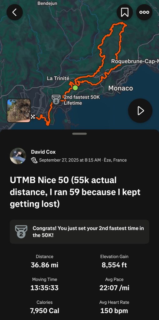
Several months ago, I chose to sign up for the UTMB Nice Côte d’Azur 50K trail ultramarathon. It was a way for me to celebrate my 50th birthday by doing something difficult but achievable for an aging endurance athlete. Officially, the course was 34 miles long with a total elevation gain of 7,100 feet. The longest race I had done in the past was the Quad Cities Marathon, which was 26.2 miles and had a total elevation gain of less than 500 feet. An extra 8 miles was one thing, but the difference in elevation gain was off the charts.

Waiting at daybreak for the race to start

My training had gone mostly according to plan; my final long run was 31 miles and around a thousand feet of elevation gain. During that training run, I did something that caused me significant pain on the top of my left foot, which appeared to be a ligament issue. It wasn’t a huge injury, but it caused me to back off my training significantly in order to allow that foot to heal up as well as possible. I didn’t want to limp through 34 miles. I hoped that the drop off in running wouldn’t affect my ability to finish.
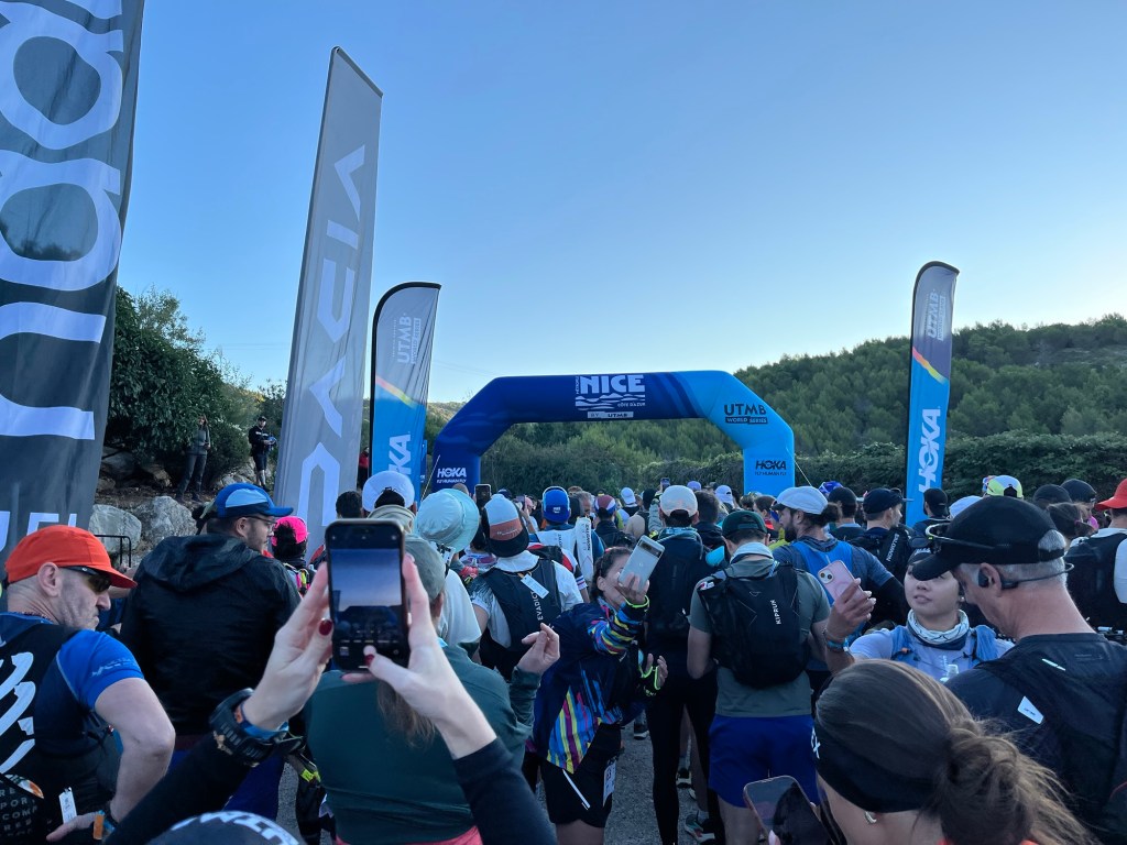
The start of the race was broken into five waves, each 15 minutes apart. With much of the race taking place on single-track trails, it was important to get the runners spread out as soon as possible, and the starting waves helped to space those runners. I was in the fourth of five waves. When it was our turn in the chute, the Race Director tried to keep us loose by playing dance music and giving us encouragement.

Our 15 minutes expired, and we were off. The first portion of the race was mostly uphill on an asphalt road through a pine forest. I was staying true to my plan—keeping my heart rate fairly low—walking the uphills and running the downhills and flats in an effort to maintain my energy for late in the race. Virtually everyone else around me was following the same strategy.

At the end of the first mile, we passed a large wooden sign that said “Parc Naturel Departmental De La Grande Corniche”. We were entering a park perched on the bluffs overlooking the Mediterranean. We would be running through that park for the next few miles. As we continued through the park, asphalt roads made way to gravel roads and finally to a rocky hiking path.
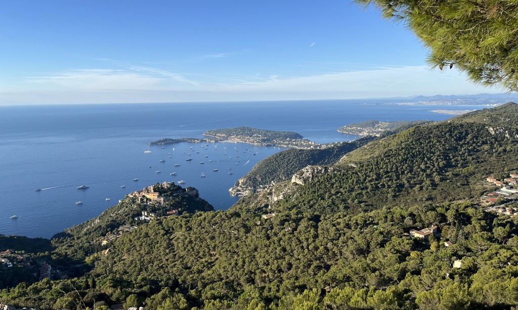
It didn’t take long to catch a glimpse of the Mediterranean, and soon we were treated to panoramic views of the coast. Early on, there were fantastic views of Saint-Jean-Cap-Ferrat, a wealthy residential development on a peninsula to the east of Nice. It is also the start of the 20K race that would start the next day.
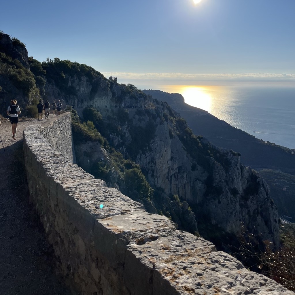
The next several miles were breathtaking. The path followed the bluffs overlooking the Mediterranean. Every view was amazing as we looked over multiple settlements along the coast from Nice to Monaco. There were countless yachts and sailboats along the coast as well.

The path was mostly crushed rock and comfortable to run. A number of tunnels were also carved out along this path. I honestly can’t imagine a more ideal setting for the beginning of a race; this was why I signed up for this race; it was just beautiful.
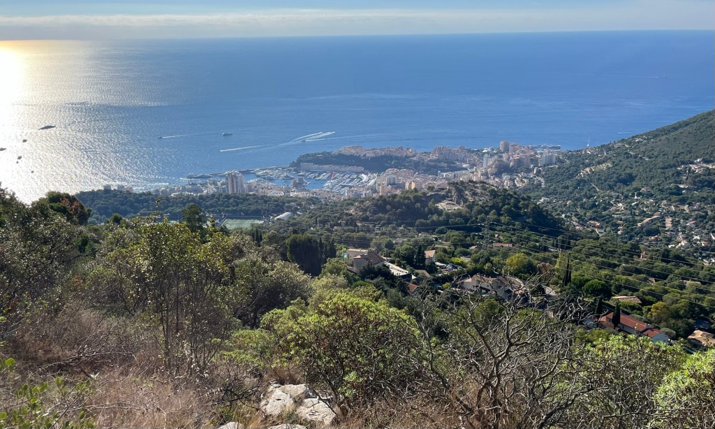
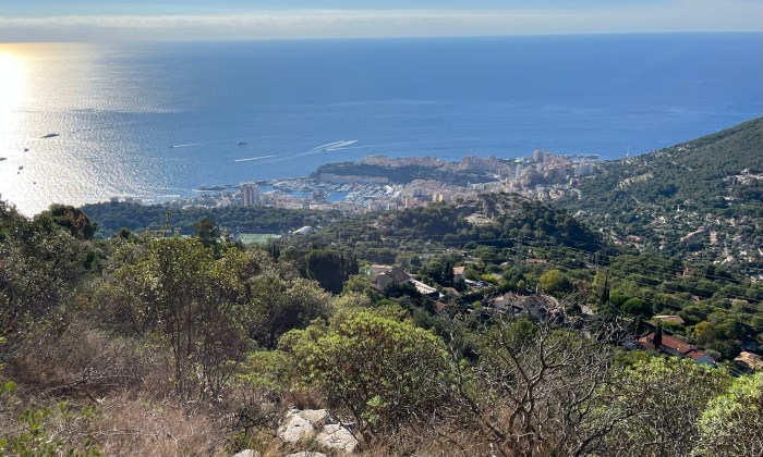
Looking down over Monaco from the trail

The UTMB Nice 50K is divided into five sections. Four aid stations are spaced approximately 11 kilometers apart, and I arrived at the first aid station in less than an hour and a half. That was a little slower than I thought I would take, but I felt good. I grabbed a couple of sugary snacks to pump up my energy and moved on to the second section.

I was worried about the second section. It was about 12 kilometers long, but had a total of more than 2,500 feet of elevation gain. It was time to find out what my legs could take.

The trail changed as well; no longer were we running on wide paths on comfortable surfaces. We had switched to narrow, single-track paths with large rocks everywhere. The next eight kilometers to Col de Madone would have a fairly gradual increase of over 1,500 feet.

Over that stretch, I had kept a fairly good pace, keeping up with the runners ahead of me. My legs were starting to feel the burn a little, but I was feeling confident. Maybe this won’t be that bad.

Once we reached Col de Madone, an official with the race instructed people to prepare themselves for the most difficult climb in the race. We were at the base of Cime du Baudon, and we needed to climb 900 feet over less than a mile. Considering I had already climbed 1,500 feet over the last 5 miles, this was going to be a challenge.
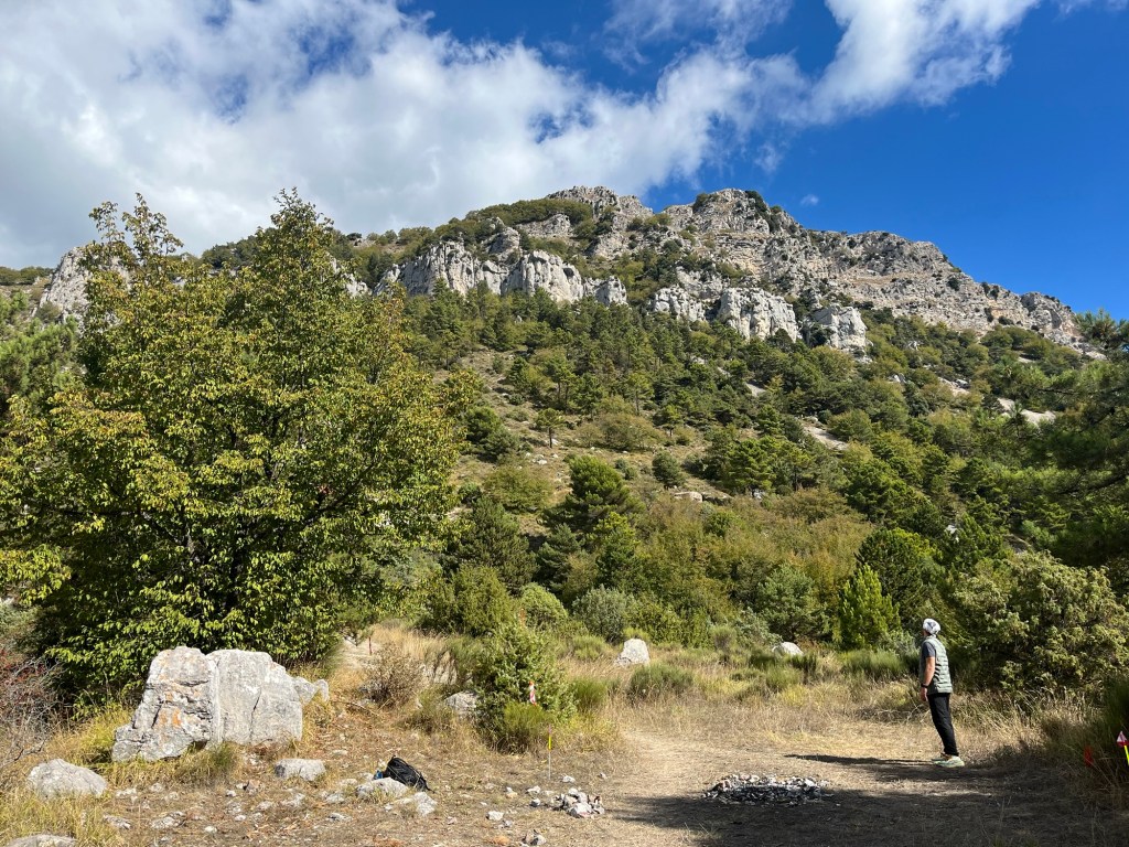
Looking up a Cime du Baudon from Col de Malone

This climb consisted of many parts where we had to use our hands to climb up on large rocks. There was also a lot of loose rock on the paths in this area, which made the footing tricky. This part of the race felt much more like an intense hike than a run. I had to take a lot of breaks to catch my breath, as did the other runners.

It became very clear to me at this point that my training in flat Iowa didn’t prepare me for this elevation change. As I neared the top, I was taking more frequent breaks, and my thighs were absolutely screaming at me to quit. I knew that at the peak, we would be nearly 4,000 feet above sea level, at the absolute highest point of the race, and we would be finishing at sea level. It becomes much more of a downhill race if I could just get to the top.

Nearly exhausted, I reached the top, and my Garmin told me that I had just completed a 52-minute mile. I can say without question that I hadn’t planned to take that long to climb Cime du Baudon, but as Mike Tyson once said, “Everyone has a plan until they get punched in the mouth.”

From the peak, the views were extraordinary. Not only were the multitude of peaks in the Maritime Alps visible, but also the Mediterranean Sea. Off in the distance, to my astonishment, I could see the runway at the Nice Airport, which was more than 10 miles away. My legs were spent, I was exhausted, but this was amazing.
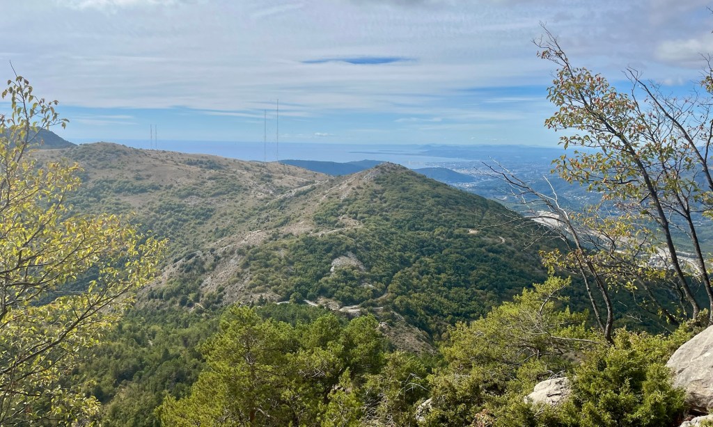
View from Cime du Baudon – off in the distance, you can see the runway at Nice Airport

The next mile was a reverse of the climb up to Cime du Baudon, with a similar grade going downhill. I spent the majority of my energy trying not to fall. I mostly used my hiking poles as stabilizers as I shuffled and slid down the loose rocks. Even though I was going downhill, I took 32 minutes to go the next mile because of how steep the terrain was.

The next aid station was just around the corner in Peille. I was looking forward to filling up my water and grabbing a few snacks. Running downhill through the cobblestone streets, I was feeling energized and encouraged to have reached the end of the second section of the race.
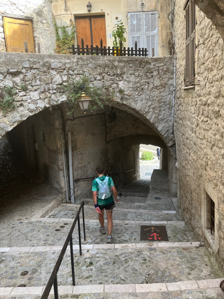
Cobblestone steps in Peille

Those good feelings were quickly squashed when I realized I had completely run through the town and missed the aid station. I had to go back. I wasn’t sure if I had to check in at each aid station to make the race official, but I needed water anyway. I overshot the aid station by more than half a mile, and now I was going uphill, asking for directions to get to the aid station. The last thing I needed was more distance and more elevation change.

Narrow street in Peille

I got to the aid station and they seemed to be cleaning up, but they filled up my water gave me some snacks, and I was back out on the trail.

Over the next couple of sections of the race, I questioned whether I could finish the race. One thing became apparent to me: I wasn’t going to be able to run nearly as much as I had hoped. The paths were full of baseball-sized rocks, and every time that I started to get a little speed, I would land awkwardly on my foot. I just hadn’t trained for running on this type of surface, and it was punishing me.

Rocky paths slowed my progress

In the middle of this, Jenn texted me, and I grabbed my phone to text her back, then immediately tripped over one of those rocks and fell hard. It was the first of four falls I took during this run. I cut my left knee this time, brushed it off, and kept going.

It was also very apparent that at this time, I was all alone. I texted Jenn that I was pretty sure that of the people still in the race, I was in last place. With the terrain and my lack of experience on this trail, I just couldn’t move fast enough without it being dangerous.

As I inched closer to the third aid station, I had a 600 to 700-foot climb, and my quads were on fire. On the downhills and flats, I felt fine, but every time I had to climb a hill, I questioned whether or not I would be able to continue. I took my time and took breaks when I needed to, and kept putting one foot in front of the other until I was at the top of the hill with just a quick couple of miles to the aid station.

At the aid station, I filled up my water and grabbed some snacks. Jenn sent me a text message saying that I had 4 hours until the cutoff at the next aid station. Until that text, I hadn’t even considered that I was close to being disqualified, but apparently, I only made the cut-off at the third aid station by a matter of a few minutes.

Our Lady of Laghet was right next to our 3rd aid station

Hurriedly, I finished my snack and left, following a couple of women, who, after about a half mile, struggled to get down a steep slope into a dried-up creek bed. I saw this and knew I was going to need my hiking poles to get down, but realized that I didn’t have them; they were back at the aid station. So I had to return to the aid station to grab them.

For the second aid station in a row, I had to double back, each time it cost me a mile and probably at least 20 minutes. Now I knew I was in last place. That became apparent when, in a couple of miles, I started to hear noise behind me. It was the sweepers, cleaning up the course behind me. They came up behind me and told me that they were closing the course, and at first, I thought they were going to disqualify me.

They asked me if I could make it to the next aid station, and I told them I had plenty of time and I wasn’t worried about it. I was, however, annoyed by their constant presence behind me. I just wanted them to leave me alone, and they were always right behind me.

It was about this time that the 50K route merged with the 100 Mile route and the 100K route. I think the sweepers no longer were closing the course, since the other runners needed to use the course, but they continued to follow right behind me, which was beginning to get on my nerves.

I got a text message from Jenn, who was following my progress on the Live Trail app, saying that I had one big hill left. Over the next two miles, I was going to have to climb about 700 feet. However, after that, there was only about another 300 feet of climb for the remaining nine miles. I just needed to get up this last hill. With the sweepers on my tail, I continued to put one foot in front of the other, gasping for air, and my thighs on fire. Finally, I made it to the top of the hill.

I was at Plateau de la Justice, just two miles from the final aid station and around nine miles from the finish. At that moment, I realized that, barring an injury, I was going to finish. The only time I questioned whether I could continue was going uphill, and except for a little bit of elevation gain, it was all flat and downhill for the rest of the race. It was an emotional moment knowing that I was going to finish after spending the better part of the last few hours questioning whether I could.

I made it to the aid station and filled my water for the final time. I choked down some cookies, hoping the sugar would give me a boost of energy, and got back to the race.

Once I hit the aid station, I was no longer alone on the course. Somehow, I managed to catch and pass some 50K runners, and an increasing number of 100 milers were coming up from behind us.

A short while from the aid station, the trail passed through Parc du Viniagrier. This section was a steep downhill single-person switchback trail, which was full of stones. By this time, running on these stones was tearing up my feet, my whole body ached, and my legs were almost completely spent. It was also getting darker by the minute as it was now dusk.

This was a highly technical section, and I was exhausted. I needed to stay focused so I wouldn’t hurt myself. Then, while in a fairly steep section, I caught a toe on a rock and fell face-first down the hill. I managed to get my hand in front of my face and stopped myself from taking a rock to the forehead. I felt a sharp pain in my hand and got up. There was blood dripping down my hand.

I decided to continue on and hoped that it would stop bleeding on its own, which it did. All of the aches and pains were starting to multiply, and I was ready to be done. As I pushed through the natural area at Mt Boron, I was treated to an amazing view of Nice at night from about 600 feet above the city.

Mt Boron had the last natural trails left in the route, and once I climbed down an incredibly steep and long set of stairs, I was at sea level. I had just a little over two miles to go along the coast and the Marina.
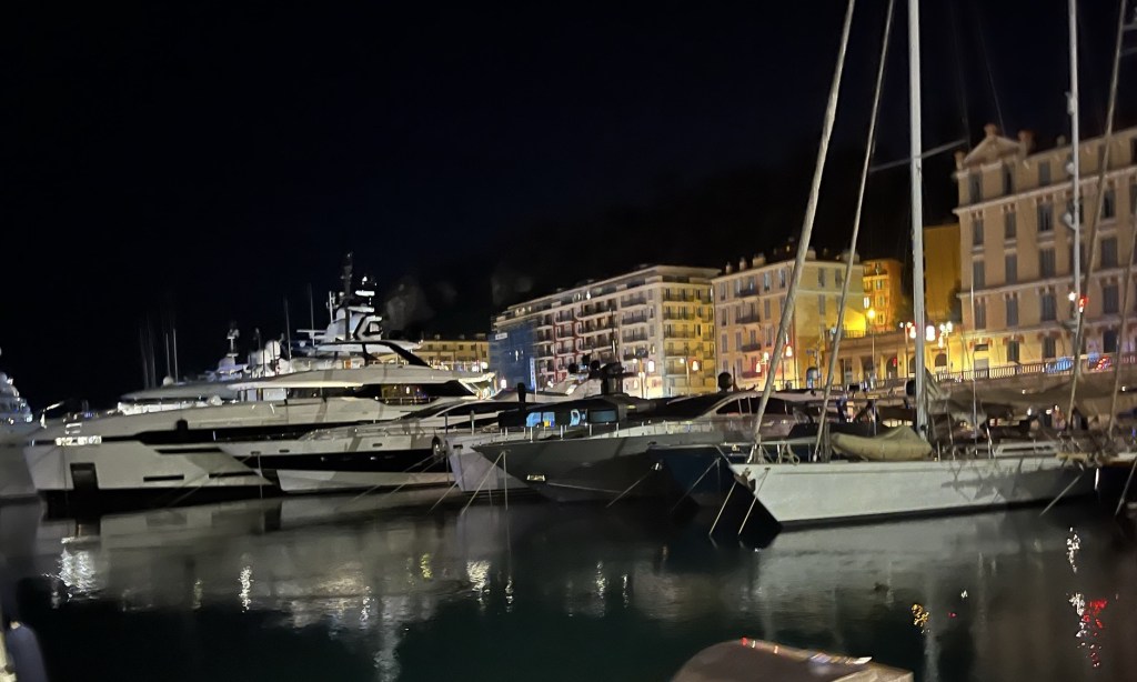
Boats in the Marina at night

My pace increased, running around the Marina by streetlight, through pedestrians. Some were unaware of what was happening, and others were cheering us on. Finally, I turned along the promenade and headed into the finishers’ chute.

Heading down the promenade to the finish

I crossed the finish line in 13 hours and 40 minutes, just 20 minutes before the 14-hour cutoff. My goal was to finish in 10 hours. I didn’t care, though; I was just happy to have finished.

It was the greatest physical challenge I had ever faced, and just finishing was enough for me. I was on the edge of exhaustion so many times and just kept putting one foot in front of the other. It’s a reminder of the power of perseverance.
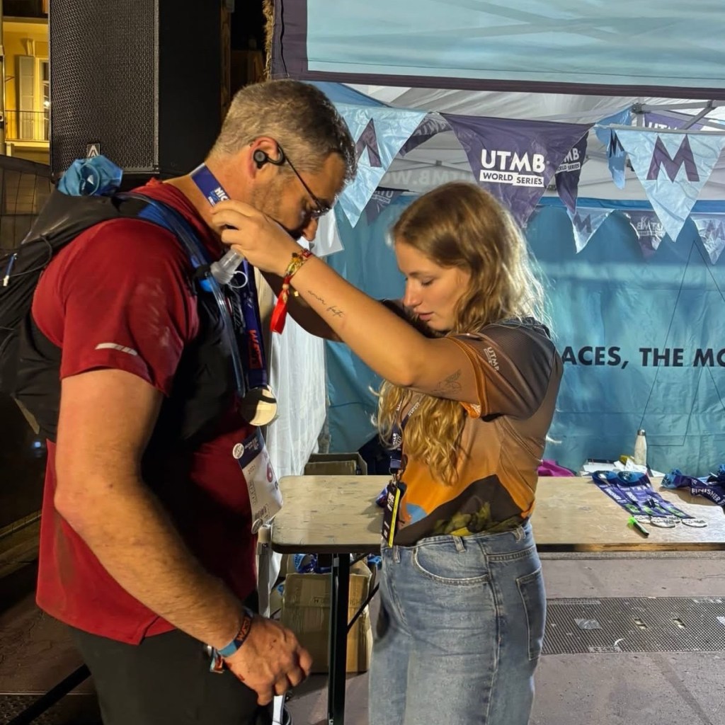
Getting my finishers’ medal

I spent the next several days physically recovering from the race. It took a day to get my appetite back, two for my energy to return, and over a week before I could walk without limping. But within a couple of weeks, I was already trying to find another UTMB World Series race to participate in.
UTMB World Series races are an amazing combination of extreme challenge and extreme beauty. They take place in some of the most beautiful parks and natural areas throughout the world. It’s worth every blister, scrape, and cut. As sadistic as it sounds, I can’t wait to do another.

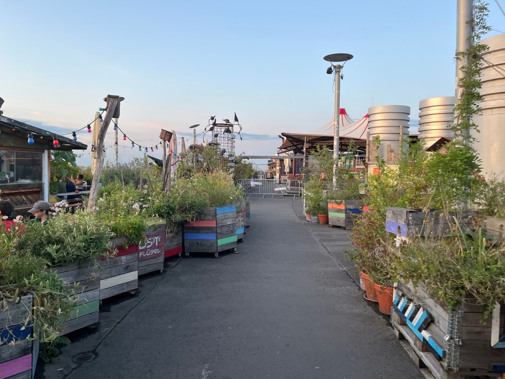
An Evening at Klunkerkranich

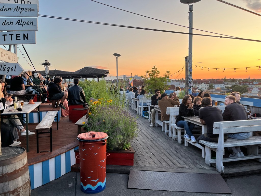
I love to visit places that are a little different, so when I was trying to find a biergarten in Berlin and came across Klunkerkranich, I had to check it out. The name roughly translates to Jewelry Crane, which is an odd name, but frankly, everything about this place is a little odd.

It is a rooftop bar/cultural center located on top of the Neukölln Arcaden, a shopping mall in the Neukölln neighborhood on the south side of Berlin. It has food, several bars, and fantastic views of Berlin.

There are planters all over the rooftop at Klunkerkranich.

Finding Klunkerkranich was a challenge. I stumbled across it on Google Maps when I searched for biergartens. When we went there, I found the intersection where it was located, but couldn’t find any signs or indication of where it was. I knew it was on the rooftop, so I decided to walk into Neukölln Arcaden to see if I had to go through the mall to get there.

Honestly, I’m not exactly sure how we found it. I know we went up as far as we could inside the mall, then ended up in a stairwell going up another floor, then through a parking garage. Inside the parking structure, we saw a ramp going up an additional level, and on that ramp, we were greeted by a gentleman who was taking the entrance fee. It’s definitely not the kind of place you just stumble upon; you have to be looking for it.

The entrance fee is variable between three and nine euros, depending on what time you arrive and what cultural program is being featured that day. The cultural program on the day we arrived was an EDM DJ, and the fee was eight euros.

The ramp up to the rooftop

Walking up the ramp, you start to get the vibe of the place. There are planters along the ramp that feel like they belong in a hippie’s garden, reminiscent of reclaimed pallet boards and whimsical paint colors. Once we got to the top of the roof itself, I felt a little sensory overload. The bass from the EDM, the views of Berlin, the sound of people chatting, the colors from the flowers in the planters, as well as the countless avant-garde decorations, took me a moment to unpack.

We looked around for a little while and then went into the bar for a König Ludwig dunkel for me and a cola for Alex. We then found a picnic table where we sat and enjoyed our drinks. The best tables along the edge of the building with clear views of the city were already taken.

Seating along the edge of the building with great city views.

For a Wednesday night, there were quite a few people there, but clearly, they could handle a much bigger crowd because only about half of the area was accessible. There was a private party in one section, which I discovered when I tried to walk up there and was sternly reprimanded. Another section, called the Ostflügel (east wing), was also closed off, which I imagine they open when they are busier.

In front of the whimsical balloon statue is the guy who scolded me for trying to get into the section with the private party.

Our plan for the evening was to have a couple of drinks here while the sun set. We had already eaten, so we didn’t have any of the food that was served. Based on the reviews, the food isn’t great, so we ate before arriving. Besides, I promised Alex I would take him for ice cream. Alex and I had spent a week together at this point, and the only way I could convince him to go with me to another biergarten was to promise him ice cream afterward.

The Ostflügel section of the rooftop was closed.

Even though this didn’t look like a traditional German biergarten, it certainly had that same feel. I find Germans to be friendly in biergartens, even though they typically don’t have the reputation for liking small talk. We had a short conversation with a gentleman from an adjacent table, which was prompted by Alex falling off the back of his bench (seriously, he was the only person there not drinking, and he’s the one who fell out of his seat).

Signs pointing to different sections of the rooftop.

I wish we had a chance to visit on the weekend. I have a feeling that the vibe goes from laid-back rooftop biergarten to a more nightclub/rave vibe when it gets really busy. Even though I would definitely rather go to a biergarten than a nightclub, it would have been really interesting to visit it when people were really partying.

We waited for sundown and walked around the rooftop, looking over the city of Berlin. It was a beautiful sunset on a warm and lovely evening. We then decided to leave and worked our way back to the ground level through the parking garage, stairwell, and the mall, and back out into the city. Now we just had to find that ice cream I promised Alex.

Berlin at sunset

If you are going to Berlin, I would highly recommend going to Klunkerkranich. The views over the city alone are worth the price of admission. I really enjoyed the hippie vibes and the avant-garde art. It was a really enjoyable place to spend an evening.

Berlin’s Lessons from a Troubling Past

Berlin is the epicenter of uncomfortable history. The city was the seat of power for Germany during World War I and World War II. During the Second World War, many crimes against humanity were directed from this city. It was also physically split during the Cold War.

20th-century German history forces people to confront the worst parts of humanity. This includes the history of concentration camps, persecution of vulnerable groups, and ethnic cleansing. It also forces people to confront totalitarianism and the stripping of basic human rights. It’s a history that confronts each and every individual who learns about it with the worst parts of the human experience.

Berlin could have decided to move on from its history and maybe built some small monuments or plaques to inform people of the past. Instead, the people of Berlin have built an impressive and thoughtful collection of monuments, allowing people to mourn the past and contemplate what it means for the present.

World War II Monuments

There are various monuments related to World War II in Berlin, and many of them recount the horrors related to the Holocaust and the Nazis’ campaigns of ethnic cleansing. There were three in particular that drew my attention related to the persecution of minorities by the Nazis from 1933 to 1945.

Memorial to the Murdered Jews of Europe

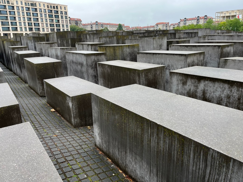
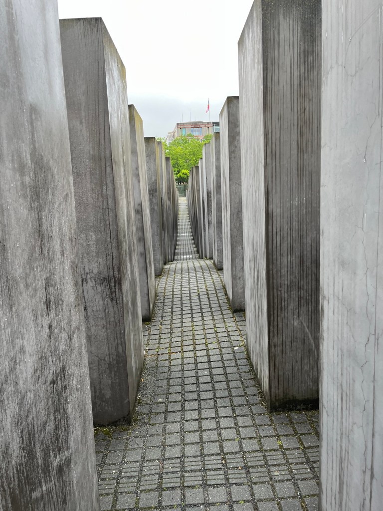
Completed in 2004, the Memorial to the Murdered Jews of Europe was designed by architect Peter Eisenman and artist Richard Serra. This memorial is built out of 2,711 concrete blocks of various sizes arranged in a grid pattern over an area of about 4 acres. The memorial is abstract, and your interpretation of its meaning is up to you.

Monument to the Murdered Jews of Europe

As I was walking through the memorial, it became very clear to me just how difficult it is to visualize large numbers. There were an estimated six million Jews killed during the Holocaust at the hands of the Nazis. That is a number that becomes incredibly hard to visualize. However, as I was walking among the concrete blocks, seeing 2,711 blocks, and that, if divided equally, each block would represent more than 2,000 lives lost, six million becomes an unfathomable number.

Monument to the Murdered Jews of Europe

People have commented that the design is meant to be disorienting, with the varying heights of the blocks and the fact that the ground they sit on is not flat. To me, instead, it felt like a place for reflection. Once you get into the sea of concrete blocks, the distractions of the city vanish, and you are only left with your thoughts.

Monument to the Sinti and Roma Victims of National Socialism

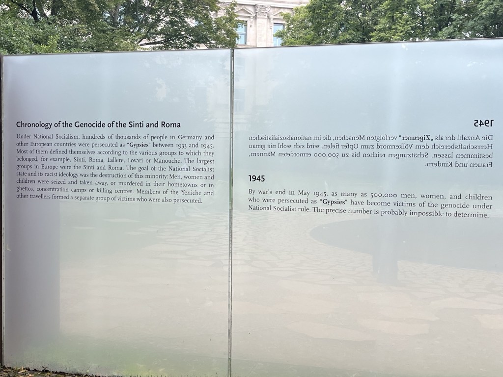
In the Tiergarten in Berlin is the Monument to the Sinti and Roma Victims of National Socialism. It was officially opened in October 2012 and was dedicated to the estimated 250,000 to 500,000 Sinti and Roma who were killed by the Nazis.

Monument to Europe’s Sinti and Roma Murdered under Nazism

The monument consists of a dark pool with a triangular-shaped stone, which signifies the badge the Sinti and Roma were forced to wear in the concentration camps. The monument also contains a large exhibit that describes the story of the persecution and genocide of the Sinti and Roma.

Memorial to the Homosexuals Persecuted Under Nazism.

The Memorial to the Homosexuals Persecuted Under Nazism looks like a plain concrete cube, similar to the concrete cubes in the Monument to the Murdered Jews of Europe. There is, however, a window in the concrete which, when you look inside, displays a short video of two men kissing. Every two years, the video alternates between two women kissing and two men kissing.

Memorial to Homosexuals Persecuted Under Nazism in Berlin

This monument is in Berlin’s Tiergarten and was opened in May 2008. I thought the monument was a great depiction of how members of the LGBTQ+ community had to live their lives in secrecy to avoid persecution.

Monuments to the Berlin Wall

From the end of World War II in 1945 until reunification in 1990, Berlin was essentially split in half, with the western side part of West Germany and the eastern side part of East Germany. West Berlin, however, was essentially an island as it was completely surrounded by East Germany.

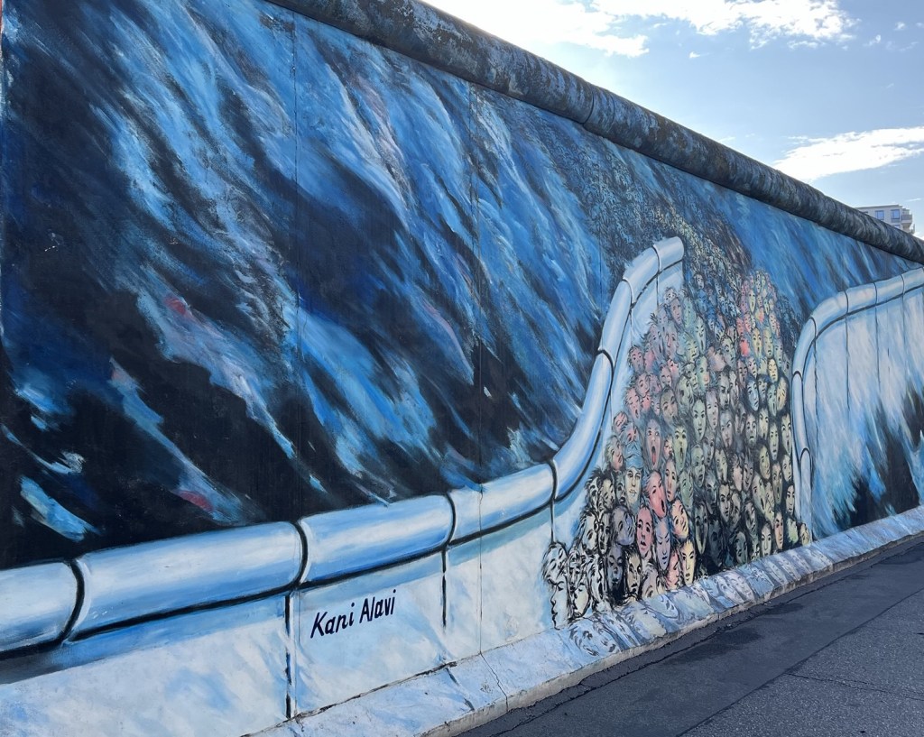
Mural by Kani Alavi depicting the crowds of people who broke through the Berlin Wall the day it fell. The mural is located at the East Side Gallery

In an effort to stop people from defecting from East Berlin to West Berlin, a wall was constructed in 1961. This concrete and barbed wire wall completely encircled West Berlin. From the construction of the wall in 1961 to the fall in November 1989, a total of 171 people were killed attempting to escape East Berlin. Approximately 5,000 East Germans were successful in escaping East Berlin during that time.

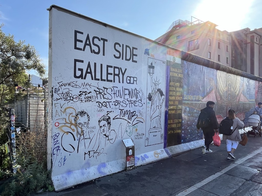
East Side Gallery

Far end of the East Side Gallery

Many sections of the Berlin Wall are left standing throughout Berlin. The East Side Gallery is a large portion of the Berlin Wall painted by a series of artists. It is a large open-air art gallery with over 100 unique paintings from across the world.

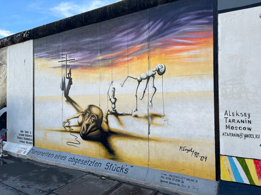
Marc Engel’s Puppets in a Dropped Play

It is impressive in its size and artistic diversity. We spent a couple of hours walking along the wall, admiring the artwork.

White Crosses

Walking into the Tiergarten, we came across a series of white crosses that were placed to commemorate the people who died attempting to cross from East Berlin to West Berlin. The stories of some of the 171 East Berliners who died trying to cross the Berlin Wall are displayed on these crosses.

The White Crosses Memorial pays tribute to people who were killed trying to escape East Germany by crossing the Berlin Wall

There were over a dozen at the location we saw at the northeast corner of the Tiergarten, but there are also 8 additional crosses along the Spree River behind the Reichstag building.

Remnants of the Berlin Wall

Remnant of Berlin Wall with peace sign sits along a thin line of bricks and stone signifying the location of the wall.

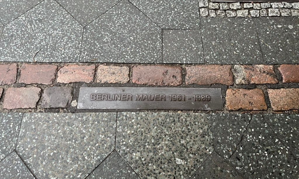
Throughout Berlin, you will see reminders of the location of the Berlin Wall. In some cases, it is a piece of the wall. In others, it’s a brick line in the pavement that marks where the wall had been. It is a constant reminder to the citizens of Berlin of when and where their city had been split for the duration of the Cold War.

Much of the location of the Berlin Wall is marked by brick lines in the pavement

The city of Berlin could have chosen to completely remove all of the Berlin Wall and turn the page on a horrible part of its history. However, they left scars throughout the city as a reminder of the trauma of the past.

Addressing the Past with Clarity

In the United States, it has been 160 years since the end of the Civil War. Even after that much time, we lack a cohesive narrative about the end of a horrible chapter in our past.

Throughout much of the Old South in the United States, there are still countless monuments to Robert E. Lee. People still proudly wave Confederate flags. For some people, the teaching of the history of slavery, segregation, and the Civil Rights movement in America is labeled ‘Critical Race Theory’ and demonized. Even after more than a century and a half, we cannot come to terms with the sins of our past.

The city of Berlin addresses its past with clarity. You will not find statues in Berlin commemorating Hitler or any of his generals. Nazi flags are illegal in Germany, and you will not find many people who defend Nazi Germany. What you will find are thoughtful monuments to their victims. The message is clear to visitors and Berlin residents – we made horrible mistakes and are committed to not repeating those mistakes.

Germany does not hide from its past; it addresses it head-on. Unlike the United States, it does not confuse or excuse its immoral actions but instead addresses them with clarity. That is the best way for a society to move forward from its mistakes.

We should not shy away from things that make us uncomfortable. Discomfort is the fertile soil where wisdom grows. It is not our responsibility to bear the weight of the sins of our fathers. It is, however, our responsibility to not repeat those sins.

Exploring the Panometer Museum in Dresden

The Panometer in Dresden is a unique museum. It was built inside a former gasometer, a round structure that was used to pressurize coal gas for use in houses. Many of these structures have been converted for other purposes, and in Dresden, one was converted into a truly unique museum.

Photo of the exterior of the Panometer in Dresden courtesy of https://www.panometer-dresden.de/en/panometer-dresden/industriedenkmal/

This museum hosts incredibly large panoramic paintings created by artist Yadegar Asisi. Only one painting at a time is on display, and each painting covers the entire inside wall of the Panometer. These paintings immerse visitors in a time and place. Previous exhibits have included a panoramic view of Dresden in the 1700s and Dresden immediately following the Allied bombings in 1945.

The exhibit we visited was Amazonia, which immerses the visitor in a 1:1 scale painting of the Amazon Rainforest. This exhibit has been hosted by other panoramic museums, but has been at Dresden’s Panometer since 2024 and should continue through the end of 2025.

Exhibit explaining the process of creating a panoramic painting.

Entering the museum, we walked into a series of rooms that explained the artwork and how it was created. There was also a lot of background information about the Amazon Rainforest and its flora and fauna.

Amazonian insects are displayed in the museum area before entering the panorama.

Once we had walked through the exhibitions, we entered the Panometer itself. My first reaction was awe at the size of the painting. Each piece of art that gets displayed at Panometer is almost 90 feet tall and approximately 350 feet long. It’s absolutely massive. But it’s not just the size that’s impressive. The detail in the painting itself, especially considering the scale of the painting, is phenomenal.

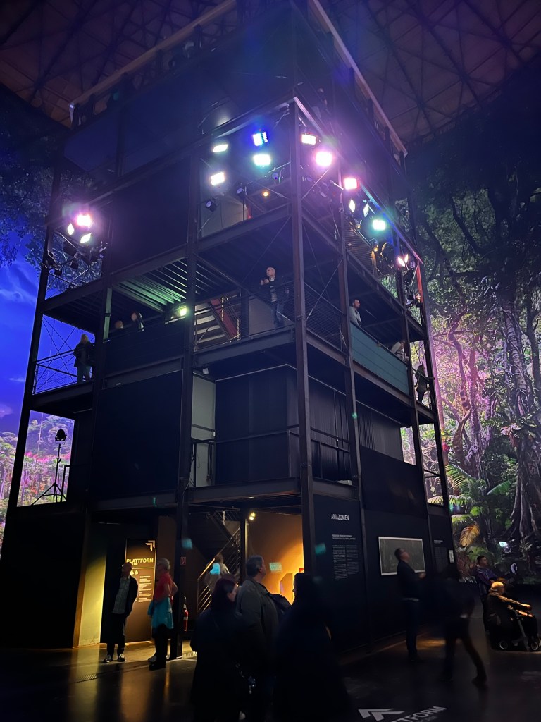
Viewing Tower in the Center of Panometer

Visitors also experience sounds from the Amazon and music. The soundscape was designed by Eric Babak, who collaborates with Yadegar Asisi on these projects.

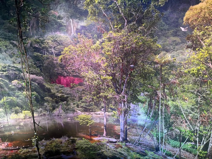
Rainforest floor in daytime lighting

In the center of the Panometer is a 50-foot-tall tower, where visitors can view the painting from various heights. Attached to the tower are a series of lights that simulate different times of the day, from moonlit night through dawn to midday. The painting reacts differently to the different kinds of lighting it’s exposed to. While daytime lighting exposes the incredible detail of the painting, the nighttime lighting hides those details, but creates an interesting glow, as it would under a full moon.

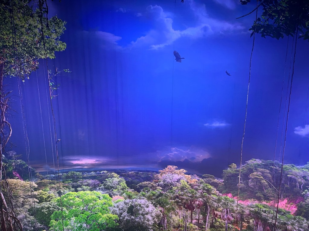
Above the rainforest canopy during dusk lighting

All of this makes for a completely immersive experience for the visitor. Instead of at an art museum where you would go to view a great work of art, this feels like a visit to the Amazon itself, without, of course, the heat, humidity, and the possibility of being eaten by a snake.

Rainforest floor at night

Viewing the work of art from the multiple levels of the tower gives the visitor many different perspectives on the same work of art. We took full advantage of the multiple viewpoints and different lighting to get the full experience. You can fully experience the Panometer in around an hour, allowing yourself plenty of time to see the art at multiple heights with different lighting.

Visiting Panometer Dresden

Panometer Dresden is about an 8-minute walk from the Dresden Reick train station. There is also a bus stop even closer than the train station. If you are driving, there is free parking in front of the building.

Tickets are 14 Euros for an adult. It costs 12 Euros for 17-20 year old students, Dresden Card holders, Dresden Pass holders, and the disabled. It is 7 Euros for children 6-16 years old. Children under the age of 6 are free.

Places to View the Art of Yadegar Asisi

Yadegar Asisi has many different panoramic art pieces on display throughout Germany.

  • The Cathedral of Monet is currently on display in Leipzig. This 360-degree panorama, inspired by Monet’s painting of the Rouen Cathedral, is scheduled to end on Jan 7th, 2026.
  • On display at Museumsinsel Berlin is the Pergamon. This art depicts the Greek City of Pergamon as it was during the reign of the Roman Emperor Hadrian in 129 AD.
  • At Panorama Berlin is The Wall. This depicts various scenes from a 25-year period centered on the Berlin Wall.
  • On display at Panorama Wittenberg360 in Wittenberg, Germany, is Luther 1517. This work depicts scenes from the life of Martin Luther and represents what Germany looked like 500 years ago.
  • At Gasometer Pforzheim, Amazonia, the same exhibit being shown in Dresden, is also on display. It is scheduled to be in Pforzheim through 2026.

Altogether, there are 6 panoramic museums in Germany displaying Asisi’s work. I think the combination of the size and the detail of the work makes it worth visiting. It also makes for a quick trip if you want to fit it in with other things. You should be able to visit any of these works of art in an hour or less, and the price is reasonable.

I don’t think that I would go out of my way to do a day trip to one of these exhibits, but if you are in one of the cities where one of these panorama museums exists, I think it’s worth a stop. It’s a great way to spend a little time if you are in the area.

Beauty and Danger on Malerweg Trail Stage Four

Stage four of the Malerweg starts in Altendorf and finishes in Neumannmühle. It is part of the Malerweg Trail (Painter’s Way), which is a series of eight point-to-point trails through Saxon Switzerland National Park in Germany. It roughly follows the path of German landscape painters who frequented the area in the 18th Century.

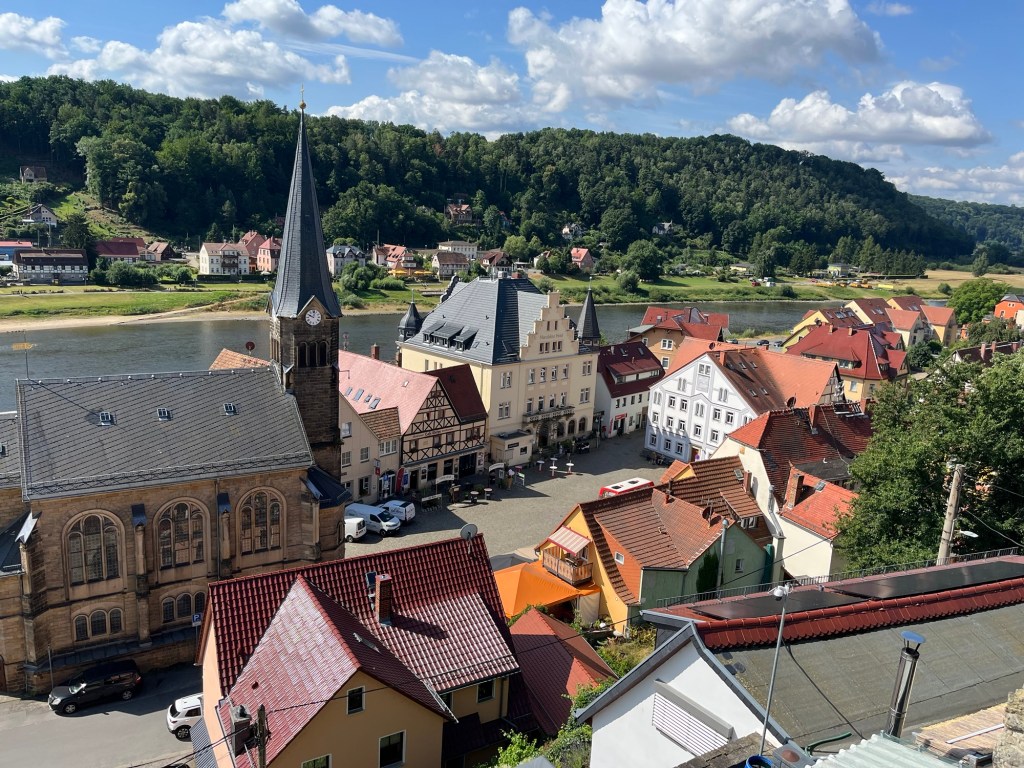
Building in Bad Schandau

My Son Alex and I had only planned four days of hiking while in Dresden, but because of the amount of rain that fell while we were there, we were only able to hike two days. Having read blog posts of people who had done all eight stages, stage four seemed to be one of the favorites of the eight stages.

Our day started with a train ride from Dresden to Bad Schandau. From there, we needed to take a bus from Bad Schandau to Altendorf. Once we got off the bus in Altendorf, it only took a few minutes to find the sign directing us to the Malerweg trail.

We followed the signs, and it wasn’t long before we came across a sign that said the path was under repair and that we needed to turn around to go to an alternative path. That forced us to turn around and eventually led us down a fairly steep trail with a lot of switchbacks that descended from Altendorf.

At the bottom of the hill was a campground where we missed a sign and walked another quarter mile or so before I thought that the trail didn’t seem right. My instincts told me we weren’t on the Malerweg, so we turned around and returned to the campground, where we saw the sign pointing to the Malerweg, which we had missed the first time. We had barely even started hiking, and we had already come across a closed trail and taken a wrong turn – not a great way to start.

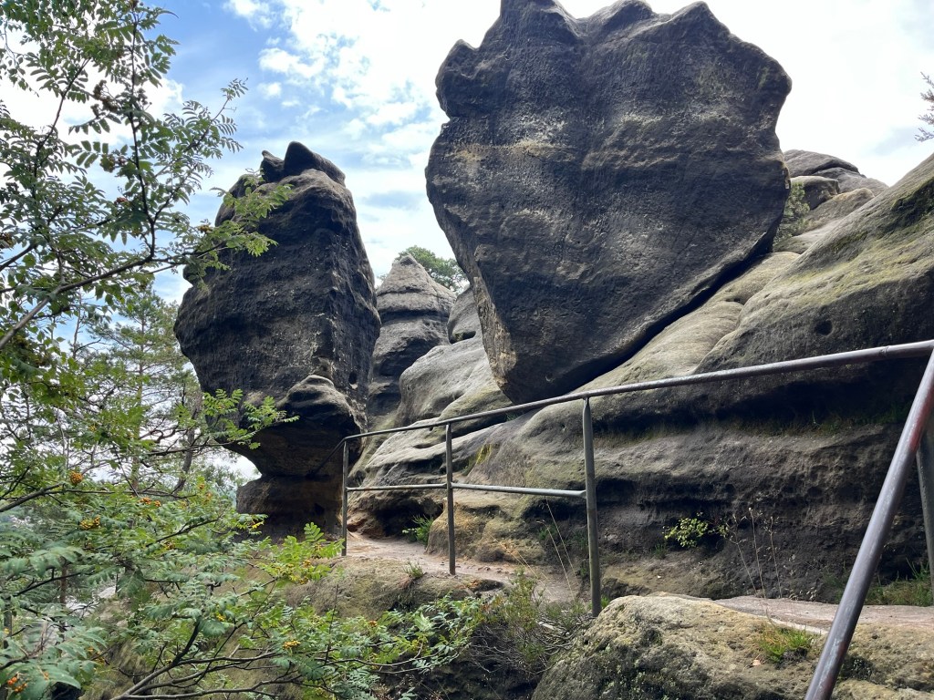
Walking beside the sandstone pillars

From there, we started an approximately 1,000-ft ascent over the next four miles. The first part of the ascent was through prairie and woods until we reached the sandstone mountains. The early parts of the hike weren’t that scenic, but as we approached those stone cliffs, we were treated to amazing views.

Sandstone pillars next to the trail

The trail took us around a series of sandstone pillars for about 15 to 20 minutes before leading us uphill. This area has a large sandstone bluff, and the Malerweg trail continues on top of the bluff for a few miles. However, first we needed to climb from the trail up onto the sandstone bluffs.

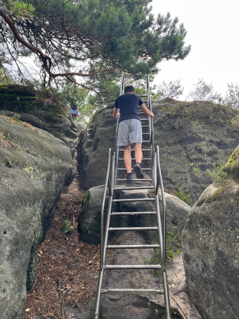
Metal stairs on the sandstone ridge

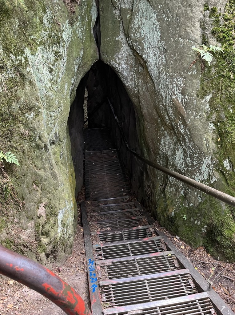
On the ascent, the trail was varied. Often there would be metal stairs with handrails, other times, wooden steps, and sometimes you would need to climb on the rocks themselves. There were spots that I thought were fairly dangerous, and the footing was tricky, but after a while, we made it to the top of the bluffs, where we were treated to some spectacular views.

Looking down on the trail after climbing onto a bluff.

I was baffled by how dangerous the trail felt in parts. At one point, I was completely stretched out, holding onto the base of a metal railing, with my feet desperately trying to grip onto a large boulder, which was slick from the sand on top of the stone. This was precariously over what would be a fall of at least fifty feet.

View from the top of the sandstone bluffs

The baffling part, though, wasn’t the fact that I perceived it to be so dangerous; it was the number of much older Germans and German children doing this hike. Alex and I are in pretty good shape, and these German hikers were treating this trail like it’s a walk along a gentle river. As I learned on the Camino de Santiago earlier this year, when it comes to hiking, Germans are pretty hardcore.

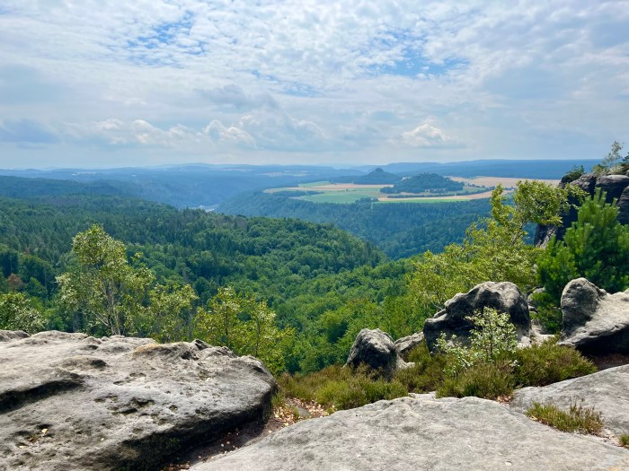
Off in the distance, you can see the channel carved by the Elbe River and across it, a plateau with farmland atop it.

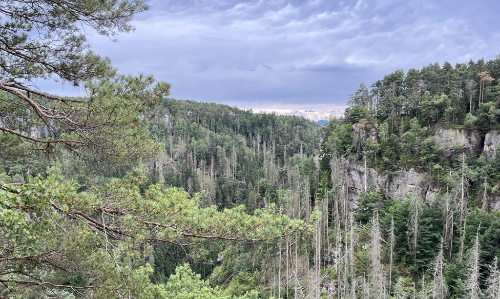
For about an hour, we walked along the top of the sandstone ridge, with phenomenal views of Saxon Switzerland National Park. On occasion, we would have to climb on top of rocks formations, and sometimes we would need to descend. However, the whole time, we were enjoying breathtaking views of the Elbe River and the Elbe Sandstone Mountains.

Metal stairs poke up between rocks on the bluff

Finally, we began our descent out of the ridge and down along the edge of the sandstone pillars. We were in a pine forest, with the sandstone cliffs next to us. We were starting to get hungry and hoped to find civilization so we could stop for some food and a drink.

A railing along the edge of a steep drop-off.

While the hike had provided us with spectacular views, it hadn’t yet passed through any towns that had restaurants. This was unlike Stage Two of the Malerweg, which had plenty of opportunities to stop for a drink and a bite to eat. After about four hours and ten miles of hiking, we finally stopped at Lichtenhainer Wasserfall.

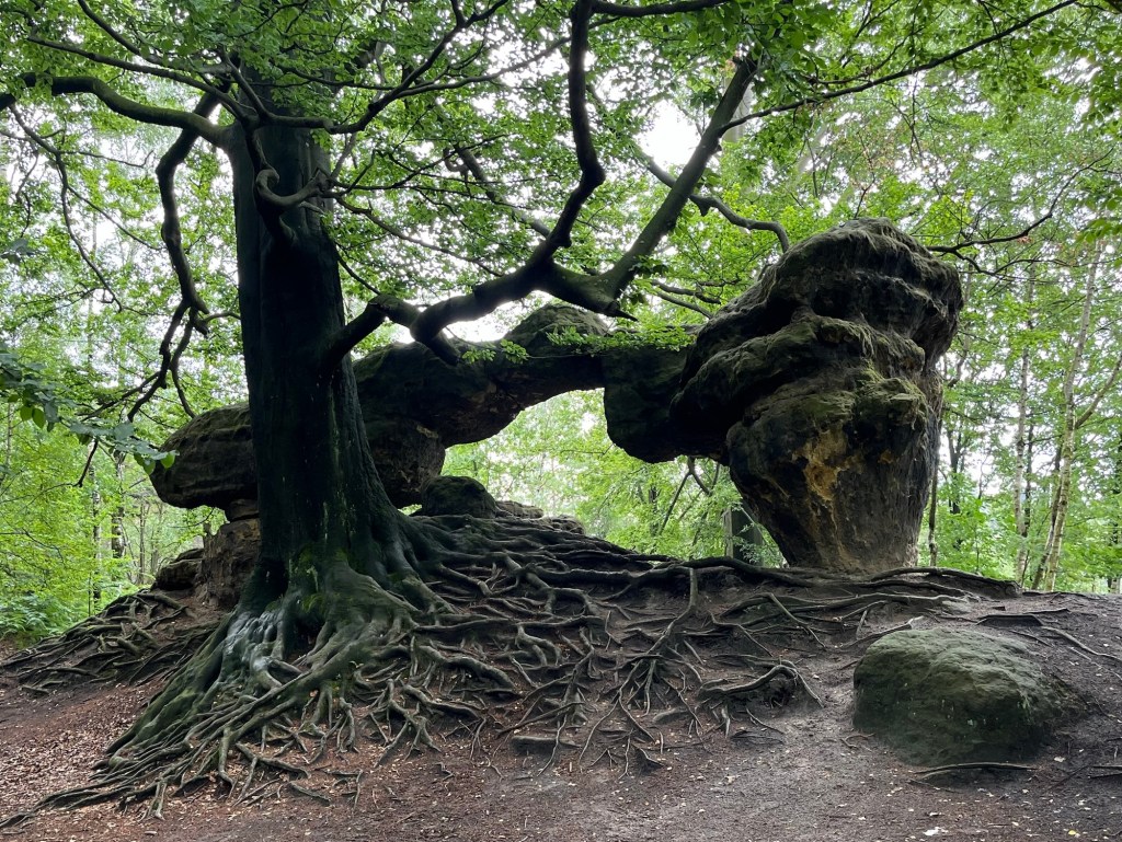
After the descent, we found this amazing tree and formation

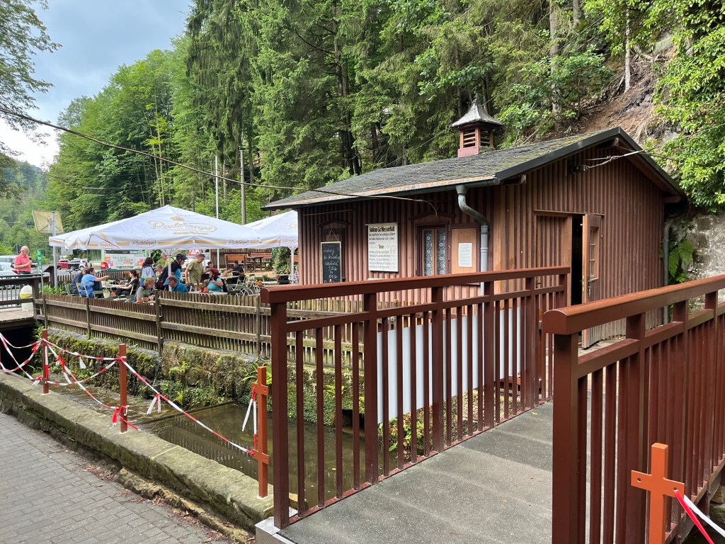
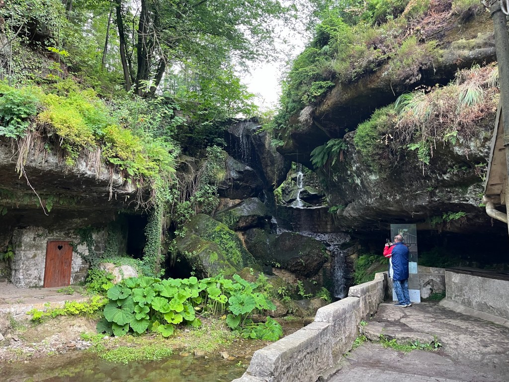
Lichtenhainer Wasserfall is a waterfall with a beer garden and restaurant nearby. We both ordered sausages and potato salad, and enjoyed some rest by the waterfall. The food tasted great, but I couldn’t tell if it was because it was actually great or because the hiking had made me extremely hungry.

A section of the trail perched on the edge of a cliff

I had a couple of beers, including a dunkel made by Sachsisches Schmuggler, which is made in nearby Sebnitz. It hit the spot, and we were ready to head off into the woods again.

Biergarten at Lichtenhainer Wasserfall

We only had two or three miles left, so with food in our bellies, we were feeling pretty good. Unfortunately, it was only a matter of about 10 minutes before it started to completely downpour. At first, we put on our raincoats and continued on, thinking that the rain would have to break up eventually.

Lichtenhainer Wasserfall

The rain was so heavy that the raincoats were powerless to stop us from getting wet. We walked about a mile away from Lichtenhainer Wasserfall before giving up and walking back in the other direction. We really wanted to finish, but without really knowing how much further we needed to go and being completely soaked to the bone, we decided to return to Lichtenhainer Wasserfall and take the train back to Bad Schandau.

It was disappointing not to finish the rest of Malerweg Stage Four; however, I felt pretty sure that we had experienced most of the beauty of the stage, with all of the amazing views at the top of the ridge of the Elbe Sandstone Mountains. It was an absolutely amazing hike, and while I wish we had finished it, I was glad that we were able to do the parts that we did.

If you are thinking about hiking some of the Malerweg, I would highly recommend doing stage four. You should, however, keep in mind that there are parts of the trail that are very technical and sometimes dangerous. Just don’t be surprised if you get passed by a German family with a couple of grandparents and a four-year-old.

Stage Two of the Malerweg Trail

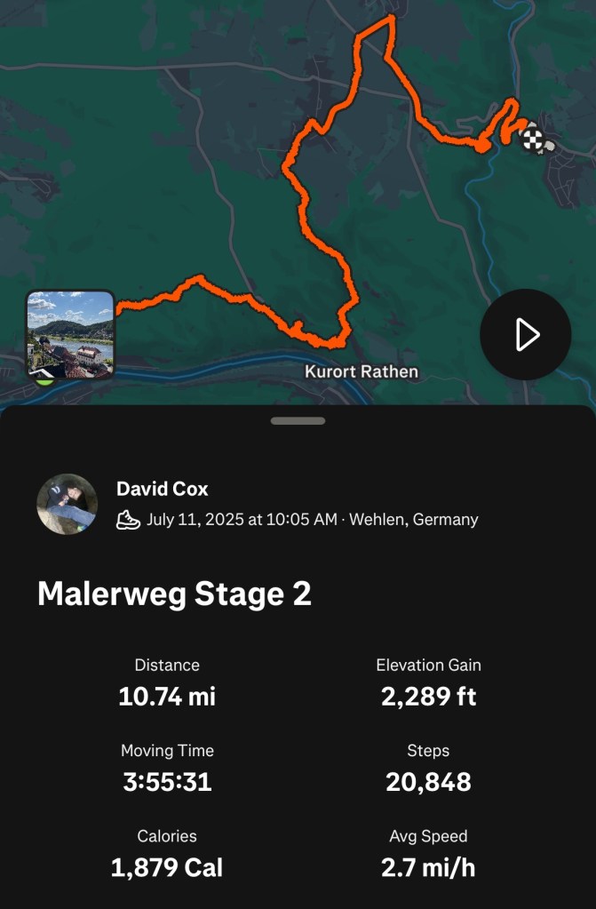
The Malerweg is a famous hiking path through Saxon Switzerland National Park in Germany. It has eight stages, each starting in one town and ending in another. For an avid hiker of average endurance, each stage takes a day to complete. Anyone who hikes the full eight days will be treated to a variety of landscapes, spectacular viewpoints, and quaint German villages.
Radfahrerkirche in Stadt Wehlen

Malerweg is German for “The Painter’s Way.” In the middle of the 18th Century, landscape artists came to the area to paint the Elbe Sandstone Mountains. The area became so popular that the artists began to share their routes, and an ideal route was created. When the railroad arrived in the 19th Century, the route fell out of favor. Over a century, efforts had been made to recreate the path, and finally, in 2006, an optimized route of 116 kilometers was created.

I knew we would not have enough time to hike the entire Malerweg, so I chose a few stages I wanted to hike. Stage two was at the top of my list because of the Bastei Bridge. As I’ve learned, if there is something that you really want to do, do it on the first day that has good weather.

We were treated to fantastic weather. It was an absolutely fabulous day with mostly clear skies and temperatures hovering around 70 degrees Fahrenheit.

View from the trail over Stadt Wehlen

The day started with a train ride from our Airbnb in Dresden, followed by a ferry ride across the Elbe from the train station in Stadt Wehlen to the town itself. From the Radfahrerkirche, the church in the main square of Stadt Wehlen, the trail starts on stairs that switchback up a steep hill overlooking the town.

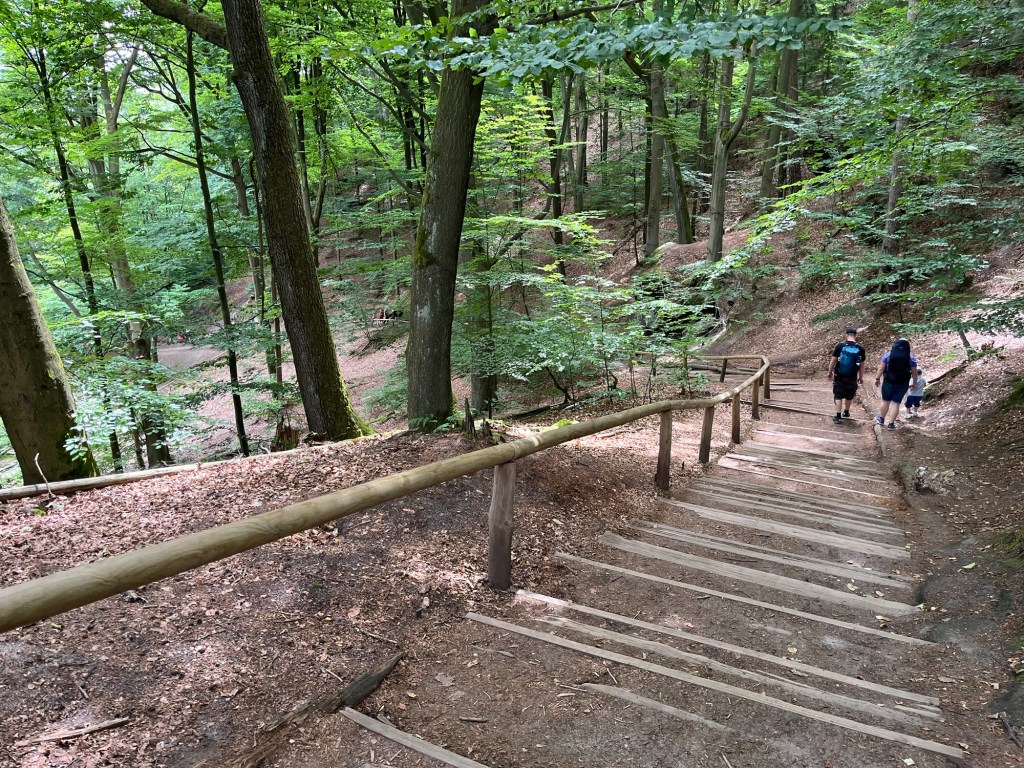
From there, we followed the signs along the Malerweg through the woods. This section involved about a 600-foot climb, which was fairly gradual but strenuous nonetheless. As I’ve learned, though, if you want a great view, you need to climb a hill. In fact, the more you climb, the better the view.

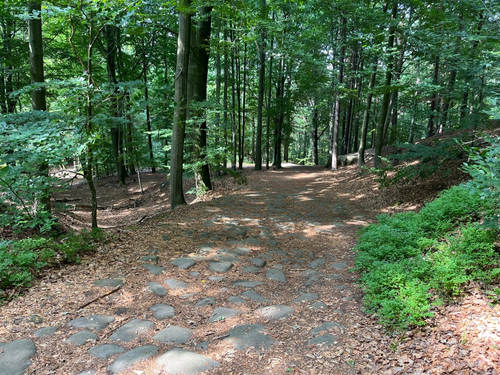
The path between Stadt Wehlen and Bastei was wooded and full of large stones

After about an hour of hiking, we arrived in Bastei. Bastei is probably the most scenic and most visited part of Saxon Switzerland National Park. We immediately stopped at the Panorama Biergarten for a couple of pretzels and drinks.

There are two sides to Bastei: one facing the Elbe River and one facing the sandstone mountains. From the Panorama Biergarten, we saw the side with the sweeping views of the Elbe. Even though the views from this biergarten are amazing, this side of Bastei is less impressive than the other.

View from Panorama Biergarten in Bastei

We finished our snack in the biergarten and walked over to the other side of Bastei, and were immediately struck by the amazing views of the sandstone mountains. Spreading off into the horizon was a sea of gray sandstone columns smoothed from millions of years of erosion.

The sandstone mountains were formed during the Cretaceous period when this area was under the sea. A 600-meter-thick sandstone slab was formed at the bottom of the sea. When geologic forces caused the area to rise from the sea, erosion of the sandstone formed these landscapes. What is left is breathtaking.

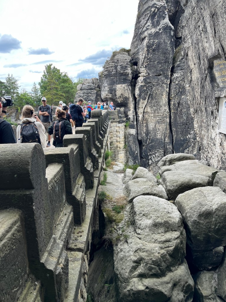
Bastei Bridge

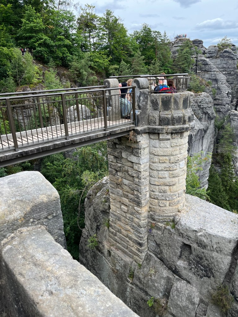
We continued walking along the path until we saw the Bastei Bridge. This sandstone bridge was built in 1851 to link multiple sandstone columns. It is a major tourist attraction and is a man-made object that complements nature rather than detracts from it.

Bastei Bridge

Most of the time we spent on the trail was by ourselves. That was not the case in Bastei. There are many ways to get to Bastei without hiking the Malerweg. There are parking lots near Bastei for people who drive, there is a bus that goes to Bastei, or you can take a much shorter 1-kilometer hike from Rathen.

Outlook stretching off the Bastei Bridge

This meant that while we were in Bastei, the trails were very crowded as people jockeyed for position to see the Elbe Sandstone Mountains and the Bastei Bridge. The crowds were fairly thick for at least a kilometer from the Bridge itself. There is a great reason for this, though—the views are tremendous.

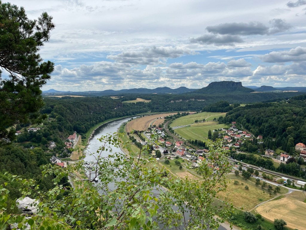
Elbe River taken from the outlook near the Bastei Bridge

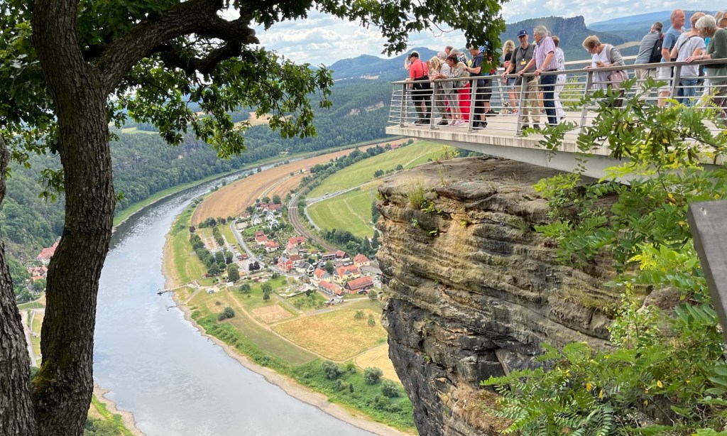
Continuing on the Malerweg past the Bastei Bridge, multiple viewpoints of the Elbe River valley and the Sandstone Mountains are simply amazing. We spent a lot of time in this area taking pictures and just looking out over the breathtaking landscape.

Viewing platform overlooking the Elbe River

Eventually, we reached the end of the sandstone bluffs at Bastei and had to start heading downhill on the trail. There were a decent number of hikers still on the trail, but they were starting to thin out.

Descending from Bastei

When we finished our descent, we were treated to a man-made lake, as the creek that ran through the area had been dammed up. People were enjoying the lake with paddle boats and kayaks, while others hiked around the lake. It was a beautiful location.

Walking along the Amelsee

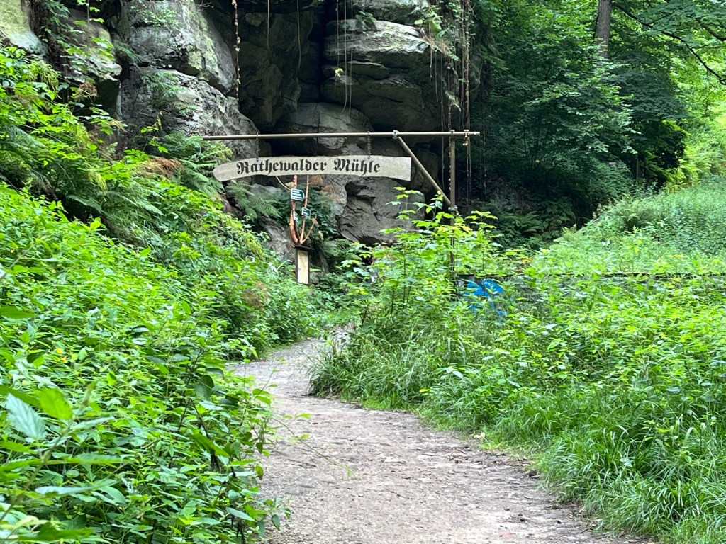
That path continued until we reached Rathwalde and stopped for a little lunch. Rathwalde is a cute little village with a few restaurants. It was a nice place to stop for a little while and rest.

After stopping in Rothwalde, we got off the correct Malerweg path. I’m not sure if we missed a sign or if we misinterpreted one, but we ended up going the wrong way and had to use Google Maps to try to get us to Hohnstein, which was the end town of Malerweg stage two. That took us on a narrow blacktopped road, which wasn’t particularly fun or scenic to walk.

View from Hocksteinaussicht

Eventually, we made it back onto the Malerweg and ended up in a place called Hocksteinaussicht, a rocky lookout with a view of the village of Hohnstein. After taking in the views from Hocksteinaussicht, we descended from the rock down a set of metal stairs between the rocks. Finally making it to the bottom of the hill, we found ourselves at a road where we could go left or right. We chose to go left, which was, again, the incorrect choice.

Metal stairs through a break in the sandstone descend from Hocksteinaussicht.

Had we chosen the path to the right, we would have been treated to a pleasant walk through the woods ending in Hohnstein. Much of that path would have been along a gentle creek. Unfortunately, since we chose the other direction, we ended up on another road walking the long way into Hohnstein.

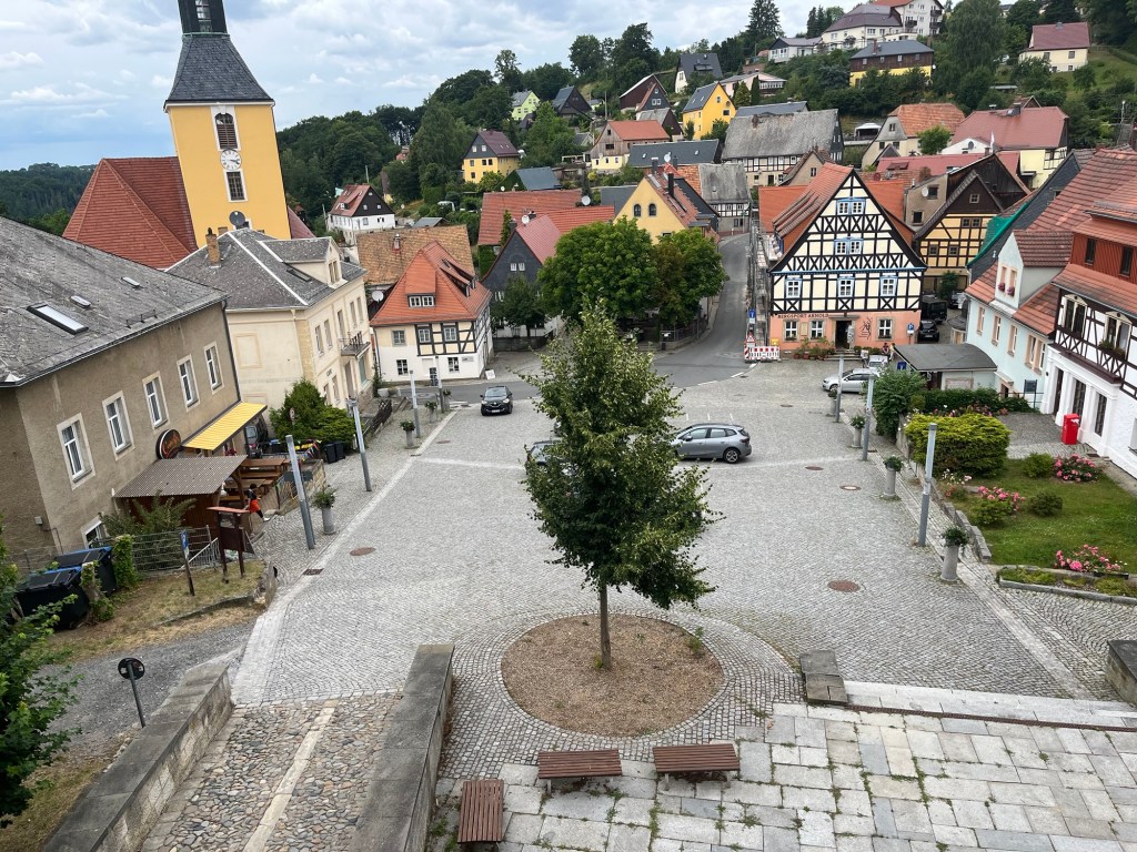
Walking into Hohnstein

When we finally did make it into Hohnstein, we were greeted by a beautiful German village with a castle on top of the highest point. It dates back to at least the 14th Century and is now a hotel.

Hohnstein

We wandered a little around the town and finally caught a bus back to the Pirna train station to catch the train back to our Airbnb in Dresden.

Between the sweeping views of the Elbe valley, the Elbe Sandstone Mountains, the Bastei Bridge, and all of the beautiful forests, creeks, and ponds, this is by far the most scenic hike I’ve ever been on. Even though the last couple of hours had been frustrating with our wrong turns along the Malerweg, we had an absolutely tremendous hike on the second stage of the Malerweg.

Fear, Hatred and Dresden’s Frauenkirche

As soon as we arrived in Dresden, we went directly to the Frauenkirche (The Church of Our Lady). I wanted to see this beautiful church for myself. Gorgeous churches are everywhere in Europe. What makes this church special is its history and how perfectly it dovetails with modern German and world history.

Statue of Martin Luther in front of the Frauenkirche

Frauenkirche is a Lutheran Church built in the Baroque style and originally completed in 1743. Its distinctive architecture and 220-foot-tall dome define the Neumarkt area of Dresden. However, the story of Frauenkirche is defined by the history of Germany in the 20th Century.

The Firebombing of Dresden

On February 13th, 1945, as Allied forces were advancing on German-held territory, and the war was nearing its end, US and British forces began firebombing Dresden. Over the next three days, Allied forces dropped thousands of tons of incendiary bombs. The intense heat from the bombing killed an estimated 25,000 people and reduced much of Dresden to rubble. Part of that was the destruction of the Frauenkirche.

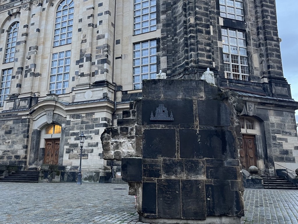
Statue of Martin Luther in front of the ruins of Frauenkirche from 1958. .https://en.m.wikipedia.org/wiki/Frauenkirche,_Dresden

The End of the Cold War and Reconstruction

Following the war, Dresden was on the Soviet side of the Iron Curtain. While Dresden was being rebuilt, Frauenkirche was left as a pile of rubble in the Neumarkt neighborhood. It remained this way throughout the entire history of the German Democratic Republic, also known as East Germany. The rubble was declared a monument against war and remained that way until after German reunification.

Following reunification, funding for rebuilding the church was raised, and a plan was created for the reconstruction. Construction began in 1994 and was completed in 2005. They removed as much as they could from the rubble pile and reused around 3,800 stones. The remaining stones necessary for rebuilding the church were harvested from nearby sandstone quarries. Due to weathering and the fire damage, the salvaged stones have a darker patina than the newer stones.

The reused stones are dark gray, while the newly quarried stones are a lighter tan. Over time, the newer stones will darken as the type of stone used will patina.

On this beautiful July day, with people enjoying Neumarkt and tourists crowding the Statue of Martin Luther for selfies, it’s easy to forget about the destruction and rebirth of the Neumarkt area. The dark stones, which serve as a reminder of the firebombing, are scattered throughout the building, but two sections have a heavy concentration of the old stones.

The Rise of Nationalism

In the 19th Century, nationalism was on the rise in Europe. This movement wanted to define a country’s borders based on the ethnic, racial, and linguistic characteristics of the people inside those borders. This was in contrast to centuries of European borders defined by the marriage alliances and the conquests of monarchs.

Statue of Martin Luther in front of the Frauenkirche

While the formation of countries with borders based on ethnic similarities made sense, it also made unassimilated groups vulnerable. There were over 9 million Jews and around 1 million Roma, otherwise known as Gypsies, living in Europe before World War II. These groups lived among the various ethnic/national groups throughout Europe and didn’t have a specific nation state to call their own. In addition, nationalistic fervor left anyone who wasn’t living within their own nation’s borders vulnerable, like the 1.7 million Poles who lived within German borders before World War 2.

As Nationalism began to rise in Europe in the early 20th Century, a toxic blend of pride and fear began to take shape. Pride and fear are natural companions, as pride in people’s ethnic/national identity often leads to the fear of other groups, especially unassimilated groups. In the early 20th century, a book called the Protocols of the Elders of Zion circulated around Europe, which was a fabricated story of a Jewish plot for world domination. Even though the book should have been seen as an obvious lie, it was treated as factual and became required reading in some classes in Germany.

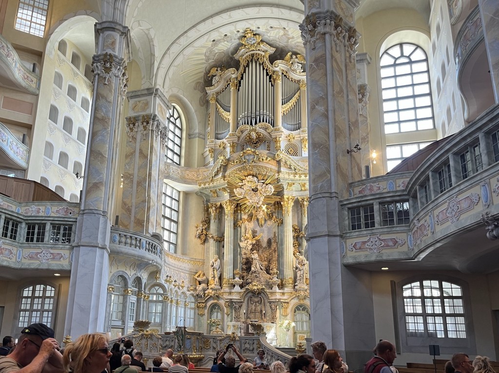
We walked around the church, admiring the Baroque architecture. We decided to take a look inside. My first reaction was that it was incredibly airy and bright, with many intricate Baroque elements and multiple balconies. It’s breathtaking.

Nationalism in the United States

Nationalism wasn’t a strictly European phenomenon. Fear of unassimilated ethnic groups has persisted throughout American history, typically when large numbers of immigrants arrived and formed their own communities. This includes Italians, Irish, Polish, Chinese, and other groups who created their communities within American cities.

Inside Frauenkirche, under the dome

In my hometown of Davenport, Iowa, the dominant immigrant group was German. There were so many Germans in the area that a German language newspaper called Der Demokrat was published from 1851 to 1918. The newspaper was shut down when the Babel Proclamation made speaking German in public illegal in Iowa.

In Germany, however, the Nationalist movement was taken to extremes as the Nazis sought to expand their borders while eliminating anything that was not exclusively German. The objective was to create a completely homogeneous German nation with expansive borders. This obviously could not be accomplished without war and ethnic cleansing, and led to World War II and the horrors of the Holocaust.

The altar in Frauenkirche

In America, World War II stoked fear of Japanese and German immigrants. Japanese-Americans were moved into internment camps, and Germans were viewed with suspicion.

Multiple levels of seating have clear views of the altar in Frauenkirche.

After walking around the inside of the church, we headed down to the basement. The basement contains an altar and seating for additional services. It also contains multiple alcoves for private prayer and reflection.

Who Sows Fear, Reaps Weapons

The story is always the same: fear leads to hate, and hate leads to violence. Fear and hatred work by dehumanizing the perceived enemy and justifying violence against that group.

Under the church, there is an altar where additional services can be performed

For the Germans during World War II, that fear justified the war and the campaigns of ethnic cleansing. For Americans, it meant justifying the bombing of civilian populations, like the ones in Nagasaki, Hiroshima, and Dresden.

Monument under Frauenkirche depicting the 10 commandments

Those justifications don’t always hold up after the fog of war clears. In 1945, according to a Gallup poll, 85% of Americans approved of the use of nuclear weapons on Nagasaki and Hiroshima as a means of ending the war. By 2005, that number had fallen to 57%.

The Cold War and New Alliances

Following World War II, enemies became allies as Western Europe began working together in military alliances and as trading partners. America and Japan, once mortal enemies, became valued trading partners and close friends. Instead, a new enemy had emerged, with the world split by the Cold War, and Dresden was on the Soviet side of the Iron Curtain, separated from their brothers and sisters in West Germany.

Visitors gather in Frauenkirche throughout the day to see this amazing church and to pray.

The Cold War defined the next 45 years of human history. There was a space race, nuclear proliferation, and the Cuban Missile Crisis – everything seemed to be defined as a competition between the West and the East, Communist and Capitalist. The entire time, Frauenkirche sat as a pile of rubble in Neumarkt, a daily reminder to the citizens of Dresden of the dangers of Nationalism.

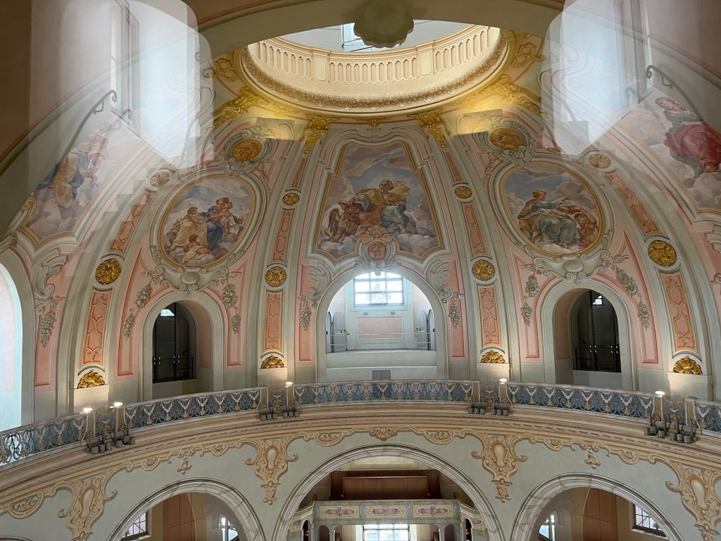
We decided to buy tickets to climb up into the dome. For 10 Euros, you can see a different perspective of the church. As you go up, you see the paintings on the inner dome. Ascending further, you can look through windows at the main dome and down through an oculus at the inner dome and the rest of the church.

Europe Unites as Frauenkirche is Rebuilt

The collapse of the Soviet Union and the fall of the Berlin Wall ushered in a new era for Europe and for the Frauenkirche. In the late 1980s and early 1990s, as Germany was going through Reunification, an aggressive fundraising campaign was conducted to raise the 180 million euros necessary to rebuild the church.

Paintings on the inner dome

In 1993, a rubble-sorting event marked the beginning of the efforts to reconstruct the Frauenkirche. As the church’s cornerstone was stabilized in 1995, the European Union added Austria, Sweden, and Finland to raise its membership to 14 members.

Reconstruction of the Frauenkirche was completed in 2005. During the eleven years of Reconstruction, the Euro was developed and established in 11 countries. The Schengen Zone went into effect in many of the EU countries, allowing freedom of movement without border controls. By the time the Frauenkirche was completed, the European Union had expanded to 25 countries.

Room above the oculus in the inner dome

Nationalism had divided the continent and led to the destruction of the church. In the 60 years from rubble to reconstruction, the continent became defined by its cooperation and connections.

Since 2005, three more members have joined the European Union, and one, Great Britain, has left. Nine countries are currently listed as candidates to join the European Union. This interconnection has ended all wars between these countries, which have fought each other for centuries. The fear is gone, and with it the hatred and the violence.

Sloped walkway between the outside wall and the inside wall of the dome

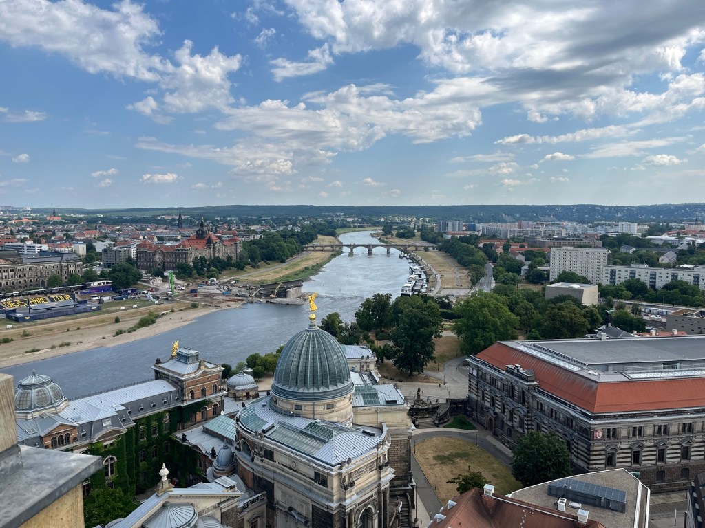
We climbed all the way to the top of the dome and walked out onto the observation deck. From the top, you could see most of Dresden. The neighborhood around Frauenkirche has also been reconstructed with shops, apartments, hotels, and restaurants. The plaza in front of the church was lively with visitors and shoppers. Neumarkt is whole again.

Tension in North America

While Europe becomes a more unified continent, North America has become more divided. A tariff war has made Canada and the United States, longtime allies and friends, suspicious of one another. In addition, statements by Donald Trump indicating that he would like Canada to be the 51st state, however unserious that sounds, have to be taken seriously by Canada because of the power imbalance between the two countries.
A view of the Elbe River from the observation deck above the dome

The relationship between the US and Mexico continues to be complicated, with the US both relying upon Mexican immigrants for cheap labor and vilifying their presence within the country.

Fear of Immigrants and the LGBTQ+ Community

Much of this is stoked by irrational fears, with immigrants being accused of drug trafficking and violent crime. Even though studies have indicated that it is likely that immigrants commit less crime than native populations in the US, the fear that immigrants worsen crime rates persists. These fears sometimes reveal themselves in strange ways, such as in the 2024 Presidential Debates, where Donald Trump accused Haitian immigrants of eating neighborhood pets. The fact that this statement didn’t disqualify him from office in the minds of voters is an indication of the public’s perception of immigrants.

Neumarkt area from the observation deck

Recently, the immigration debate has turned extremely dark as a detention center has been constructed on swampland in Florida. Known by its supporters as Alligator Alcatraz, its goal is to house illegal immigrants until they can be deported.

However, some of the supporters of this plan have expressed more extreme ideas. Laura Loomer, who traveled with President Trump during the 2024 campaign, recently tweeted, “The good news is, the alligators are guaranteed at least 65 million meals, if we get started now.” 65 million is the total population of all Hispanics in the US, most of whom are citizens. So, as you can see, for the most extreme members of the Republican Party, the issue of protecting the border has now moved toward ethnic cleansing.

Fear also affects the LGBTQ+ community. The LGBTQ+ community has been the target of many ridiculous accusations over the years, including the idea that same-sex marriage destroys the sanctity of straight marriage and the idea that homosexuals groom children for pedophilia. These are accusations meant to paint all LGBTQ+ individuals as a danger to society.

A pride flag hangs from a balcony of an art museum that faces the Frauenkirche

Another persistent fear among right-wing communities is that transgender women will use women’s restrooms to rape cisgender women. I’ve never heard of a real case where this happened, but the fear persists nonetheless. The idea is ridiculous, of course, because anyone willing to commit rape would not be deterred by laws that limit access to restrooms based on biological gender.

Lessons from the Past

Much like the lies told in the Protocols of the Elders of Zion in the early 20th Century, these lies persist in the early 21st Century. These lies are told to marginalize communities within the United States in the same way that communities were marginalized in Germany before World War II. They spread fear. Fear leads to hate, hate leads to violence.

Europe has shown what is possible when people put their fears aside and work together. They have lived through the horrors of war and chosen to work together towards a peaceful and more prosperous future.
We ended our visit to Frauenkirche, standing in front of the last remaining piece of rubble from what was the pile that lay in Dresden for decades. It was a large piece of the dome recovered from the pile, placed as a monument with a plaque containing the account of a survivor of the firebombing.

The remaining piece of rubble from the dome was left as a monument to the destruction of Frauenkirche.

Standing in front of the monument, I was reminded of the vulnerable communities within my country and the lies and slurs they endure daily. We live in a precarious time when we must decide whether to listen to the sounds of fear and hate or embrace empathy, kindness, and love. I hoped that one day, a curious traveler wouldn’t be standing in front of a similar monument in the United States.

People should be treated with empathy and kindness regardless of their immigration status, sexual orientation, gender identity, race, religion, or disability. People are people, and love is love.

Points Check April 2025

April was about the only breather we could take for a while. March consisted of a trip to Spain and Portugal to do a week on the Camino de Santiago. In July, Jenn is taking our daughter Emma, as well as her sister and niece, to Munich and Dublin. Meanwhile, I will be taking our Son Alex to Berlin and Dresden as well as doing a little hiking in Bohemian Switzerland National Park. In September, we will be going to Nice, France, to participate in the UTMB Nice Côte d’Azur. It’s almost a little too much traveling in too short a time, but I’m willing to take this challenge head-on.

A Decent Deal on a Delta Flight?

I had been looking for months for a decent price on a flight for Alex and me to go to Europe, preferably Germany. For a while, I was getting frustrated because I could get flights to Europe for a decent number of points, but the prices for getting home were more than I wanted to spend. I was patient, and finally, Delta came through with round-trip flights for 40,800 Delta miles and $132 each. The price was 48,000, but Jenn has a Delta Gold Card, so the redemption was 15% off.

That meant Alex and I were set to go to Berlin in July for 81,600 Delta Miles and $264. That’s a pretty good price, but the downside was that it was the price for Basic Economy. In other words, we don’t get to choose our seats, so Alex and I may not be sitting together. I’m sure he’ll survive; he is 16 after all.
Those points came from a small amount of Delta miles that Jenn had, but she also had to transfer 76,000 American Express Membership Rewards points to Delta to cover the rest. Those flights would have cost around $1,000 each, so the redemption came to around 2.1 cents per point, which isn’t bad.

This was the last of the redemptions that we have planned for flights this year. It’s honestly difficult for me to believe it, but we booked 12 flights to Europe this year on points as well as a flight to San Antonio. Those flights weren’t “free” because they always come with taxes and sometimes come with fuel surcharges, but they have always been at severely discounted prices.

There is no way I would have paid cash for all of those flights, so I’m glad that we were able to use points to get to these amazing destinations. This year alone, I will have visited Portugal, Spain, France, Monaco, Ireland, Germany, and the Czech Republic. That’s pretty amazing, and I’m very thankful that I’m able to take these trips.

Sign Up Bonuses

In January, I signed up for the Alaska Airlines Visa Signature Card, which had a signup bonus of 75,000 Alaska miles and a companion fare after $3,000 spend in 3 months. In April, I finally completed my spending and received the bonus. The companion fare is essentially a $122 fare that you can use on any Alaskan flight if you purchase a second flight. It’s only good for a year, and I don’t think I’ll get an opportunity to use it. The Alaska Air miles, though, will definitely come in handy, especially when there are a lot of chances to use 4,500 Alaska miles to fly American Airlines on short flights. For us, they are especially useful for flying from our home airport in Moline to Chicago O’Hare.

Jenn got her 75,000 Membership Reward Points bonus for spending $6,000 in 6 months on her American Express Gold Card. That came just in time to replenish the points I used to book the Berlin flights for Alex and me. Membership Reward points are very valuable, and it’s always nice to have a little stash of those.

100K on Chase Sapphire Preferred

It doesn’t happen very often, but Chase occasionally offers a 100,000 point bonus on the Chase Sapphire Preferred card. When it does happen, every points and miles enthusiast checks to see if they’re eligible to receive the bonus. The basic requirements are that you have signed up for less than five personal credit cards in the last 24 months, you haven’t received the bonus in the last 48 months, and you currently don’t have a Sapphire Card.

Chase Ultimate Rewards points are the most coveted points in travel rewards outside of Bilt points. Getting 100,000 Ultimate Rewards points with one signup bonus is phenomenal, but the card itself is an excellent travel credit card. This card earns 5x on travel through the Chase Travel portal and 2x on all other travel purchases. It also earns 3x on dining, online groceries, and streaming services, and 1x on everything else. There is also a $50 hotel credit per year that you can receive if you book a hotel through the Chase Travel Portal.

What makes the points valuable, however, is their transfer partners. They have some great Airline transfer partners such as United, Southwest, Air France/KLM Flying Blue, Aer Lingus/Iberia/British Airways Avios, Air Canada, and Virgin Atlantic. A lot of people, however, love their Chase Ultimate Rewards points because they transfer to Hyatt at a 1:1 ratio. Hyatt has the most valuable hotel points, with most people valuing their points at around twice the value of Marriott points and about triple the value of Hilton points.

Jenn referred me to the Chase Sapphire Preferred card, so she will receive 10,000 points, and I will receive 100,000 points. I need to spend $5,000 in three months to receive the bonus. She also referred another friend, so she will be getting an additional 10,000 for that signup. I think I know five people who jumped on this deal, because it was so good.

On to the Point Check!

Most of our spending in April was on cards for which we were working on signup bonuses, so the spending below is almost entirely recurring charges. That being said, a 7.1 percent return on those charges is phenomenal, so I feel good about how I have our recurring charges set up.

Card UsedSpendPoints EarnedPoint ValuePoints Per $Return on Spend
Amex Gold$5522,130$42.603.97.7%
Ink Cash$4452,224$45.595.010.2%
Wyndham Business Earner$3471,736$19.105.05.5%
Venture$345690$12.772.03.7%
Total$1,6896,780$120.054.07.1%
This month’s spending not devoted to earning a signup bonus

On top of the spending listed above, I spent a little over $1,000 on my Alaska Airlines Card, earning over 1,500 Alaska miles as well as the 75,000 Alaska mile bonus. Jenn spent a whopping $8,500, a good portion of which was our annual taxes, nailing down her 75,000 point bonus as well as an additional 12,000 Membership Reward points. After all of that, we ended the month with:

  • 126,900 Chase Ultimate Rewards Points
  • 122,600 Amex Membership Rewards Points
  • 93,000 American Airlines Miles
  • 85,000 IHG points
  • 79,100 Alaska Miles
  • 60,000 Marriott Bonvoy Points
  • 58,900 Wyndham Points
  • 32,100 Citi Thank You Points
  • 15,900 United Miles
  • 6,500 Hyatt Points
  • 1,100 Delta Miles
  • $109 in Cash Back

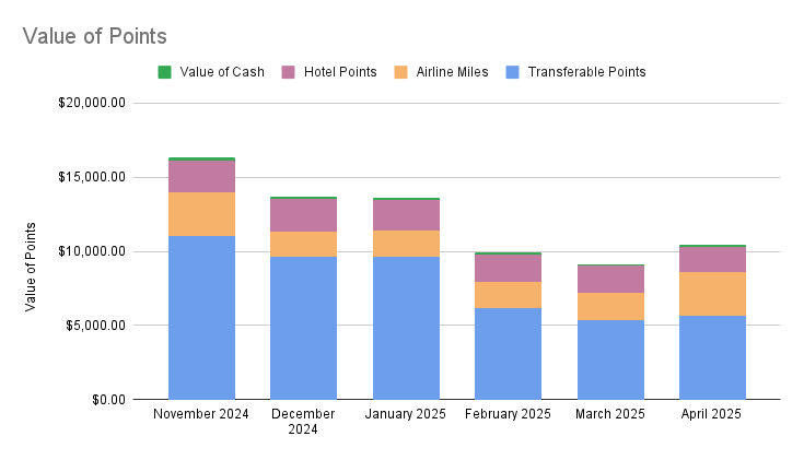
When you add everything up, the total value of points and miles, using the valuations from The Points Guy, comes to over $10,400. That is a $1,300 increase over last month. I don’t anticipate us booking very much for a while, since our trips for the year are pretty much planned. That means our point totals should be growing for the rest of the year and hopefully leave us with enough points to make some fun decisions for trips in 2026.

Day 6 – Quitting the Camino

This is the final post in a six-part series on our experiences doing the Portuguese Central Route of the Camino de Santiago starting in Valenca, Portugal, and ending in Santiago de Compostela.

I didn’t get more than a couple of hours of sleep. The wind slamming the shutters on the windows was a constant reminder of the massive challenge ahead. At this point, we were all struggling with nagging pain. The hike from Padrón to Santiago de Compostela would be our most challenging to date. In addition, the weather looked horrible. The weather app called for sustained winds of 20 miles per hour with gusts up to 40 miles per hour. The forecast also called for rain all day.

All I could think was, do we really want to spend eight or nine hours hiking in the wind and rain, limping in pain? Jenn and I decided to ask the kids what they wanted to do.

We walked into their room, told them about the weather, and asked them what they thought. Emma was conflicted and said she wanted to finish, but that it sounded terrible. She said she’d leave it up to Alex. He took one look at us and said, “I’m done,” and then he rolled over and tried to go back to sleep.

So there it was, after five days hiking the Camino, we were quitting just 17 miles from the end.

I was conflicted about it, because after all, this was supposed to be a vacation, and I felt like I spent the better part of a week torturing my family. On the other hand, there is value to completing something so physically demanding.

The Camino is a hard physical challenge that is achievable by normal people. Jenn and I have both completed these types of challenges before. Jenn has done two RAGBRAIs (a week-long 400-mile bike ride across Iowa) and a couple of half marathons. I’ve done a RAGBRAI, about ten half marathons, and a couple of full marathons.

The kids hadn’t experienced what it’s like to complete a challenge like that, and I was a little sad they wouldn’t finish. For me, those challenges are important because they build confidence and character. I hoped that quitting that close to the end didn’t invalidate any personal growth that resulted from the first five days of the Camino.

We took our time getting ready, then took the walk of shame through the rain and wind down to the train station and bought a ticket to Santiago de Compostela. We shared the complex feelings of regret for not finishing the Camino as well as the relief of not having to hike that day. I was happy, however, to have a little more time to visit with my friend Nate.

While on the train, I texted Nate to tell him we quit and we would be in Santiago de Compostela in a little bit. He said he would meet me at the Pilgrim House, which is the community center where he works.

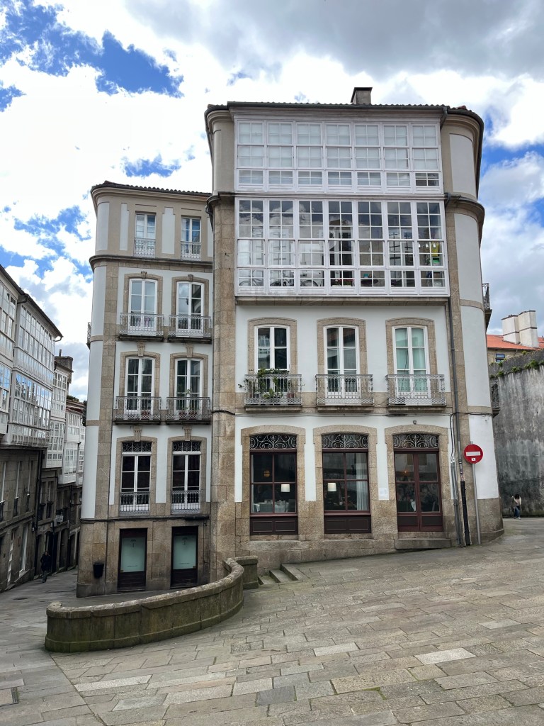
Building in Santiago de Compostela

When we met, he introduced us to the staff at the Pilgrim House and even pointed out someone from our hometown who volunteers with the organization. She was talking with Jenn and mentioned that she also works with the youth symphony orchestra in our hometown. Alex happens to be a viola player in that orchestra, so she took a picture of her and Alex and texted it to his conductor with a message: “Guess who I ran into in Spain?” It’s a small world.

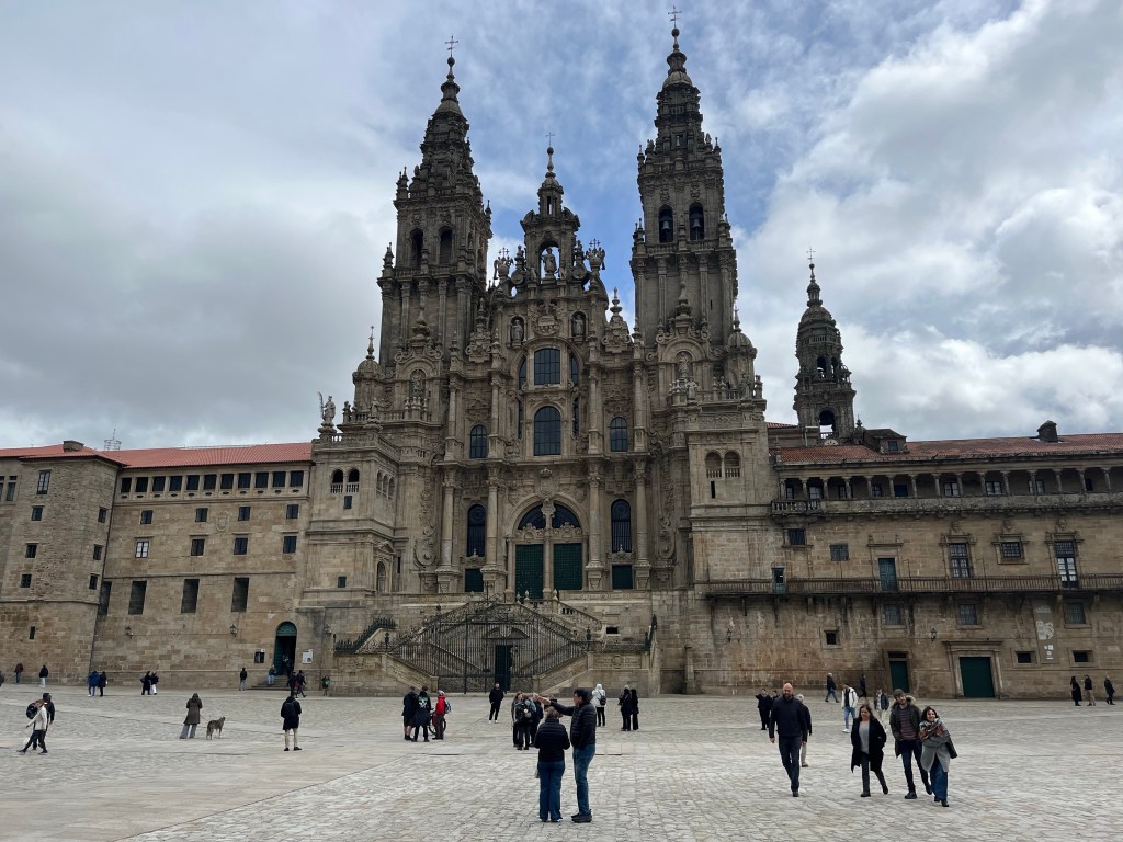
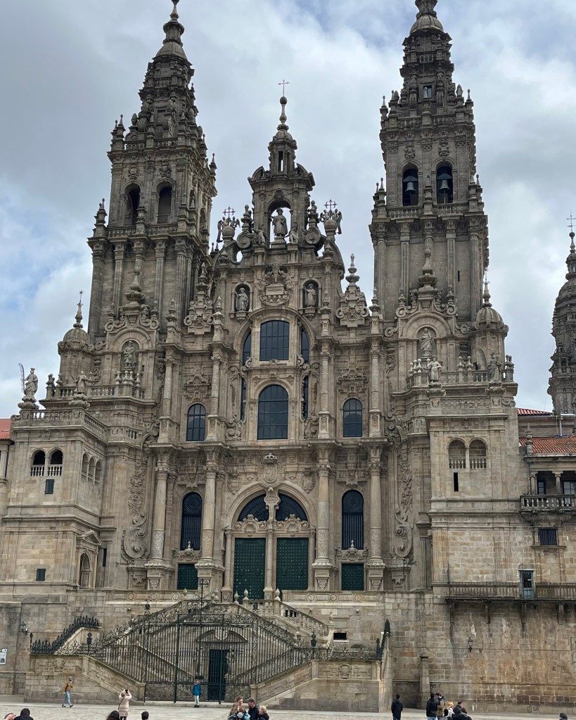
Santiago de Compostela Archcathedral Basilica

We talked with them about our experiences on the Camino and what we would do differently. They have a different perspective as veterans of the Camino themselves and as people who listen to thousands of Camino stories each year. They chucked a little and said, “You spend your first Camino learning how to do a Camino.”
Nate gave us a tour of Santiago de Compostela, showing us his favorite coffee shop, the Cathedral, and the wonderful architecture of the city. We talked about the old days and what happened to our old friends. He talked about his family and what it was like for them to raise kids in Spain.
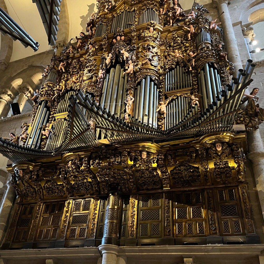
The organ is decorated in a baroque style

It was wonderful catching up with him after all these years, and if there was one blessing from having quit the Camino, it was the ability to spend a couple of hours with an old friend, thousands of miles away from where we grew up.

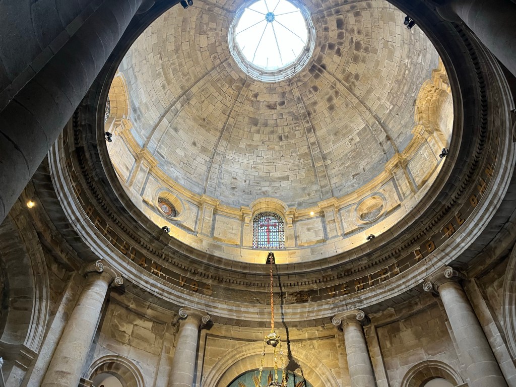
A dome in the Cathedral

We said our goodbyes to Nate and headed to our hostel at Albergue Alda O Fogar de Teodomino. We were able to get a private room with four beds. The hostel was nearly empty. I think most people didn’t hike that day because of the weather. I assume that most people who would have finished in Santiago de Compostela that day were instead taking an off day and would finish the next day.

We checked into the hostel, and I said that I wanted to tour the Cathedral. Emma wanted to join me, while Alex and Jenn stayed back to take a nap.

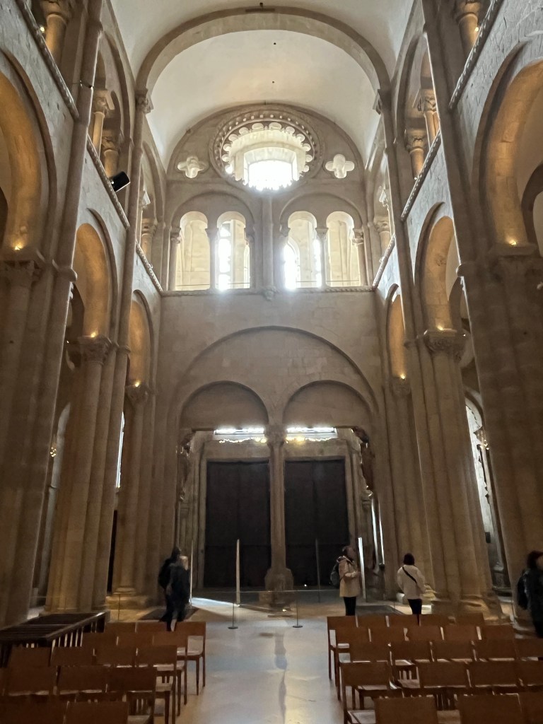
The full name of the cathedral is the Santiago de Compostela Archcathedral Basilica. Construction began in the late eleventh century, lasted well over a hundred years, and was finally completed in 1211. It was built to house the supposed remains of St James, which were discovered in the 9th Century near modern-day Padrón.

I definitely question the validity of the claims that the body of St James was discovered more than 800 years after his death, thousands of miles away from where he died. However, this discovery led to millions of pilgrims over the centuries walking the Camino to this cathedral in Santiago de Compostela.

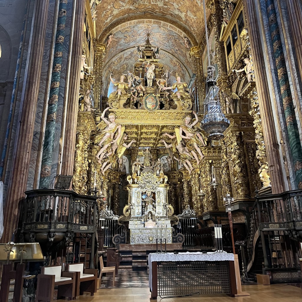
Seeing the Cathedral is the goal of every pilgrim who embarks on the Camino. As is the case with so many Cathedrals, it is lavish, with statues and artwork everywhere. The altar of the church is done in a baroque style, with gold and silver elements everywhere. There are countless golden pillars and a group of angels holding up a golden ceiling over the altar. It’s so ornate that I couldn’t really discern what the artwork was supposed to symbolize, but it is beautiful.

Right side of the altar in the Cathedral

My favorite thing in the Cathedral was a giant incense burner called the botafumiero, which is about 5 feet tall and weighs around 180 lbs. Traditionally, it took a team of eight men with ropes to swing the burner over worshipers. The purpose of this was to cover the smell of the pilgrims who had spent the day on a long hike to the Cathedral. They now only do this on special occasions, since it’s so labor-intensive. Presumably, because of modern deodorants, it’s also not as necessary.

Altar with botafumiero hanging in front.

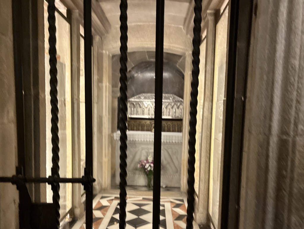
We also walked down to visit the crypt, the supposed final resting place of St James. Behind an iron gate, you can see a silver ossuary. There it is – a beautiful, yet simple box containing the remains of someone, who may or may not be St James. It is the inspiration of millions of pilgrims over centuries to take time out of their busy lives to hike for days or weeks.

Silver Ossuary in the crypt of the Cathedral

I don’t buy it. I think people do it for so many reasons, but seeing a silver box can’t be the motivation for most people. For some, it’s the drive to complete a physical challenge. For others, it’s the opportunity to hike through towns, villages, farms, and forests. Some are taking time for introspection, and others are there for the camaraderie and fellowship with their fellow pilgrims.

I was there for a combination of those things, and I think that’s probably true for most pilgrims. I was also drawn by the opportunity to participate in something that draws people from around the world. According to the official pilgrim website, which keeps statistics on the number of people who complete the Camino, so far in 2025, about 37% of pilgrims were Spanish, 8% American, 7% Portuguese, and 6% were German. The remaining 42% were from various countries around the globe. It’s an amazing opportunity to spend time with a lot of wonderful, diverse people who are all working toward the same difficult goal.

The opportunities to connect with people at cafes, along the Camino, or at an albergue are endless. Those conversations also don’t feel forced. People who come to do the Camino are generally friendly.

Walking around the Cathedral, however, felt a little hollow. We hadn’t finished, and it felt like I didn’t deserve to be there. Visiting the Cathedral is a rite of passage for people who complete the Camino, and we hadn’t. Jenn and Alex didn’t even want to visit the Cathedral.

We finished up our trip to the Cathedral and met up with Jenn and Alex for dinner. At dinner, we discussed the disappointment of not finishing.
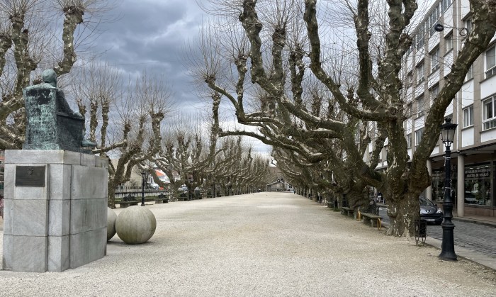
With everyone still dealing with being somewhere between sore and injured, I asked if they would like to try this again. Jenn laughed and said that she thinks we owe the kids a beach vacation for the next Spring Break trip. To my surprise, however, everyone said that they would like to do it again, but with some optional off days.

There isn’t an experience like doing a Camino. It’s real. It’s authentic. It’s a tremendous physical challenge. It’s the opportunity to meet people from around the world, as well as the chance to experience Spain in a non-touristy way. I would love to give it another try, but I definitely want to do it when I can hike for at least a couple of weeks. I definitely think it would go better the next time, now that I’ve spent my first Camino learning how to do a Camino.

Day 5 – Caldas de Reis to Padrón

This is part five of a multi-part series on our experiences doing the Portuguese Central Route of the Camino de Santiago starting in Valenca, Portugal, and ending in Santiago de Compostela.

At seven o’clock, we woke up in Caldas de Reis at Hotel O Cruciero. We told the kids to pack up and meet us in the cafe downstairs for coffee. Jenn and I grabbed a table, ordered everyone a café con leche, and questioned whether we were hiking today or if our Camino was finished.

Emma and Alex had their own room, so we hadn’t yet had a chance to talk with Emma about her ankle. She had used some topical cream to ease her pain, but I didn’t know if that would be enough to get her on the trail. Emma complained about pain in her Achilles tendon, which had started early in the week but was worsening daily.

Caldas de Reis to Padron is a fairly flat and rural stage of the Camino de Santiago

Emma played basketball for eight years and learned to play through pain, so when she complains, I know she’s not exaggerating. When we asked how she was feeling, she said she wanted to give it a try. We told her that she needed to rely heavily on her trekking poles to take the pressure off her ankle.

We didn’t hurry out of the cafe. The coffee was great, and they served little pieces of cake with it. We had a couple of rounds of coffee, trying to prepare ourselves for the hike. I was sincerely worried. I saw her play basketball with ankle pain and shin splints in High School, and I was afraid she was legitimately hurt and was just pushing through the pain.

Fountain in Caldas de Reis

I trusted her judgment, though, and once we got started, things were pretty good. The weather was lovely. Emma was leaning on her trekking poles, which kept the pressure away from her ankle and helped with the pain.

Igrexa de Santa Mariña de Carracedo

Since Caldas de Reis was fairly small, it didn’t take long for us to hike through it and into the countryside. Once we left town, most of the Camino between Caldas de Reis and Padrón was rural, which made for really peaceful hiking.

Crosses at Igrexa de Santa Mariña de Carracedo

Early in the day, we arrived at Igrexa de Santa Mariña de Carracedo, a beautiful stone church. It is typical of the churches we saw in the area, with a gorgeous stone bell tower.
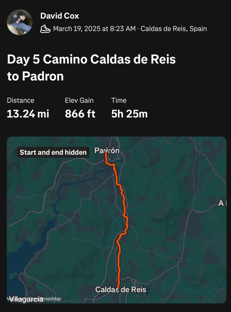
Iglesia de Santa Mariña de Carracedo

From there, we continued through the countryside, walking between farms and forests. The trail roughly followed the path of the small river.

White cow near O Gorgullón

We stopped for an early lunch at Bar Pardal around eleven o’clock. They were extremely busy, and it was difficult to get service. The main reason why it was so busy was that The Boys were there.

Just like during the previous day, the fact that there were around 30 in that group made it difficult for the staff to handle all the customers simultaneously. This made for chaos and slow service, but we got our breakfast sandwiches and drinks and enjoyed them in the covered patio.

Trees form a tunnel over the trail.

While at Bar Pardal, we saw many familiar faces, including The German Girls, The Boys, and The British Couple. We enjoyed our brunch and then hurried out to get in front of The Boys, knowing it would take them a while to finish their meal and return to the trail.

On a Bridge over Rio Valga

We continued along the Camino, walking through the Galician countryside among farms and forests. We crossed Rio Valga and stopped for a drink and a snack at Buen Camino, a cafe across from Iglesia de San Miguel.

Iglesia de San Miguel

Buen Camino is a cute little cafe in a beautiful location next to Iglesia de San Miguel. That church is constructed in the same style as the other churches we saw in Galicia. Next to the church was a large cemetery. The cafe sits elevated over the cemetery with a fantastic view of the church and the hills on the horizon.

Cemetery at Iglesia de San Miguel

Once again, we ran into The English Couple who had also stopped for a quick drink. They were sitting on the patio overlooking the church, and we chatted with them while finishing our drinks, and then went back to hiking.

Galician Countryside past San Miguel

We were getting close to finishing our hike for the day, but as was becoming almost routine at this point, we were starting to hurt. Emma was still struggling with her Achilles tendon, Jenn was starting to limp as the hot spot in her foot got worse, and Alex was complaining about a bruise on his hip that was getting worse as the week went on.

Fountain along Camino

The fact that we didn’t schedule an off day was beginning to look like a mistake. I was certain that our discomfort would have improved with an off day, and it was a mistake not to schedule one.

View of Rio Ulla from Pontecesures

The options for lodging in Padrón were limited, so we booked an Airbnb for the evening. We stopped for another drink at Cafe Bar Galicia in Pontecesures and to contact the Airbnb. We finished the remainder of our hike and met with the host of the Airbnb in Padrón. After dropping off our backpacks, we ventured out to explore Padrón and get some dinner.

Padrón was a lovely town, but it was nearly impossible to get food before seven o’clock. Since the Spanish like to eat dinner fairly late, we had to check four or five restaurants before we found a restaurant serving dinner. While eating, we discussed the final day of the Camino. We were going to have our longest hike to date, about 17 miles, with about twice as much elevation change as our hilliest day so far. The forecast also called for rain.

Igrexa de San Xulian de Requeixo

No one was excited about hiking the last day between Padrón and Santiago de Compostela. Between the injuries, the difficulty of the final day, and the weather, the final day felt impossible.

In addition, I had planned to meet my friend Nate in Santiago de Compostela. Nate was an old friend that I hadn’t talked to in years, mainly because he had moved to Santiago de Compostela years ago to work in a community center. He was the main reason I had heard about the Camino, and I was looking forward to seeing him after all these years.

Paseo do Espolón in Padrón

But everything seemed a little bleak. How were we going to arrive in Santiago de Compostela with enough time to spare to see Nate and Santiago itself? Especially when, at this point, we were barely capable of hiking, let alone at a faster pace on our most challenging day.

Rio Ulla

We decided that we should get up an hour early, and hopefully we would make decent time. After dinner, I settled into bed for the evening. I started to hear rain and then strong winds as they began to shake the shutters on the windows. I checked the Weather Channel app, and it was calling for rain tomorrow with gusting winds of up to 40 miles per hour.

What I wouldn’t do for an off day, I thought. A single day off would allow us to avoid the bad weather and get valuable rest for our aching bodies. I closed my eyes and tried to ignore the banging of the shutters on the windows and all of my anxiety about the upcoming day.