Exploring Beer Culture in Ontario’s Wine Country

One thing that surprised me about our trip to Ontario was the number of wineries and vineyards that exist in the area between Niagara Falls and Toronto. According to Ontario Wine Appellation Authority, cool weather varieties thrive in this area, like Riesling, Chardonnay, and Pinot Noir.

We were staying in Hamilton, having parked our camper for the week at Fifty Point Conservation Area. From where we were staying, it seemed like every exit along the Queen Elizabeth Way had signs for at least two wineries.

Maybe we should have popped into a winery and checked out what was special about the wine in the Niagara region, but we were more interested in checking out the beer scene. While we were in Ontario, we noticed that there were a few differences between beer culture there and beer culture in Iowa.

Production Breweries vs Brewpubs

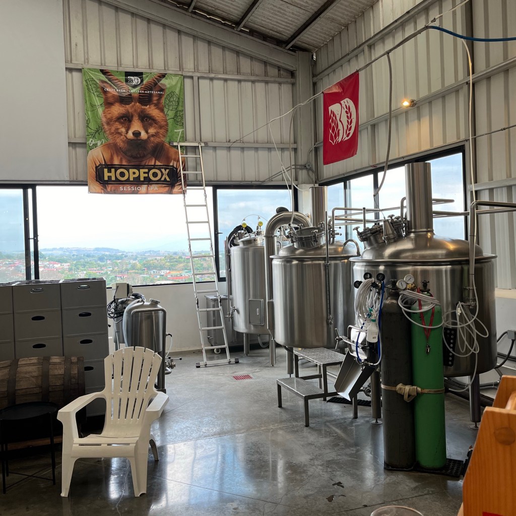
Our first night in Ontario, we decided to go to Newark Brewing Company. It is a pretty large production facility set in an industrial area. There is, however, a large grassy side lot that makes the tap room feel like it’s much more out in the country. In fact, our server told us they were part of Harvest Hosts which is a group of wineries, breweries and other attractions that allow you to camp on their site for free. So that grassy lot might just be available for camping.

Dunkel Lager at Newark Brewing

This was the first of many production breweries we visited. Throughout our visit, one thing became fairly clear. Most of the breweries we visited were full scale production breweries first and taprooms second. It’s a different vibe from most of the breweries we visit in Iowa where most of the beer goes straight into kegs to be served at the brewpub. Some canning is done at these brewpubs, but a very low volume is sold, mainly at the taproom itself for carry out.

Session Beers and Low Alcohol Drinks

I love how the beer culture of Iowa has really grown over the last 20 years or so, but if I had one complaint it’s that Iowa craft brewers (and frankly most US craft brewers) brew too many high alcohol beers.

High alcohol beers are rich, flavorful and delicious but they tend to lack drinkabilty, and aren’t refreshing on a hot day. They also, predictably, make the drinker inebriated at a quicker pace, which creates its own series of problems.

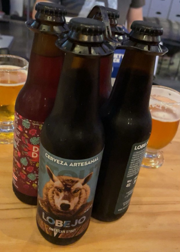
At the first brewery we went to, we noticed that there wasn’t a single beer over 6% and most were 4%-5%. I had the Dunkel while we were there which was right at 5%.There are breweries in Iowa where finding a beer under 6% can be tricky, so being at one where everything was 6% or under was refreshing.

The next day we visited Collective Arts. That is a super funky production brewery in a highly industrial area in Hamilton. They served a micro pale ale at 2.9%. I had never heard of a pale ale that low in alcohol.

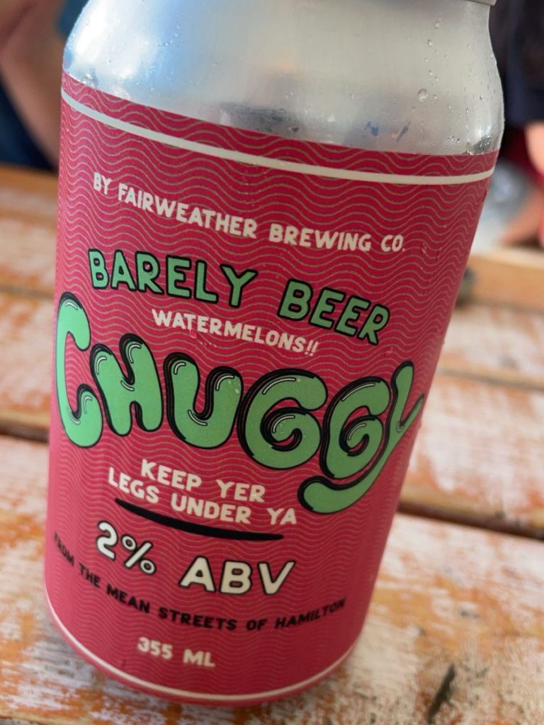
Later in our trip, we went to Fairweather Brewery which had a series of fruited ales that were 2% alcohol. They were called Chuggy, Jenn tried one of them and really liked it.

Throughout our trip, the focus that most of the breweries had was on beers with traditional alcohol content not Imperial or Double beers. The fact that a few also had beers under 3% was a nice little bonus. I wish this was something that we saw a bit more often in Iowa.

Our Favorite Breweries in Ontario

This isn’t really a full assessment of breweries in the Ontario area since we were only able to visit a few breweries in the week we were there. But I can definitely tell which ones we would’ve been visiting multiple times if we lived in the Hamilton area.

Collective Arts

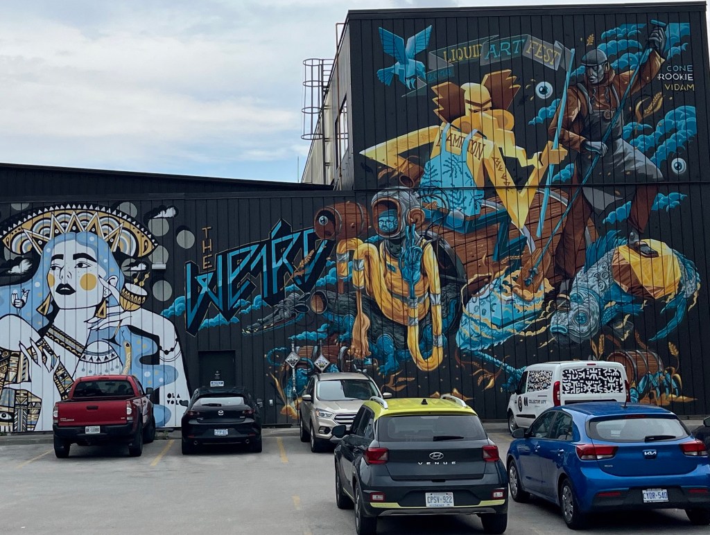
I found this one by searching around on Google Maps and it didn’t disappoint. They have an amazingly funky vibe. Art is everywhere around the facility with murals on practically every wall. It’s a huge facility but they have a cool patio area where we sat for a beer. Next to the patio area is a large industrial room that looks like maybe its used for canning and barrel aging (I’m not sure about that, I didn’t go snooping). That room also has a bunch of cafeteria style tables in it for when its too cold for the patio.

Barrel Aging at Collective Arts Brewing.

Collective Arts also has a good carryout facility and we did pick up some beer for the camper. The cans also had some great artwork. The beers that we tried, both at the facility and back at the camper, were very well done. If we lived in this area, I think we would visit regularly. For more information on Collective Arts, visit their website.

Bench Brewing Company

Bar at Bench Brewing Company

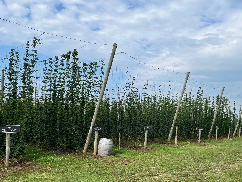
Bench Brewing Company is a large production facility set off in the middle of wine country. The facility is in a very scenic country setting with an apple orchard and several wineries nearby. They actually have their own hop farm on site.

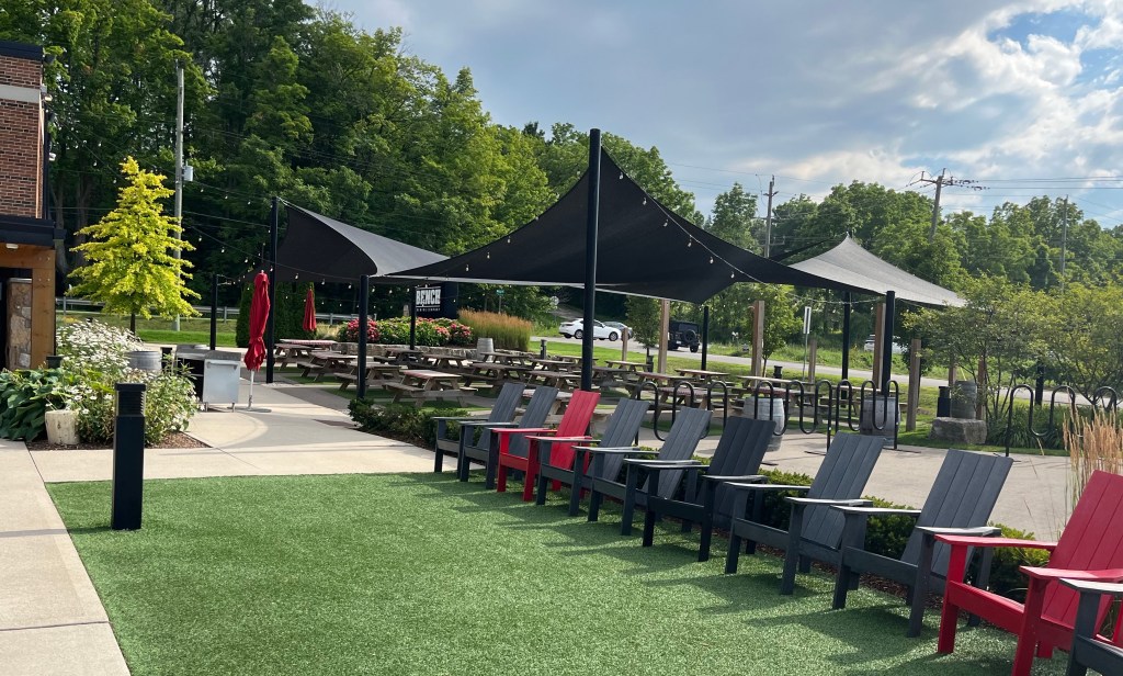
It has a little bit of an modern industrial vibe to it. The bottle and gift shop is actually two shipping containers that you have to walk past to get to the tap room. They have a large patio area and a large restaurant. Since it was a weekday afternoon, they were only offering service in the restaurant so we sat in a covered deck seating area at the restaurant. We had a little snack and a couple of beers. Everything was well done, the beers that we tried were all of session strength and well made.

Rows of hops at Bench Brewing Company

I would have liked to have spent some time in the patio area. Bench Brewing is in an idyllic and peaceful location, being at the restaurant wasn’t taking advantage of the location. If I were looking for a place to relax on a nice day, this would be the place I would want to sit outside and have a beer. More information about Bench Brewing can be found here.

Outdoor Area at Bench Brewing Company

Trust The Locals

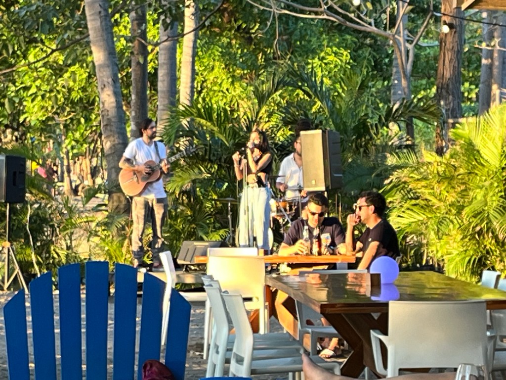
We always like to ask the folks who work at breweries where they go for a beer. Most bartenders and servers at breweries are beer lovers themselves and tend to have very good suggestions. A couple that came up were Merit Brewing and Fairweather Brewing.

Menu at Merit Brewing

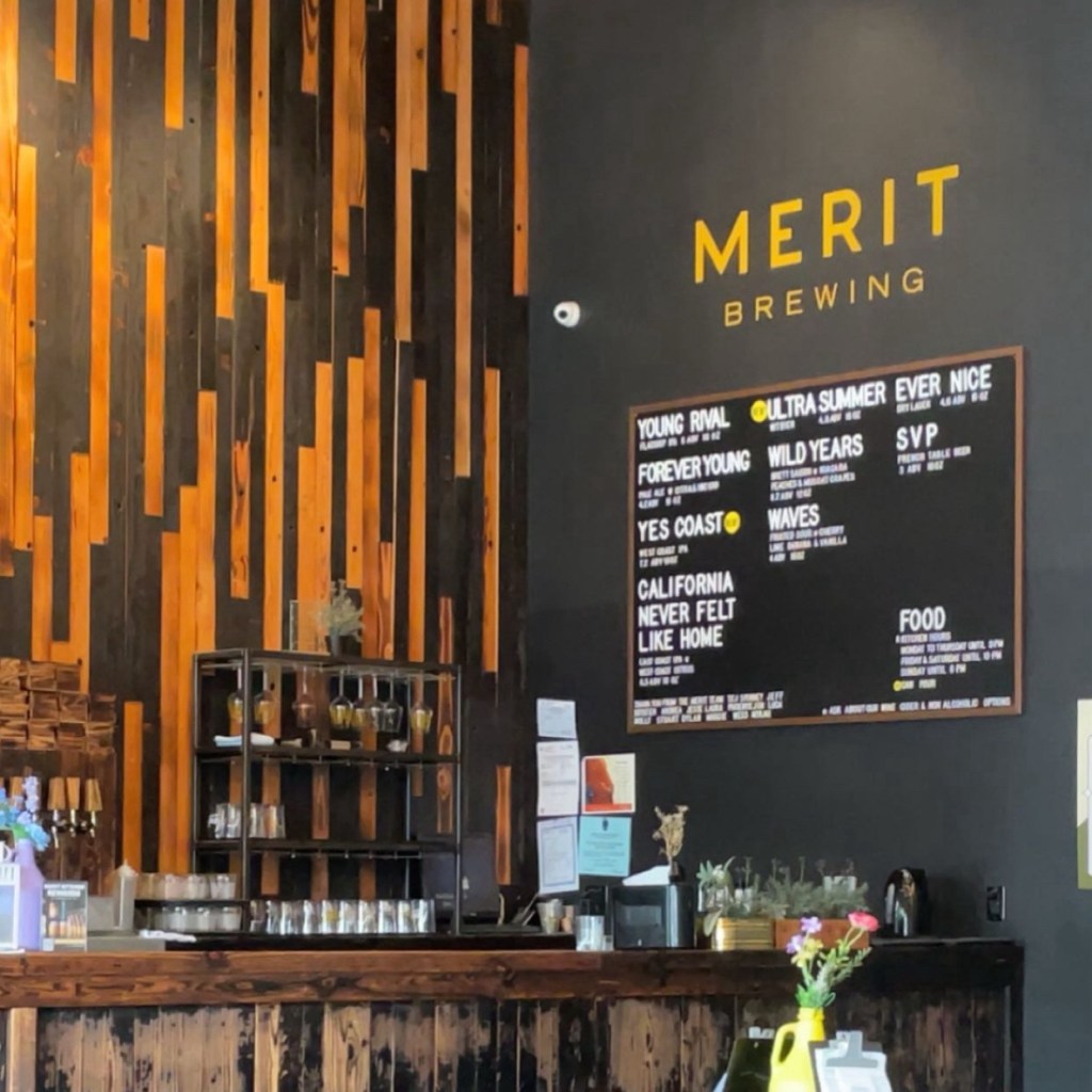
We did go to Merit Brewing and I understood the hype. There is some creative brewing going on at this facility. I’m not into sours, but I did have to try a small pour of the Wild Years, which is a brett saison with peaches and muscat grapes. Hats off to the brewer on this one, that’s a very creative beer and if you’re into sours, definitely worth a try. I also tried Young Rival, which I thought was a very good IPA. More information on Merit Brewing can be found here.

We also managed to make it to Fairweather, which wasn’t my favorite mainly because they did have a focus on sours, which again, I avoid. Jenn loved the low alcohol Chuggy beers. They are doing some creative things with sours. Right now they are serving a beer called Apsara that is a sour with peaches, milk sugar, vanilla and chai. If you love sours, I think this is a great brewery to visit. More information on Fairweather can be found here.

Silversmith Brewing

My personal favorite was a little brewery set in Virgil Ontario called Silversmith. It’s located in a little church that’s been converted into a microbrewery. It has a little patio out back where we enjoyed the warm weather and a couple of pints.

The Black Lager

I had The Black Lager, a schwarzbier which was delicious. I don’t know why schwarzbiers aren’t at every brewery to be honest. They are drinkable, flavorful, usually around 5%. They are just perfect all around beers that can be enjoyed year round. Silversmith not only brewed a great beer style, but they nailed it on the execution.

Silversmith is a converted church so I guess you can say you went to church if you go there.

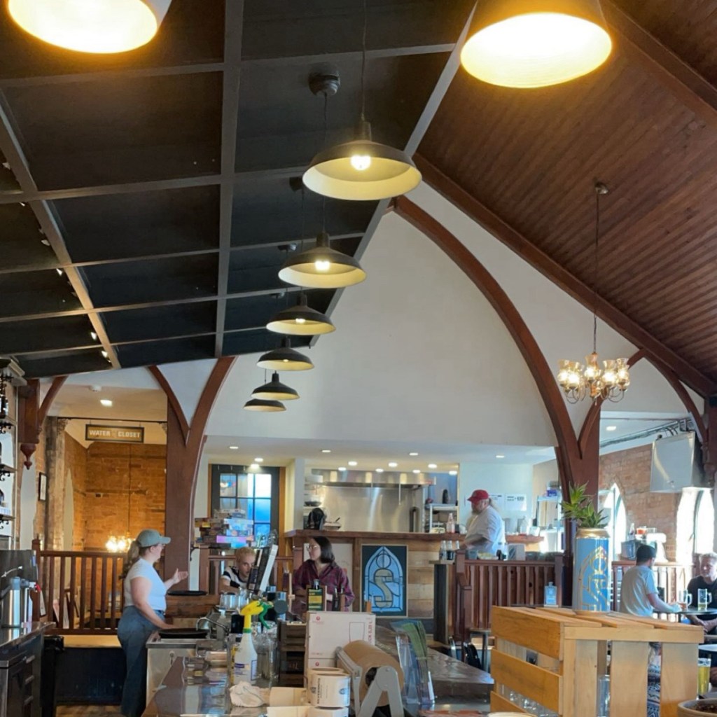
Silversmith seems to focus on well executed classic beer styles and I appreciate that. There are so many breweries now that are going out of their way to invent new kinds of beer, and I applaud the creativity, but sometimes a well executed classic styled beer hits the spot. They are classic beer styles for a reason, after all. More information about Silversmith Brewing Company can be found here.

Belly Up to the Bar

The best thing about beer culture in general is the people. Wherever I am in the world, sitting at the bar is a fantastic way to talk to friendly people. Canadians have reputation for being extremely nice. Our week in Ontario confirmed that stereotype. We’re known in Iowa for being “Iowa Nice” and I can confirm that the folks in Ontario are just as warm and welcoming. Someday we’ll have to visit again.

Hiking to Avalanche Lake

The Avalanche Lake Trail is a beautiful wooded hike in Glacier Park. It is an extremely popular out-and-back hike in the park and follows the mostly whitewater Avalanche Creek to the gorgeous Avalanche Lake.

Getting to the trailhead requires a park pass to Glacier National Park as well as a pass to drive Going-to-the-Sun road. If you can’t secure a driving pass on Going-to-the-Sun road you can take the free shuttle service. We secured a road pass by booking a boat trip on Lake MacDonald, which you might find easier than getting a pass for the road by itself.

We found parking to be a little hard to come by, so you’ll either need to be patient and circle the lot next to the Trail of the Cedars for a while or arrive early in the day. Avalanche Lake Trail is around 5 miles round-trip, so you’ll definitely want to bring along some water, maybe a snack, and someone in your group should have bear spray.

We started on Trail of the Cedars, which is a very flat, easily accessible trail. It has a lot of wooden walkways to make things easier for folks with limited mobility.

Elevated walkway in Trail of the Cedars

This is a very serene hike with tall, thin cedar trees everywhere. It is a very heavily traveled path because of how easy it is to hike. We saw a lot of parents hiking with their young children who wouldn’t be capable of doing a more difficult hike.

Avalanche Creek carving out a passage in rock

Along the Trail of the Cedars is the Avalanche Lake trailhead and there is a park sign marking the entrance. Once you leave the Trail of the Cedars for Avalanche Lake Trail, the hike becomes more challenging. Alltrails.com has Trail of the Cedars rated as an easy hike and Avalanche Lake Trail as moderate. For most people, Avalanche Lake Trail will be fairly easy to hike, but you should be aware of your personal fitness before getting two miles into the hike and regretting your life’s decisions.

In some areas Avalanche Creek is somewhat narrow

The Avalanche Lake Trail roughly follows Avalanche Creek from the trailhead until you reach the lake. This is a fast flowing, whitewater creek. The creek in some spots has carved out smooth mini-canyons and in other spots opens up into wide rapids flowing over smooth river rock.

Where Avalanche Creek hasn’t been restricted by a rocky passage it opens up and widens into rapids.

According the data recorded from my Garmin on the hike, the hike to the lake is about 2 1/2 miles and the elevation goes from around 3,500 feet above sea level to around 4,000 feet in that span, The creek basically has the same stats. Any time a creek has a 500 foot drop over a couple of miles, there will be a lot of whitewater.

There are plenty of times that the trail veers away from the creek which lets you enjoy the forest. Most of the trail itself is fairly wide and comfortable to walk. There is quite a bit of traffic on the trail, but because the trail is wide, there is plenty of room to maneuver around other hikers.

Some of the mountains in the area of the trail.

After a little over a couple of miles, we arrived at the lake. In my opinion, there is nothing more stunning than a mountain lake, and this is a breathtaking one. The beach is filled with smooth rocks and the water is crystal clear. The water was extremely calm which made for a perfect mirror of the sky and mountains in the background.

Avalanche Lake from the beach at the end of the trail

The shore itself was lined with hikers and we found a little chipmunk who had grown accustomed to begging for snacks from the hikers. He was rewarded by one who gave him a little chunk of a snack bar.

Fairly tame chipmunk

While we were there, I caught the end of what was a young man proposing to a young woman in front of their friends and family. She said yes, and everyone cheered. Congratulations to the happy couple and I have to say that was an excellent choice of location for the proposal.

Avalanche Lake

After resting, having a snack, congratulating the couple, and taking a ton of photos and selfies, we headed back to the trail. The hike back is quite a bit easier, since now its dropping 500 feet over 2 1/2 miles instead of climbing it.

Tall pines along the trail

It gave us a second chance to view all of those beautiful rapids that the creek has created on our way back to the parking lot.

Avalanche Creek

The Avalanche Lake Trail is the most consistently beautiful trail that I’ve ever hiked. From the pine trees, to the mountains, to the whitewater and finally the calm mountain lake, there just isn’t a boring or ugly spot on this trail. It is beautiful from beginning to end and I would recommend this trail to anyone who has the opportunity to take it.

Discovering Niagara Falls

Niagara Falls is one of the oldest and best known tourist spots in North America. Dividing the United States from Canada, the St. Lawrence River has been carving out the landscape remaining after glaciers retreated at the end of the last ice age for around 10,000 years. Because of the 160 foot difference between the top and bottom of the falls and the massive amount of water that flows over the edge, it makes for dramatic views.

American Falls

We arrived in Niagara Falls, Canada around 10 AM, and parked in the parking lot near the amusement park. We paid $20 CA to park, but based on the reviews, I think that’s a variable price based on whether its a weekday, weekend, summer, etc. From there we walked down Clifton Hill, which is a street with all of the ridiculous tourist trap things like a wax museum, a Ripley’s Believe It or Not, and lots of gift shops.

Rainbow International Bridge and American Falls

Once we walked past the tourist traps, we finally got a view of American Falls. American Falls are the less dramatic falls to the north of the Horseshoe Falls, which is what most people think about when they think of Niagara Falls.

Looking towards Horseshoe Falls along St Lawrence River

We made our way down to the walkway that edges the St. Lawrence River. From there, we saw the entire wonder of Niagara Falls with Horseshoe Falls off in the distance to the right and American Falls directly in front. The walk from the end of Clifton Hill to the Table Rock Welcome Center by Horseshoe Falls is almost a mile walk.

Mist climbing from Horseshoe Falls

Walking along the St Lawrence River has a similar feel to a lot of popular tourist destinations. There are people lined up along the railing taking photos, people speaking in a variety of languages, and vendors selling keepsakes. This is one of those places where people are in a good mood, spending time with their families or friends and just enjoying a nice walk in a beautiful spot.

Horseshoe Falls from in front of the Table Rock Visitor Center

The Welcome Center was extremely busy, but I think that’s pretty normal. We walked past a fairly large gift shop to get to the ticket counter. The ticket counter was busy selling tickets for several attractions. The main ones are the White Water Walk, Whirlpool Aero Car, Power Station tour and the Journey Behind the Falls.

We decided to do the Journey Behind the Falls tour, and quickly jumped into line once we paid for the tickets. It took about an hour to get through the line, and they queue you through a museum-like area to teach you a few things about the history of the falls while you wait. Essentially, the tunnels only have so much space in them and they have to wait for others to leave before you can go down into the tunnels. We did notice on our way out that the line was three times as long, so I’m glad we arrived fairly early.

View from the observation deck on Journey Behind the Falls

Clad in the yellow ponchos that we were handed while in line, we headed down in the elevator. There is really only two attractions for the Journey Behind the Falls, the first one is the observation deck. The observation deck is a huge patio area near the edge of the falls. This really gives you a sense for the power and volume of the water rushing over the edge of the falls. It’s also the place where about a dozen selfies per second is taken because it is an absolutely beautiful place to take photos. Unfortunately everyone has their photos taken with an unflattering yellow poncho, so there are drawbacks.

View from behind the falls. It feels a bit like a scene from an escape from prison movie.

After we were done with the observation deck we headed back into the tunnels to see the falls from behind the water. Construction crews carved out tunnels behind the falls which allow you to see a very small part of the falls from behind them. It doesn’t really give you a great view, but it does give you a sense of just how powerful these falls are. The water rushing over the end of the tunnel is fast and loud.

Once we got our chance to stand up close to the end of the tunnel, we headed out and then went up to the restaurant on top of the Visitors Center. We weren’t hungry yet, but we wanted an opportunity to relax and enjoy a beautiful view of the falls. They called themselves a wine bar, but once we were seated, we realized that they had an interesting variety of local microbrews, so we ordered flights, all of us, except for Alex, of course, who I think got a lemonade.

My flight of microbrews with a peek at American Falls.

They originally sat us away from the railing, but we were asked to be moved when someone got up from a table by the railing and they were happy to let us move. The view from this restaurant is spectacular, and we had a pretty close view of Horseshoe Falls as well as American Falls off in the distance. We were also able to watch as one tourist boat after another approached the falls, stayed as still as possible and then retreated back to the docks. The number of full tourist boats that approach the falls is impressive. They are even color coded, with the tourists on American boats wearing blue ponchos and the tourists on Canadian boats wearing Red ponchos.

Tour boat from the American side (note the blue ponchos) approach Horseshoe Falls.

We finished up our drinks and headed back on the mile walk back to the car taking in the beautiful scenery along the way. We didn’t spend a ton of time at Niagara Falls, but I feel like we got a great sense of what it was like. We would like to experience Niagara from the American side, so there is a good chance that we will return and perhaps do a boat trip.

View from Wine Bar

All in all, it was a beautiful day to experience one of North America’s great natural wonders.

Going-to-the-Sun Road – Glacier National Park

Normally, I’m the one who does the planning for our family trips. However, I recently found myself in Montana with a group of my old high school friends who made the trek to see our friend Mat get married. It was pretty obvious early on that they were on top of it and I could just show up and enjoy it. I knew that we would be going to Glacier National park as part of this, but I didn’t do an ounce of research on it before we left, which is very unusual for me.

Glacier National Park Entrance Sign

On the first night, we went to Tamarack Brewing for dinner. I was enjoying an IPA while we caught up on old times. The conversation switched to how we would secure passes to “Going-to-the-Sun Road”. Tracy said she would set a reminder for 7 p.m. the next day, which was during the wedding reception, to get the car pass.

Having done zero research for this trip I thought the pass was for “Sun Road” and she just said that in a weird way. Then I heard some of the others say things like “It will be fun to drive Going-to-the-Sun road” and “I’m glad they managed to get Going-to-the-Sun road open.”

I started to strain my ears and look quizzically at them. What’s going on, am I having a stroke? These are all smart, accomplished people, why are they talking like they just learned English last week? Once I figured out that the road was called “Going-to-the-Sun Road,” I was both a little relieved and still a little confused by why a road would be named that.

What is Going-to-the-Sun Road?

According to the National Park Service, Going-to-the-Sun Road is a two lane road built in the late 1920’s and early 1930’s. It is 50 miles long and essentially bisects Glacier National Park from Apgar to St. Mary. It is the only road that goes through Glacier National Park and is one of the most scenic roads in the United States.

The road is named for Going-to-the-Sun Mountain. It is unclear whether the origin of the mountain’s name is based on a Blackfoot Indian legend about the deity Sour Spirit teaching the Blackfoot to hunt or whether the explorer James Willard Schultz made up the name.

Getting a Pass for Going-to-the-Sun Road

The number of cars allowed on Going-to-the-Sun Road is limited. This is to keep the narrow two-lane road and especially the small parking areas on the side of the road from being overwhelmed by cars. Reservations for Going-to-the-Sun Road can be made at Recreation.gov.

There are two types of reservations, one that can be made 120 days in advance, if you have sufficiently planned ahead, and one that can be made at 7 p.m. mountain time, the day before. Tracy grabbed our pass at 7 p.m. which is why she needed to do it during the wedding reception.

The next morning we packed up the minivan and headed out to Glacier National Park. After a quick stop for coffee and breakfast, we had to check our park passes at one set of security and then our pass for the Going-to-the-Sun Road at a second security stop. Once we were through security, we were on our way.

Driving Along Lake McDonald

The drive begins from Apgar along Lake McDonald. Lake McDonald is about 10 miles long, about a mile wide and a pretty impressive 472 feet deep. The beginning of this drive is a beautiful and calm drive through the forest with Lake McDonald on the left hand side. It remains a pretty calm drive past Lake McDonald Lodge, the Trail of the Cedars and up until you hit the West Tunnel, about 20 miles into the drive.

Tunnel cut into rock face

The Ascent to Logan Pass

After the West Tunnel, there is a switchback and then a constant and gradual ascent toward Logan Pass. This is the beginning of a long stretch of road built on the edge of cliffs with long beautiful vistas, waterfalls and mountaintops poking out through the clouds.

View of a valley on the way up to Logan’s Pass on the Going to the Sun Road.

Being the driver is a definite disadvantage. Tim was our driver and while the rest of us were gawking over the views, he had to pay attention to the road. Going-to-the-Sun road is an active driving situation with narrow lanes, tight curves and frequent stops. The temptation to stare at the landscape instead of the narrow road has to be pretty intense.

Much of the early part of our ascent to the pass was marked by a lot of fog, but it made for dramatic views of the mountains and valleys when they cleared.

Ascending up towards Logan’s Pass, we entered the clouds.

At one point, we caught a quick glance of a Big Horn Sheep or a Mountain Goat right on the side of the road, just poking his head out from behind the stone wall, but it happened so fast my brain didn’t fully process it. We stopped at the next pull-off but couldn’t see him, so I don’t know what exactly we saw but it had horns and it was right next to the road.

Waterfall where Adler Creek goes under the Going to the Sun Road.

As we continued our ascent, we started to come across snow. It became very obvious why they aren’t able to open the roads until June or July because the amount of snow that has to be removed every year is massive. The remainder of the snow accumulation was still pretty deep by the side of the road in some spots.

According to the National Park Service, Glacier National Park receives an average of 157 inches of snowfall per year at its headquarters in West Glacier and much more at higher elevations. Opening Going-to-the-Sun-Road is a massive undertaking that starts around April and lasts for months. This past year, they had to deal with a drift that was 80 feet high, so it takes a long time for this snow to melt completely.

Snow on the side of the road, slightly before Oberlin Bend

We got out of the car on multiple occasions to take photos at pull-offs along the road, but we got out to walk around at Oberlin Bend. There is a wood and steel grate walkway there. There was still a considerable amount of snow left in the area and it gave us a sense of how long it must take for it to melt every year – this was June 30th!

It was still very snowy at Oberlin Bend

Logan Pass and the Highline Trail

Just a little bit further up the road from Oberlin Bend, we then had a chance to stop at the Logan Pass Visitor Center. There is some bathrooms and a cute little gift shop there. Steph and I took a little walk out the back of the visitor center and she showed me the people who were hiking the Highline Trail.

Mountain obscured by clouds near Logan Pass

Prior to the trip we briefly considered doing that trail, but decided to do the Avalanche Lake hike instead since it was considerably less terrifying. The Highline Trail is known for its breathtaking views and a section called “The Ledge” which is only 6-8 feet wide with a sheer drop over a hundred feet down. There is a steel cable to hold onto in this section. If you’re brave enough, parking for people doing the Highline Trail is available at Logan Pass Visitor Center.

Jackson Glacier Outlook

We got back in the minivan and continued on, now going downhill. We stopped at the Jackson Glacier Overlook, where a ranger explained to a fairly large group about the remaining glaciers in the park and how the number of glaciers and size has been shrinking since around 1850. That overlook, of course, has a view of Jackson Glacier, but it is quite far from the overlook.

Way off in the distance is Jackson Glacier, one of the 26 remaining glaciers in Glacier National Park. There were 80 at the end of the Little Ice Age, which ended around 1850.

St Mary’s Lake

We completed the drive by stopping at the Visitors Center at St Mary. There is a little gift shop in there as well as some museum-like exhibits about the history of the Native American people indigenous to the area.

St Mary’s Lake

As is going to be the case for most people on the Going-to-the-Sun Road, we needed to do the entire drive back to the start at Apgar, so we returned to the car for the 50 mile return trip.

Piegan Pass Trail

When we did the first half of the drive, we didn’t get to do a hike near St Mary’s Lake. We tried on the way through the first time to get a parking spot on one of the pull-offs near Piegan Pass Trail but couldn’t. On the return trip, after a little work, we were able to get a parking spot and get out and stretch our legs a little.

Bering Falls on Piegan Pass Trail

We walked a very short distance to see Bering Falls and then turned around and walked to along the path to a point which I believe was the end of Piegan Pass Trail. There is a rocky area jutting out into St Mary’s Lake there where there was a lot of great photo opportunities.

View of St Mary’s Lake from Piegan Pass Trail

Piegan Pass is a heavily traveled trail, at least in this area, so the odds of being approached by a bear is low. We did bring along bear spray just to be sure, but there were no signs of bears in this area. We hiked around 3 miles, and returned back to the minivan to finish our drive.

St Mary’s Lake from the end of Piegan Pass Trail

A Bear Sighting

Near the end of the return trip back to Apgar, we came across a traffic jam. Obviously, we weren’t expecting a traffic jam on Going-to-the-Sun Road, so we assumed that there must be an animal around. Once enough cars had cleared, we pulled off to the side of the road to see what was going on.

The cub is looking for mama, definitely thinks she’s across the road.

There was an animal making noise by the side of the road, and it was a sound I wasn’t familiar with. After a little while, I saw a baby bear head pop up on the side of the road. It was very clear that the bear was in distress and probably looking for his mama. Now, honestly while that is adorable, it’s also pretty terrifying since I’m assuming a stressed mama bear must be nearby as well.

The cub makes an attempt to cross the road but gets scared back into the tall grass by a car.

The cub made several attempts to cross the road, but kept getting scared off by traffic. Finally Tim jumped out into the road and stopped traffic so that the bear could finally cross and hopefully be reunited with his mama.

Tim stops traffic and finally allows for the bear to cross the road.

The Importance of Great Travel Companions

If you’re driving Going-to-the-Sun Road, you will be spending probably a minimum of 6 hours with people in a car, assuming that you are at least stopping once in a while to take pictures and enjoy nature. Spending that much time in a car, you might want to have people with you that you also enjoy spending a minimum of 6 hours with.

For me, this turned out to be a great group with whom to do this drive. We talked about the old days, our families, and a lot about travel. Obviously, I like to talk about travel, but sometimes feel a little weird about it. Honestly, I avoid the subject with people who don’t travel much, because they’re either not interested or I’m afraid it comes off as braggy. It’s something that I’m really passionate about and to have spent a few days with people who are as passionate about travel as me made for great conversations.

The crew being silly. From left to right: Julie, Tracy, Steph, Carrie and Tim.

I loved hearing about all of the places they’ve been and I’ve certainly taken some mental notes about places that I might want to visit based on our conversations. In between all of these conversations, there was also plenty of carpool karaoke, which I abstained from to save everyone else’s eardrums. In the end, it was a great time with some great friends.

I would definitely recommend driving Going-to-the-Sun Road if you get a chance. It’s an unbelievably beautiful drive. The variety of views from mountain lakes and snow covered peaks to waterfalls is astonishing. It’s also one of the few really accessible places in Glacier National Park for people who aren’t doing long hikes. Keep in mind that the number of car passes are limited and you will need to purchase those in advance. Then all you need is a full tank of gas, some great friends, and some snacks and you will get to witness one of America’s great treasures.

Great Places to Eat and Drink While in Grecia Costa Rica

Grecia is centered around the big metal church in the center of town called Iglesia de Nuestra Señora de las Mercedes.

We spent about a week in Grecia, a community with a population of about 15,000 residents, located in the Central Valley of Costa Rica. Of the places where we ate and drank, there were a few that stood out in our minds that are worth a visit while in town.

There were some places that we didn’t care for so I won’t mention those, but there were a few that we really enjoyed and I thought I’d share them here, in case you find yourself in the Grecia area.

El Chante Gastrobus

El Chante Gastrobus is a funky restaurant with a couple of school busses that form the side walls of a pavilion. One of the busses is used as the kitchen while another has diner style tables where the seats used to be.

There is art everywhere at El Chante with murals on the busses as well as tables made out of what appear to be a variety of reclaimed materials, including a bus door.

My impression of the food was that it was pretty good, not fantastic. I ordered a dish that had french fries, queso, pulled pork and toppings.

The beer selection had pretty much all of the typical Costa Rican staples such as Imperial, Pilsen, and Bavaria. They also had some other fairly normal international favorites like Corona, Stella Artois, and Heineken. There was a good selection of mixed drinks. This place seems like a perfect place to stop and have a few drinks and maybe a snack. It’s a pretty fun place to hang out.

Table made out of two barrels and a bus door

As a bonus for El Chante Gastrobus, it is located basically in a huge parking lot. Parking can be difficult to find in Grecia, and I appreciated being able to park my car easily and walk in. There was a small charge, maybe $2-$3, which is pretty standard in Grecia.

Los Jardines Vivero y Cafe

We saw this restaurant while driving by it one day and said that we had to stop in there. It turned out to be a great decision. This is just a great restaurant that serves traditional Costa Rican food in a really fun atmosphere.

We came in for lunch and everyone ordered Casado which is a Costa Rican combo meal traditionally served for lunch. They are various combinations at different restaurants but here it came with rice, beans, plantains, a mini-salad, and your choice of protein. They also gave us iced tea and ice cream with the meal.

We had Casado a few times while in Costa Rica and this was our favorite. I thought everything was extremely well done and the plantains were perfect.

Los Jardines has a lot of antiques and little gardens scattered around the restaurant. It makes you want to walk around and get a look at all of the little touches that they have set up throughout the restaurant. We even sat at a table where all of the seats were swings. It was just a nice, fun place to have a meal.

I have read a lot of reviews talking about how busy it gets there, and I will say it was almost empty for lunch, so that might be a great time to check it out. The food was great, the atmosphere was fun and the prices were pretty reasonable. Definitely worth a visit.

Vuelta al Mundo

In downtown Grecia, across the street from Grecia Park is Vuelta al Mundo. It’s located inside Mangifera Hostel. Its tucked in the back of the building in an open area. Its menu consists of dishes from around the world.

Kebab Wrap

This is a great place to go if you have a group of people arguing about where to go for dinner. We had gyros, pasta carbonara, and a kebab wrap, but there were also dishes on the menu from China, Uruguay, Costa Rica etc. We also had an appetizer called Bitterballen which is some kind of fried breaded meat balls from the Netherlands.

Gyros

They also had a good selection of local beer as well as some interesting European selections.

Pasta Carbonara

It’s difficult to be able to cook a variety of international foods effectively, but I think they handle it well. It was a also a comfortable and interesting dining area and the service was very good. It’s definitely a great stop if you’re hanging out by the park or the main church.

Menu of available juices at Vuelta Al Mundo

La 33

North of Grecia on Calle Brenes there is a local favorite called La 33. How do I know this was a local favorite? Because the entire time we were there there was a parade of delivery drivers and pickup orders coming and going. This is a small and very busy restaurant.

The dining room was full and we were lucky enough to get a table as someone was leaving. The prices were very inexpensive and the food was well prepared. Jenn and Alex got Tacos Birria and I got Taco con Papa.

Jenn said the Tacos Birria were the best she’d ever had. I will say I didn’t care for the Taco con Papa, but in all fairness I didn’t expect to, even though it was well made.

I had heard of Costa Rica’s take on tacos and I wanted to try it even though I was suspicious. The taco itself is shredded beef wrapped in a tortilla and fried to a golden brown. It’s then served with French fries. Sounds delicious, right? Then they add a side of shredded cabbage (I might have gone with lettuce, but ok). Lastly, they top all of this with lots of ketchup and mayonnaise.

Taco con Papa

I tried the taco thinking that maybe I was missing something, but no, I just don’t think mayonnaise and ketchup belong on that. I mean if it was sour cream and hot sauce it would’ve been amazing. Anyway if that sounds good to you, you should definitely try it.

Beer Designers

There are a handful of craft brewers in the area including Cerveceria San Roque and Beer Designers. However, as far as I can tell, if you want to visit a brewery near Grecia, it has to be Beer Designers and it has to be on Saturday night.

The production area has a beautiful view of the valley between the ridges where Calle Brenes and Calle San Roque are.

Since we love going to breweries and the only available one was Beer Designers on Saturday, that’s where we went on Saturday night.

Bar area at Beer Designers

We got a chance to try a couple of IPAs which were both very good. Jenn really liked their Dorado Dragon which is an IPA with dragon fruit.

For me, the standout was Lobejo which is an American stout. It’s a was rich and flavorful. Overall it’s just a great example of an American Stout. I consider myself to be a bit of a beer snob, and that was easily one of my favorite stouts, and I’ve tried alot of them.

Dorado Dragon has a nice reddish hue

We had a chance to talk to the brewer and a couple of the locals while we were there. It seemed like the word hadn’t gotten out on them yet because while they definitely had quite a few regulars, they weren’t that busy. The quality of their beers wasn’t matching the amount of business that in my opinion they should be getting.

We were able to pick up a 4 pack to go

A great bonus for Beer Designers is that it is right next door to La 33, which I mentioned earlier as a great place to get takeout. I don’t know if it’s okay if you bring it over and eat it at Beer Designers but I think I would at least ask if I could, because that would make for a great combination.

Cuisine in Grecia Costa Rica

There are actually quite a few great options for eating in the area around Grecia Costa Rica. We obviously weren’t able to visit all of them in less than a week. For the best dine-in experience I would go with Los Jardines Vivero y Cafe. If you just want an inexpensive and delicious authentic Costa Rican experience, I think La 33 is great. For just a nice comfortable hang out I would definitely think El Chante Gastrobus or Vuelta al Mundo and if you like craft beer, check out Beer Designers on Saturday night.

There are also at least two ice cream shops around the park and I would highly recommend going to at least one Costa Rican soda while you are in town. “Sodas” are just small mom and pop shops that sell inexpensive authentic Costa Rican food.

There is a pretty impressive amount of good food options in the Grecia area even though doesn’t have a huge population. A lot of people head to this area for because the weather is beautiful, the people are lovely and frankly the Airbnbs are pretty cheap. If you are thinking about heading to Grecia for those reasons, you definitely won’t be short on food options.

Hacienda Alsacia Coffee Farm

Barns and silos at Hacienda Alcascia

Hacienda Alcascia coffee farm is the only coffee farm in the world owned by Starbucks. Its a beautiful farm located on the southern slope of Poas Volcano about a 30 minute drive north of San Jose Airport in the Alajuela province of Costa Rica. Besides being an operating coffee farm, they also offer tours and have a gift shop and cafe.

Classic truck between parking lot and cafe

When we decided to go to Costa Rica, and knowing that we had an Airbnb in a major coffee producing region of Costa Rica, we knew that we would want to visit a coffee farm at some point. Since I personally drink about 2 gallons of coffee a day, I thought visiting a farm would be nice.

Wall art showing coffee growing regions of Costa Rica

I looked at quite a few local coffee tours, but Jenn found out that there was a Starbucks farm near where we were staying and suggested that. I was a little snarky about it, saying “Oh great, we’re going to go to Costa Rica to visit Starbucks. I mean, they’re so hard to find in the US.” In retrospect though, Jenn was right. This place was spectacular and if you’re anywhere near this, its an absolute must visit.

Coffee Bean Sacks on display near entrance

Starbucks History

A massive sliding door on the backside of the cafe has a sketch of the first Starbucks in Pike Place Market Seattle

Starbucks was formed in 1971 at Pikes Place market in Seattle. Since that time they have grown to over 35,000 stores worldwide. In my mind, Starbucks is largely responsible for getting Americans to drink flavorful coffee again. I can remember a time when Americans would only drink coffee flavored water produced by Maxwell House, Folgers or even Sanka. In the same way that the Boston Beer Company paved the way for microbrewers, Starbucks created a market for so many coffee shops and roasters in the US. My taste buds definitely thank Starbucks for that.

Coffee bean drying table

We’ve been to the Starbucks Reserve Roastery in Chicago, which I would recommend if you are in Chicago. It is one of 6 reserve locations throughout the world. While the Hacienda Alsacia farm is not one of these reserve locations, it has a very similar feel. The architecture is modern and clean. There is art everywhere you look and everything is meant to enhance the experience with your cup of coffee.

The Cafe and Gift Shop

They chose a phenomenal location for the coffee shop and gift shop. It is perched on a what is essentially the southern slope of Poas Volcano, with the building cantilevered over the slope. There is a huge bank of folding glass doors that when opened completely expose the cafe to an amazing view. That viewpoint is perfectly centered over a valley between two ridges. Adding to the amazing view is a waterfall coming off the ridge on the right hand side.

A large square shaped bar area is in the center of the cafe area, with a variety of baked goods on display. There is quite a variety of seating areas in the cafe, nicely spaced out. The seats that were in the highest demand, of course were along the railing which overlooks the valley.

Waterfall on right hand side when looking out of the cafe.

On top of the amazing views, that the building is located at an elevation that in Costa Rica virtually guarantees pleasant temperatures. We were there on a crystal clear day, but I would imagine that fog probably isn’t uncommon in this area. Either way, I would imagine the sliding wall of glass doors is probably open most of the time.

Center bar at Hacienda Alsacia

We sat down in an area with couches near the railing. I ordered a pour over coffee, which I assumed meant a drip coffee, which it apparently isn’t. Pour over coffee is when they put the coffee grounds into some sort of filter and then pour hot water over it. I’m still not sure how this is different from a drip machine, but apparently I’m a knuckle-dragging moron when it comes to coffee.

There is a microroaster in the gift shop which both produces the coffee beans in the gift shop but also is used to demonstrate the roasting process for the tours.

Either way, what I got, after a painfully long wait (I need my caffeine!), was probably the smoothest cup of coffee I’ve ever drank. I normally use creamer, but they gave me a little bit of cream and some sugar, which I used at first. However, this coffee was so good that eventually, after I ordered a second pour over, I just drank it black.

Roasting beans

I don’t know if it was the Costa Rican beans, the pour over method, or the roast itself, but that was probably the best regular cup of coffee I’ve ever had.

The Grounds of the Farm

After we had our fill of coffee and snacks, we decided to walk around the property a little bit. There is a decent amount of the property that they allow guests to roam, even without paying for the tour.

Mural on the coffee processing building

There is a building behind the cafe that is used to process the coffee fruit into coffee beans.

Typical wildlife at Hacienda Alsacia

If you continue walking toward the back of the property there is a tree nursery.

Young coffee plants in the nursery

There is patio area in the back that allows you to get a really great view of the cafe as well as great views of the valley.

Much of the displayed art at Hacienda Alsacia are tributes to the farmers of the region.

Starbucks Hacienda Alsacia Farm Tour

Hacienda Alsacia offers a tour at the facility. It takes about an hour and a half to complete and costs $30 for an adult, $25 for students and $25 for seniors. Children under 6 years old are free.

The tour covers their tree nursery as well as their processing areas and the microroaster. We chose not to do the tour. Without the tour you actually can see a lot of the areas that are covered in the tour, but I imagine that you would get a much better understanding of the history and the process of making coffee by doing the tour. Two Weeks in Costa Rica has a very well written post about this tour if you are looking for more information.

Other Considerations

If you are planning to come to Hacienda Alsacia, I would recommend pairing it with either a visit to the Poas Volcano National Park, or to La Paz Waterfall Gardens Nature Park. Both of those parks are still a half hour drive from Hacienda Alsacia, but by Costa Rican standards, that’s actually a pretty quick drive.

Coffee tree with fruit growing on it

If you take the tour, you’ll probably be there for 2 to 2 1/2 hours, assuming you’ll stay for a coffee and visit the gift shop. If you’re not doing the tour, it’ll probably be an hour to an hour and a half so keep that in mind.

Rows of coffee trees

There is plenty of parking, with a paved lot on site and a gravel overflow lot across the road. and parking is free.

Starbucks logo behind cashier station

We had a great time at Hacienda Alsacia. The views are amazing and the coffee is delicious. They did an absolutely fantastic job creating an experience for coffee fans to enjoy a cup of coffee while learning something about the process of making this magical drink. I would highly recommend a visit.

Visiting the Breathtaking Blue Falls of Costa Rica

The Blue Falls of Costa Rica are a group of seven gorgeous waterfalls set on a tributary to Rio Toro. The river is fed by runoff from the northwest slope of Poas Volcano and is a seemingly unnatural shade of blue due to a high concentration of aluminum sulfate. This aquamarine colored water flowing over rocky terrain makes for an unbelievable landscape of pools, waterfalls and rapids.

There is a tour company that maintains the Blue Falls as well as Catarata Del Toro, which is another waterfall on the same property, but it is on Rio Toro, not on the tributary where the Blue Falls are located. They take admission for both attractions and have a station where you can pay, use the restrooms and potentially get some food, although the snack bar was not open the day we were there.

When we arrived at the visitor center, we were greeted by a gentleman who asked us whether we would be doing Catarata Del Toro, the Blue Falls or both. We paid for the Blue Falls, and he gave us our wristbands for entrance and instructions to go back to our cars and drive up the road a bit and park in a different lot and enter there.

The first river crossing is literally a few inches wide. Only 2 people are allowed on this bridge at a time.

The crazy thing about this gentleman was that, while we were standing there, he also was giving instructions to other hikers and I’m not 100% sure, but it sounded like to one group of hikers he spoke in Dutch (maybe German) and another in French while he was talking to us in pretty flawless English. I’m pretty sure he probably speaks Spanish as well, but the fact that he was just switching back and forth between languages that quickly was amazing to me. I asked him how many languages he knew, and he just responded humbly with “oh, a couple”.

This was early along the road, as you continue to walk the rocks have been moved into the center of the road to operate more like a sidewalk.

We moved the car to the parking lot by the Blue Falls entrance and began our hike. There is a dirt road to follow for the first half to three quarters of a mile. The dirt road had basically turned to mud, which I’m sure is the case a lot of the time. There was a row of stones in the center where most people walk to avoid the mud.

Little “sidewalk” like rock formation to help hikers stay out of the mud

At the end of the road, we came across some signs pointing to where to find the falls. Three trails to the left – La Pintada, La Turquesa and La Celestial, and three trails to the right – Poza Azul, Las Gemelas, and Tepezquintle. Las Gemeles is one trail with two waterfalls.

La Celestial Waterfall

Makeshift stairs on the trail to La Celestial

We decided to visit La Celestial first. Once we started to hike down the actual trail to La Celestial, the trail became more like forest stairs for lack of a better term. The trail has been altered to be more like steps. As wet as this area is, I assume that without the steps it would be incredibly slippery.

There are metal stairs on the trails where the trail would be too dangerous without them.

There were other sections that had some makeshift metal stairs and railings. As we got closer to the falls, the steps made way to boulders. As we descended down the trail, the sound of the waterfall grew in intensity until finally the waterfall appeared in view.

La Celestial waterfall taken from the end of the trail

La Celestial is fairly wide with quite a bit of water coming over it. It’s probably about 30 feet tall and has a bit of a pool under the waterfall. I don’t know how deep the pool is because, I didn’t get more than about waist deep there.

The family enjoying La Celestial

The water is fairly cold, which wasn’t unexpected, since it is running off of a mountain, but it’s not so cold as to want to avoid it completely.

A group of rocks about 50 to 100 feet from the falls creates a pool under and near the falls which you can swim in.

We hung out there for about 15 minutes enjoying the waterfall and the cold water and then decided to go back to the trail to head over to our second waterfall, La Turquesa

La Turquesa

The trail down to La Turquesa seemed much easier than the trail down to La Celestial. There still was quite a bit of steps on the way down, however, once we reached the river, we came across a metal structure with a ladder. There was a guide there to greet us.

A fairly typical trail at Blue Falls. It’s been altered to be more like steps,

In order to get to La Turquesa, you have to cross the river. The guide showed us the right place to cross and helped us through some of the more treacherous parts of the trail, which at this point mostly consisted of stepping on wet slippery rocks.

Guide helping Jenn across the river on the trail to La Turquesa

There is a fairly brisk section of rapids that we needed to climb over to that was the last main obstacle to getting to the falls. In this section, we had to climb over a boulder to get there. The guide was very helpful in making sure that none of us slipped on the boulder.

You need to climb over this boulder to get to La Turquesa.

The reward for this hike is a probably one of the shorter falls here, but it has a really nice pool area where you can kind of relax a little and swim, if you can stand the cold water. I got in up to my neck, but Alex actually dunked his head. Emma bet him $5 he wouldn’t do it.

La Turquesa

This was a really calm and relaxing area to hang out in. We stayed for a little while and then decided to head back to the trail and go down one last trail.

Las Gemelas

We headed back up to the main trail, and we knew that we probably only had one more trail left in us. The hiking at the Blue Falls is somewhat challenging and some fatigue was beginning to set in. Jenn suggested we see Las Gemelas (The Twins). It was a great choice.

A metal bridge over the river at La Gemelas

Once we got down to the river from the main trail, we were greeted by a narrow metal bridge.

Once you crossed that, the trail mostly stayed dry on the left side of the river as we approached the first of the two twins.

One of the falls at Las Gemelas.
The first of the falls at La Gemelas

This was easily the tallest of the waterfalls we had seen that day.

Once you walk closer to the first of the twins and can see further down the river, the second of the twins appear in view.

The second of the falls at La Gemelas

There is a location on the left side of the river, where both waterfalls can be seen simultaneously. This is a surreal spot.

Standing where both of La Gemelas can be seen.

At this point of the day we were pretty hungry and tired and were ready to head back. We hiked back to the main trail and then to our car.

Getting to Blue Falls of Costa Rica

We drove to the Blue Falls from Grecia, but in general if you are coming from San Jose or the Central Valley you will be coming over a fairly tall ridge on Ruta Nacional 708 from the south. I mention this for one specific reason, that is the steepest section of road I have ever driven on.

The steep section I’m talking about is a very new road, but as we were descending the mountain, I suddenly got terrified because I knew I would have to drive back up this mountain, and I rented a Geely GX3. It has a not at all impressive 102 horsepower, and I had 4 full-sized Americans that had to ride in this car up this insane grade. Long story short, we made it, it was terrifying and my speed going up this grade was about 5 MPH with the pedal on the floor. I would suggest maybe a more powerful car if you are going to attempt this drive.

Much of the drive is typical of rural Costa Rica with narrow roads, switchbacks, and limited visibility. We did come across some pretty sketchy bridges made of wood near the end of the drive. At one point I asked Jenn “Was there a hole in that bridge?” She replied as calmly as she could “Yep.”

If you are coming from La Fortuna, you will probably be coming down from the north, so you wouldn’t have the steep grade that we had to deal with. That being said, I have no experience with the roads from La Fortuna, so I don’t know what they are like.

What to Wear at the Blue Falls of Costa Rica

You need to be prepared to get wet and muddy. You also need to have shoes that don’t slip. This does present a challenge for me, because frankly I’m a big fan of wearing socks and you’re not going to want to wear socks. They are going to get wet and your feet are going to prune, and you will be hating your life decisions.

Rocks are wet and slippery. Make sure your shoes grip properly.

You will also be walking on some extremely slick rocks. Having a pair of water shoes that have excellent grip that you can wear in the water is essential. They should also be a good fit, because as you can imagine, wearing ill-fitting shoes on a hike without socks can cause blisters in a hurry.

The alternative to water shoes is to do what the guides do and wear rubber boots. I’m pretty sure the guides know what they are doing, so following their lead can’t be a bad idea.

As far as your clothes are concerned, again you need to take into account the fact that you are both hiking and swimming. A swimsuit might not cover as much as you want when you are hiking and hiking clothes might be too heavy and uncomfortable once you get them wet. I settled on a quick dry shirt and a pair of board shorts. That seemed to be a pretty good compromise. Keep in mind the trails are pretty well maintained so you probably don’t need to cover your legs from things like thorns.

Other Considerations

We didn’t plan out our day very well. We had a light breakfast before driving an hour to get to the falls. A couple of hours of hiking had made us pretty hungry and we had not brought anything to eat. We basically quit out of fatigue, but if we had decided to do all of the falls, it would have taken us a bit more time and we would’ve been extremely hungry.

I would recommend packing a lunch if you want to do the entire Blue Falls hike. I think you could probably do the whole hike in 2 or 3 hours, but honestly, why are you hurrying? It’s beautiful, chill out and swim in the pools for a while. If you’re really enjoying the hike, I would think it would take you at least 4 hours, maybe longer, and with the amount of calories you’ll be burning with constantly going up and downhill, you’ll probably want something to replenish your energy.

I took along a regular backpack, but this is a very wet area, and the chance of accidentally falling into the river is fairly high. I would recommend using a dry bag or a dry backpack. I was carrying everyone’s phones in my backpack, so had I fallen, it might’ve been a really bad day. A dry bag would prevent that.

At the beginning of the hike, they will offer you a hiking stick. Take it! It must’ve saved me from falling a dozen times – its slippery out there!

Also, keep in mind you are in a forest in Costa Rica – if you have ever needed bug spray and/or sunscreen, you will need it here.

How Much Does the Blue Falls of Costa Rica Cost?

Entrance fees for the Blue Falls of Costa Rica is $17 USD per person. If you plan to also visit Catarata Del Toro, then a combo ticket costs $25 USD per person.

For more information visit the Catarata Del Toro/Blue Falls website.

Using the Lodge

Where you pay to get in, there are a bunch of tables where you can eat. There is a snack bar, but it was closed that day, so I’m not sure I would count on them having food available.

Tables at the lodge

There are a couple of bathrooms in the back, and we used them to change our clothes after the hike. Pretty much anywhere you go when you leave the Blue Falls is going to be a long drive and you’ll want to be dry for that drive. Also, there aren’t any bathrooms on the trail itself, so you might want to use it before you head onto the trail.

One of the hummingbirds at the lodge

I don’t know if tipping is customary, but we did leave a tip with the gentleman who was running the front desk. He asked us who the tip was for and we just let him know what falls we hiked at and he was happy to give the tip to the guides who were working those falls.

Hummingbird swooping in to the feeder

There is a hummingbird feeder in the lodge that gets a ton of activity with some very aggressive hummingbirds. Make sure you take a few moments to enjoy the hummingbirds as well.

Conclusion

If you have an opportunity to hike at the Blue Falls, jump at it. This was, by far, the most beautiful hike I have ever been on. Keep in mind that you should be in pretty reasonable shape to do the hike. It is wet, steep, and your balance will be challenged constantly.

Make sure that you come prepared and enjoy the beauty of Costa Rica. Pura Vida!

Unwinding in Playa Hermosa

Playa Hermosa is a small, laid back beach town along the Pacific coast in the Guanacaste region of Costa Rica. The sand on the beach is a little darker than you might expect because of the volcanic rock that helped form Costa Rica over millions of years. The bay around Playa Hermosa is crescent shaped and creates some stunning views, especially at sunset. It also makes for a nice stopping point for flights in or out of Guanacaste Airport.

Playa Hermosa is a Great Stop after Landing at Guanacaste Airport

The reason why we stayed at Playa Hermosa was simply that we didn’t want to drive at night. We had about a 3 to 3 1/2 hour drive from Guanacaste Airport to our Airbnb in the Central Valley near Grecia. Even though we landed around noon, by the time we got through passport control and customs, took the shuttle to the car rental place and finally got the keys to the rental car, it was around 2:30.

The problem with Guanacaste Airport is that almost all of the planes from the US and Canada (which are the majority of planes landing there) arrive between 10:30 and 2:30. Also, the airport itself isn’t really near many tourist spots. A lot of the typical stops for tourists are a bit of a drive from the airport:

  • La Fortuna – 2.5 to 3 hour drive from the airport
  • Monteverde Cloud Forest – 2.5 to 3 hour drive from the airport
  • Jaco – 3 to 4 hour drive from the airport
  • Central Valley – 3 to 4 hour drive from the airport

Driving at night in Costa Rica, if you aren’t familiar with the area that you are driving, can be tricky to say the least. Between the fact that the roads are narrow, curvy and unlit, the lack of street signs, and the fact that there are always people walking in the road, you might just want to drive in the daytime, at least at first.

Lodging in Playa Hermosa

For being a pretty small travel destination there are a number of choices of places to spend the night in Playa Hermosa, all of whom are small operators (your Marriott Bonvoy and World of Hyatt points are useless here). For more expensive hotels, there are some villas on the north side of Playa Hermosa and Hotel Bosque del Mar on the south end. We stayed in the center of Playa Hermosa where you will find some modest boutique hotels.

We stayed at Huetares Hotel and Villas. It had a nice pool area, which we really enjoyed. The rooms were spacious but a little rundown, which didn’t bother us too much since we were just sleeping there one night and then moving on. Our room had two full bathrooms and two bedrooms, each bedroom had a single and a double bed. It also had a kitchen area which would’ve been nice if had stayed longer.

There was a questionable shower there with exposed wiring. At first I didn’t understand why there was wiring on a showerhead, but I think it was an instant water heater showerhead. Either way, I’m not sticking my head under a showerhead with exposed wiring – luckily there were two bathrooms and two showers, so we didn’t use that sketchy thing.

Yeah, I’m not taking a shower under this thing. I don’t feel like dying today.

Swimming at the Beach

The sand at Playa Hermosa is fairly pleasant. It’s not a white Cancun style of beach, this is a little darker with volcanic sand mixed in. This makes the water appear dirtier than at a white sand beach, but its really that the sand is just darker.

There is a first row of trees on the edge of the beach, then a path and then the rest of the trees which allow you to walk the beach in the shade.

The water is about as warm as at any beach I’ve been to. It was very pleasant to swim in and we did see a bit of fish activity while we were swimming. The waves were fairly gentle to moderate which also made swimming very pleasant.

Wildlife in Playa Hermosa

In the short amount of time we spent in Playa Hermosa, we spotted quite a bit of wildlife. At our hotel, we spotted an Iquana that was probably 2-3 feet long. There were also quite a bit of tropical birds that were flying around and chatting to each other. The squirrels that we saw were grey and reddish orange.

Two howler monkeys in a tree. You can also see in the tree, a couple of wires. That is the monkey bridges that have been built to allow the monkeys to cross the roads without having to use electrical wires or walk across the street.

What you really need to go looking for are the howler monkeys. If you don’t know where they are, don’t worry, you’ll hear them. I don’t know how many of them live in Playa Hermosa, but there are at least a dozen who spend a lot of time at the tops of the trees. Howler monkeys are known for being loud with calls that can be up to 140 decibels. We had a lot of fun watching them in the wild and they weren’t in the least bit concerned with us.

Dining at Sunset

Playa Hermosa is located on the west coast of Costa Rica, making it a beautiful place to watch sunsets. There are also a handful of restaurants along the beach making it a great place to have dinner on the beach while watching the sunset.

The majority of the seating at Aquasport is in the sand, which is exactly where you want to sit.

The restaurants that I noticed while we were there were La Casita del Marisco, Roberto’s and Aquasport. We chose Aquasport.

There was a large swing there that was in constant use throughout dinner.

I really liked the menu at Aquasport because it allowed us to try a pretty wide variety of food that’s not available in our hometown in Iowa. Alex got the Surf and Surf, which was mahi mahi and shrimp in a pretty interesting sauce. Jenn got the mahi mahi fillet, while I ordered the beef tacu tacu and Emma ordered a chicken causa. We also shared some patacones.

Chicken Causa – a Peruvian dish with layers of potato, avocado and chicken.

Most of the food was very good. The prices were a bit on the high end, but I wouldn’t have expected anything else considering Aquasport is directly on the beach.

A live band played during dinner. They played mostly American pop music covers.

We also had a few chiliguaros, which is a shot that has guaro (a Costa Rican liquor made of sugar cane, similar to unaged rum), tomato juice and tobasco served in a salted shot glass. We chased those chiliguaros with the national beer of Costa Rica, Imperial, which is a pretty descent pilsner.

Rope lights provide great mood lighting after dusk.

We enjoyed our dinner and the fresh breeze as the sun disappeared into the Pacific Ocean. The staff was excellent, the food great, and the sunset was spectacular.

A First Taste of Gallo Pinto

Huetares Hotel and Villas is attached to a traditional Costa Rican restaurant called Coco Viquez. They serve their breakfast the way that a traditional Costa Rican ‘soda’ does. It’s set up as a buffet where you get one plate, you tell them what you want and they fill the plate up for a set price, in this case $10 US, or 5,000 Colones.

There are two sections of this buffet, one with hot foods like gallo pinto, eggs, and sausage, and the cold section with cheese and fresh fruit

Traditionally a Costa Rican breakfast comes with gallo pinto, which is essentially black beans and rice mixed together. Gallo pinto is also not complete without some plantains, some meat – I had salchichon (a type of sausage), and as much fresh fruit as they can squeeze on the plate. We also got some coffee, which they served with hot milk, which is a nice touch to not cool down your coffee, but it was already 90 degrees outside, so I’m not sure it was necessary.

Must’ve eaten the papaya before snapping this photo. The papaya was amazing.

It was all very good and the staff was very friendly. I can see why this style of breakfast became a staple in Costa Rica, it’s fast, nutritious and is delicious. This is how fast food should be done.

Small Town Feel

Playa Hermosa is a very small area. We could pretty much walk the entire town in about 30 minutes. There really is only about a half dozen restaurants, a mini grocery store, a few hotels and a beach. I think that’s the real attraction to Playa Hermosa. There isn’t a ton to see, but the views are tremendous. There aren’t a lot of choices of places to eat, but the food is really good.

There were only really two streets to walk on in Playa Hermosa. No tall buildings, not a lot of traffic. It definitely had the feel of a small town.

Because the choices are limited, Playa Hermosa will force you to take it easy. Go ahead and spend a few hours on the beach. Have a long dinner in the sand as the sun dips into the ocean. Relax and unwind. Life is stressful and hurried, but that is not the vibe in Playa Hermosa. You’re not in America anymore, you’re in Costa Rica now – Pura Vida!

Moving Along

With our bellies full of Gallo Pinto, we got into the car for what turned out to be a stressful 4 hour drive to Grecia in the Central Valley of Costa Rica. I’m glad we had a chance to unwind from our flight before attempting that drive.

We spent less than 24 hours in Playa Hermosa, because we were using it as a stop before moving on to the rest of our journey. I have a feeling that we will find our way back to Playa Hermosa, there are a few other places that I would like to visit in Costa Rica, including La Fortuna, Jaco, and Manuel Antonio National Park. I can definitely see this being a stop over anytime that we might go to Costa Rica in the future, if we are using Guanacaste Airport. The proximity to the airport, the gorgeous sunsets, and the great food make it an ideal first taste of Costa Rica.

Gamla Stan

Gamla Stan dates back to the 13th Century and was founded when leaders from Sigtuna were having issues with armed bandits and were looking for a more defensible capital. Since the area is a series of islands and islands are easier to defend, it was a great place to build a capital. Now, without those pesky marauding bands of raiders, it makes for a great place to shop, eat and have a drink.

St George and the Dragon Statue commemorating the slaying of a dragon who was extorting villagers. I’m skeptical about the historical accuracy of this story.

Gamla Stan is the old town of Stockholm and consists of the islands of Stadtsholden, Riddarholmen, Helgeandsholmen and Stromsborg. Stadtsholden is the main island and the one that most people associate with Gamla Stan.

A look down Osterlanggatan, a road built on the location of the original east wall of the city.

On our first full day in Stockholm, we made it to the old town fairly early. The streets were mostly empty and some of the shops were still closed, which gave us a fairly calm walk to start the day. We popped in a couple of shops and made our way through town to find a cup of coffee. We managed to find that at Sundberg’s Konditori. We enjoyed the coffee sitting out in the cobblestone plaza. While we were drinking our coffee, however, the streets went from being fairly empty to being pretty packed.

A look down a side street at the belltower on the Stockholm Cathedral, also known as the Great Church.

Quite a few tour groups showed up, who traveled in packs of a dozen or two and tended to stretch all the way across the narrower roads. Tourists and shoppers started to pop up everywhere, but this was only a Thursday, so it probably could’ve been busier.

A typical building in the old town.

For the next couple of hours, we checked out a lot of shops while making our way down the crowded cobblestone streets. There were quite a few kitschy shops selling Swedish keepsakes scattered amongst art galleries and jewelry stores. After a while, we decided to go looking for a beer.

Swedish Attitudes towards drinking are A Bit Conservative

Sweden seems to be less comfortable about drinking than most of Europe. They have separate state owned grocery stores to sell any alcoholic beverage over 3.5%. They also apparently frown on drinking mid-week. The drinking age is 18, but you have to be 20 to buy alcohol from a store and restaurants and bars can choose to not serve you until you’re 20, which is interesting. Also, the grocery stores that we visited sold only non-alcoholic beer, a product I have yet to understand.

I mention this because as we were looking around for a beer, I noticed that there didn’t seem to be any Swedish bars, Swedish beers, or frankly any kind authentic Swedish alcohol anywhere. Most of the bars we came across were English, Irish or American, so we decided to stop in at Wirstrom’s Pub, an Irish Pub.

The Cellar Pubs of Stockholm

Wirstrom’s had a pretty nice selection of beers and Jenn ended up getting a nice Belgian Dubbel and I had a English Ale. They were showing a soccer game, and the majority of the clientele were pretty laser focused on that. We were admiring the building, which was lovely and has a really interesting basement where you can have a beer in an old cellar.

Belgian Dubbel at Wirstrom’s

This, as it turns out, was not unique to Wirstrom’s. We went to O’Connell’s Irish Pub for lunch where I think everyone but Emma got Fish and Chips. The food was great and I developed a love for mushy peas there, but they also had cellar with a bar in it. That bar wasn’t open at the time, but I got the impression that they use it at night when the bars fill up.

Staircase to Kallerbyn.

Later on we came across another cellar pub named Kallerbyn. It looked very nice, but we didn’t stick around very long. I believe we picked up a to go coffee there and they let us walk around.

Kallerbyn seating

I think if we kept looking, we could’ve found more, It might be fun to do a cellar pub crawl in Stockholm. I mean, fun for me, Jenn couldn’t get out of these cellars fast enough, for some reason they creeped her out.

Narrow Roads and Fika

A lot of our time in Gamla Stan was spent wandering the narrow roads and admiring the architecture. The old stone roads were mostly car free, which made the walks fairly carefree and enjoyable. It was crowded but not so much as to be unbearable.

We did manage to stop in to a coffee shop and experience fika, sort of. Fika is a Swedish tradition of taking a set break during the day and have a small snack, usually something sweet like a cinnamon roll and a cup of coffee. Fika is meant to be a ritual that you spend with your coworkers or friends and it apparently is taken pretty seriously by Swedes as a way to disconnect for a few minutes and take a breather. We just sat down and had a cup of coffee and a cinnamon roll in a crowded coffee shop. I don’t think we did it right. By the way, Swedish cinnamon rolls are amazing, I might have to go back just for those.

Riddarholm Church

Riddarholm Church grabbed my attention right away when we approached the old town. I was fascinated by the beautiful iron spire on top of the belltower.

The church began it’s life as a monastery in the late 13th century. The church itself began to be built almost immediately after the monastery was opened. It became a popular place for Swedish royalty to be buried and there are 17 regents buried in the church. When the protestant reformation happened, the monastery was vacated and the church became a Lutheran church which stopped using the church in 1809. In 1835, a lightning strike destroyed the original spire and was replaced by the beautiful and unique iron spire.

Currently the church is known for being the burial church of the kings, even though Swedish Royalty stopped using the church for burials in 1950.

Riddarholmen Church looks remarkably well preserved.

Personally, I was struck by the contrast of the traditional 13th Century gothic church design mixed with a much more modern iron spire. However, knowing that by the time the iron spire had been added it was no longer being used as a church, that somehow made a little more sense to me. It’s absolutely unique and gorgeous, but unfortunately, we didn’t have tickets, or frankly a lot of time to visit, so we walked around the outside of the church, admired it’s beauty and left.

Reasons to Return to Gamla Stan

There were so many things that we didn’t really make time for in Gamla Stan. There is the Nobel Prize museum and the Royal Palace as well as Parliament. There are a couple of beautiful cathedrals to tour, the house of Nobility and the Bonde Palace. If you really wanted to explore the area to its fullest, I think you would need to devote at least 3 days to it, maybe more. We didn’t have enough time for all of that, but that’s okay with me, since that just gives us an excuse to return and get more of those amazing Swedish cinnamon rolls.

A Relaxing Ferry Ride in Stockholm

Stockholm was the last of our stops on our 14 days in Europe. We had been averaging around 8-9 miles per day of walking, so having a nice relaxing boat ride was just what our sore feet needed. Many residents here rely on these ferries since Stockholm is built across 14 islands. For visitors, however, it can be a great way to relax and see some of the lesser visited areas of Stockholm.

“God our father on the rainbow” by Carl Milles. This statue is actually a fountain which shoots water out of the end and forms a rainbow shape. Unfortunately, the fountain was turned off for our visit.

The Ferries are Included with SL Card

One of the most amazing benefits of Stockholm’s great public transportation system is the fact that you can ride a number of ferry routes with your SL Card. The SL Card gives a visitor unlimited access to Stockholm’s public transportation system for the period of time that it’s valid. The cards are fairly expensive but the public transportation system in Stockholm is excellent, so it is worth it. The SL Card covers most of the subways, trams and ferries in the city of Stockholm and it’s surrounding areas. Tourists would most likely be looking one of the choices below.

Cost for Adults 20-64Cost for Under 20 or Over 64 years old
24 hour pass165 SEK (about $16 US)110 SEK (about $11 US)
72 hour pass330 SEK (about $33 US)220 SEK (about $22 US)
7 day pass430 SEK (about $43 US)290 SEK (about $29 US)
30 day pass970 SEK (about $97 US)650 SEK (about $65 US)
more information can be found at the SL website

We bought 4 of the 72 hour passes, 2 adults and 2 children, so we spent around $110 US on the passes. That seemed like a lot, but with the ferries being included in the price, it seemed pretty reasonable. Purchasing the tickets was easy, we just went to the subway station near our hotel and bought it from the attendant who was watching the turnstiles.

If you leave from the Nybroplan terminal, you will see some of the amazing Swedish buildings from the ferry.

There are 4 ferry lines that are covered with the SL card – lines 80, 82, 83, and 89. The maps for where those lines go are located on the SL website.

Most of the tourists seemed to be getting onto route 80 at the Nybroplan terminal, located near Berzelii Park. That is where we chose to get on as well.

Hotel Diplomat near the Nybroplan terminal

The ferries are two levels with the bottom floor being completely covered. Rows of seats face both directions. There are tons of windows, so if you prefer to stay out of the elements this is a great place to sit. The second level is out essentially a deck on the top of the first level and it is a fantastic place to enjoy the beautiful weather that Stockholm often has during the summer. There is a set of stairs on the back of the ferry that provides access to the second deck.

One of Stockholm’s many public transportation ferries

Daytripping on Commuter Lines 80 and 83

The main commuter ferry line was commuter line 80 from Nybroplan to Nacka Strand. That was as far as we went and we returned on the same boat. If you want to continue on the route, you need to get off at Nacka Strand and continue on the route with a different boat. There might be a boat that does the entire route, I just didn’t see it. That being said, as you can see, line 80 covers a large portion of Stockholm.

The first stop from Nybroplan is Allmanna Grand. It is on Djurgarden island which has an amusement park named Grona Lund as well as an open air museum/zoo called Skansen. It is also home to the very popular Vasa Museum, which houses a poorly designed 17th century warship that sunk early into it’s maiden voyage in 1628. It was raised in 1961 and was towed into the museum in 1990. Djurgarden also has ABBA the Museum, which of course is a museum commemorating a Disco group responsible for some of the worst atrocities ever inflicted upon popular music.

Djurgarden is an extremely popular stop and I noticed that a large portion of the people on the ferry got on at Nybroplan and off at Allmanna Grand. We actually used it the next day to get back from a visit to Skansen, even though the tram would’ve been faster, because we enjoyed the ferry so much.

You can also get off at Nacka Strand and get on line 83, which covers a lot more rural islands. Nacka Strand has a handful of restaurants near the terminal which makes it an interesting place to stop, especially if you are using this opportunity to leave line 80 and get onto line 83. Restaurant J looks like a particularly good place to stop for a drink or a bite to eat, as it sits on the dock overlooking the water.

Restaurant J sits right by the Nacka Strand ferry terminal and looks like a great place to stop for a drink. We should’ve stopped!

A full round trip on line 83 takes about 3 hours and could be a great relaxing trip on a beautiful day. Line 83 terminates at Rindo, which is primarily a residential island and has multiple stops along the way. Some of these islands are small and have only a dozen or two houses on them.

Timetables for stops on the ferries can be found at the SL website.

Vaxholm island might be a good stop on a trip like this because there is a decent number of bars and restaurants near the ferry terminal.

We took the much shorter route from Nybroplan to Nacka Strand and back, mainly because we didn’t have all day to devote to a ferry trip. If we were to go back to Stockholm with more than 2 days to really enjoy the city, I definitely would’ve taken advantage of the longer routes. We had a really relaxing time on the ferry and if we had some more time available to get off at some stops and really enjoy the trip, I think we could’ve made a full day of it. Oh well, I guess that gives us a great excuse to return to Stockholm!